Le Pouce Hike Mauritius: Trail, Difficulty, Best Time & Tips
Le Pouce Mountain Hike Mauritius: Trail, Difficulty & What to Know
Last checked: 26 October 2026
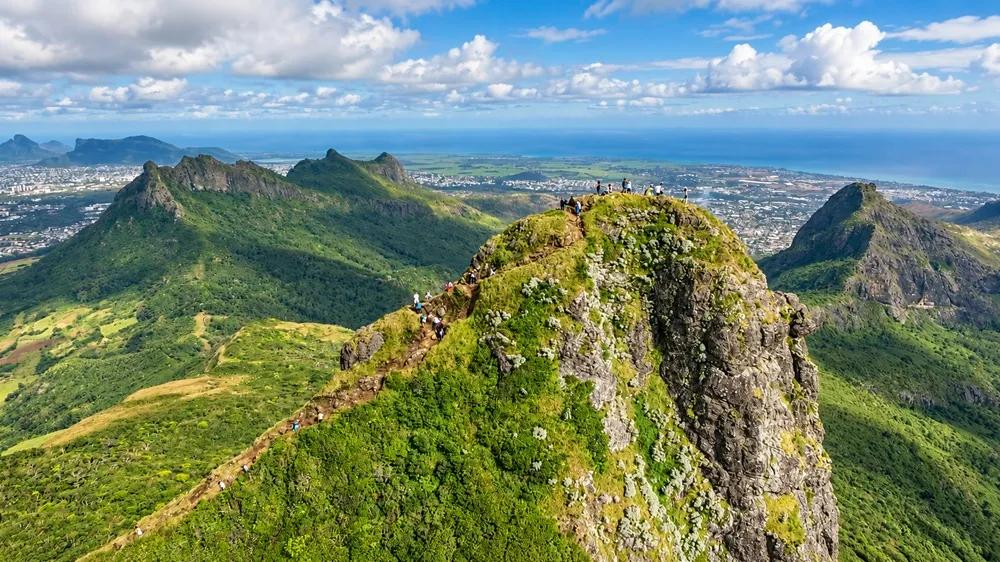
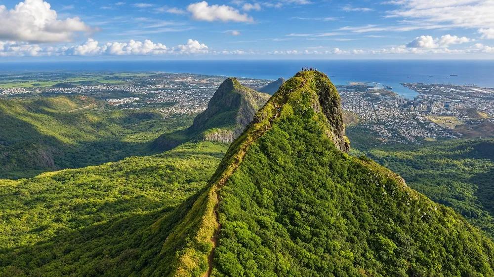
Le Pouce is the thumb-shaped peak above Port Louis and the most rewarding half-day hike on the island for the effort it asks: a steady, mostly gentle climb through forest and open slope to 812 metres, with the capital, the harbour and the whole central plateau laid out below. Most active walkers manage it comfortably. The one thing to know before you go is that the last few metres to the actual summit are a short, steep scramble on rock, and if you would rather not do them, the view from just below is nearly as good.
Charles Darwin and Le Pouce: The 1836 Connection
On 2 May 1836, near the end of the Beagle’s voyage, Charles Darwin spent his second day in Mauritius climbing Le Pouce. He was not the first to do it — the peak had been climbed before — but he was the most famous, and his notes on the day survive "The view from the summit, the volcanic geology of the Moka Range, the sense of the island as a ring of mountains around a plateau. The Beagle had anchored at Port Louis a day earlier, and the mountain above the town was the obvious thing for a geologist to climb. You will not find a plaque on the summit, and the trail is a different one, but it is a good thought to carry up with you" the view that stopped Darwin is the one you are walking to.
Le Pouce at a Glance
Height - 812 m — the third-highest mountain in Mauritius, after Piton de la Petite Rivière Noire (828 m) and Pieter Both (about 820 m)
Where - Moka Range, between Port Louis and the central plateau; usual approach from the Moka / Saint-Pierre side
Time - Around 3–4 hours return at an easy pace, including time on top
Distance - Roughly 4 km return from the usual Moka-side start
Difficulty - Moderate for active walkers; a short, steeper, hands-on finish to the summit
Terrain - Earth and grass track, rocky in places; exposed open slope; bare rock on the final section
Best time of day - Early morning — cooler, clearer and quieter
Guide- Not required on the marked trail; useful for first-timers, families and anyone who wants the natural history explained
Views - Port Louis and its harbour, the central plateau, Pieter Both and the Moka Range, the north coast on a clear day
Main caution - Wet rock, wind and exposure on the summit section; postpone after heavy rain
Is Le Pouce Worth Hiking?
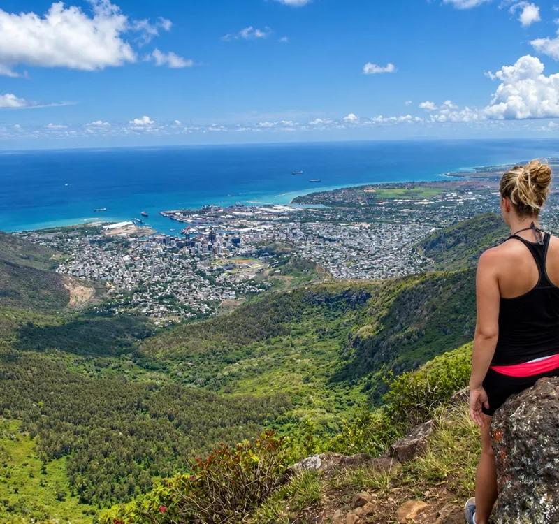
Yes — and for a particular reason. Mauritius has higher mountains and harder ones, but none gives you so much for so little. The trail is short enough to fit before lunch, gentle enough that you can talk most of the way up, and the summit sits at exactly the point where the whole north-west of the island opens out: Port Louis spread between the mountains and the sea, the ships in the harbour, the sugar fields of the plateau behind you and the strange, top-heavy spike of Pieter Both close enough to study. It is the view people imagine when they picture the island from above, and it costs you a morning.
It also has a story. Charles Darwin climbed it in 1836. It carries a nature reserve on its slopes with plants that grow nowhere else on earth. And it sits ten minutes from Moka’s heritage houses and twenty from the capital’s markets, so the hike becomes the first half of a very good day rather than the whole of it. Our Le Pouce Mountain overview has the mountain as a place; this guide is about walking up it.
How Difficult Is the Le Pouce Hike?
Moderate, with a qualification. The honest description is “an easy-to-moderate walk with a short hard bit at the end,” and the two parts need to be thought about separately.
Lower trail vs final summit scramble
For most of the way, Le Pouce is a hike, not a climb. The track rises steadily from the Moka side through scrub and native forest, levels across an open grassy shoulder below the peak, and climbs again on an earth-and-rock path toward the summit block. There are steep stretches and loose stones, and in the heat it will make you work, but there is nothing technical about it. Anyone who walks regularly, including active older children, can do this part.
The final section is different in kind. The last fifteen or twenty metres to the true summit go up bare volcanic rock, steep enough that you use your hands, with open air on one side. In the dry it is a scramble — short, well-worn and not difficult for anyone who is steady on their feet and comfortable with a drop beside them. In the wet it is slick and genuinely unpleasant, and in strong wind it is exposed. It is not Pieter Both, where you need ropes and a guide; it is a few minutes of concentration. But it is the part that decides whether Le Pouce is “easy” for you, and the only way to know is to look at it from the bottom and decide.
Who should stop below the summit?
Anyone who does not like the look of it. That is a complete answer, and it is the one most people are not given. The grassy shoulder below the summit block has almost the same view — Port Louis, the harbour, the plateau, Pieter Both — and plenty of room to sit. Children who did the lower hike happily, walkers who dislike heights, anyone in trail shoes that have lost their grip, and everyone on a day when the rock is wet or the wind is up: the shoulder is the summit. Nobody will know the difference in the photographs, and you will have had the hike.
Le Pouce Route: What the Hike Feels Like Step by Step
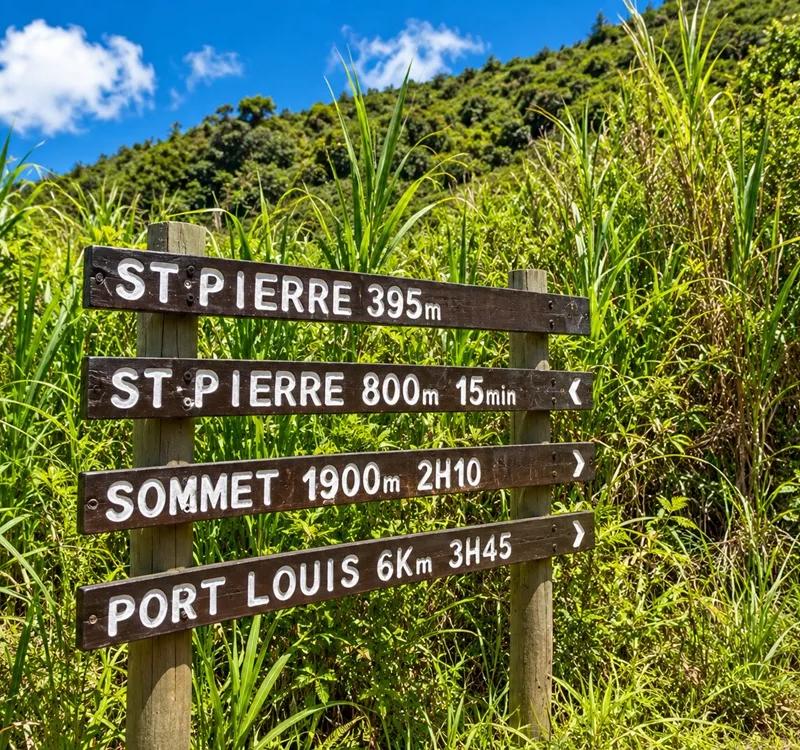
The standard route climbs from the Moka side of the mountain, from the Petit Verger / Saint-Pierre area where the road ends and the track begins. It is the shortest, best-walked way up and the one the figures in this guide refer to. (A longer route comes up from Port Louis on the other side; the times and distances below do not apply to it.)
Trailhead and approach
The hike starts on the inland side of the mountain, uphill from the village of Saint-Pierre. The approach is a quiet lane through fields with the mountain ahead of you, and the trail proper begins where the surfaced road gives out. Leave the car where it blocks nothing — a field gate, a driveway, a turning space — and walk from there; there is no formal car park, and a few minutes on foot at the start is the price of a mountain this close to town.
The mountain above the countryside
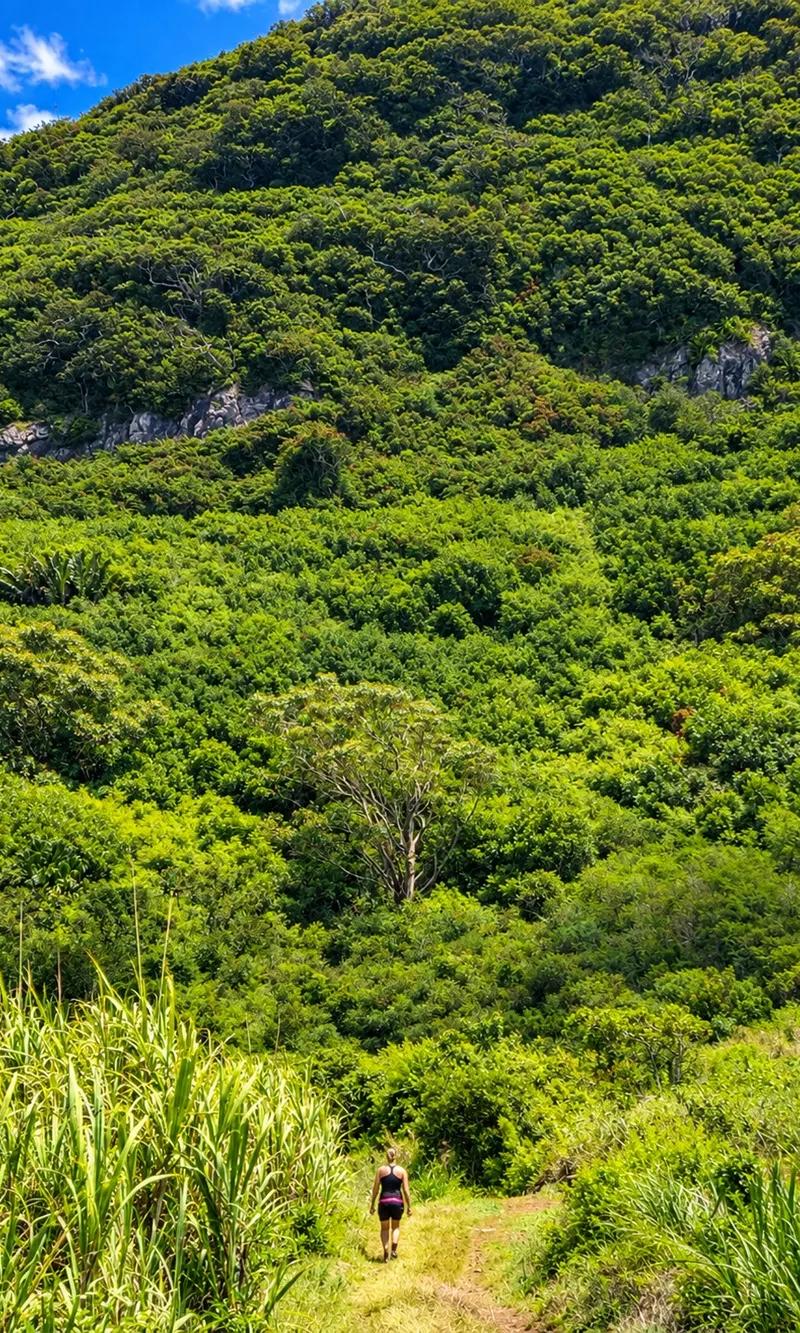
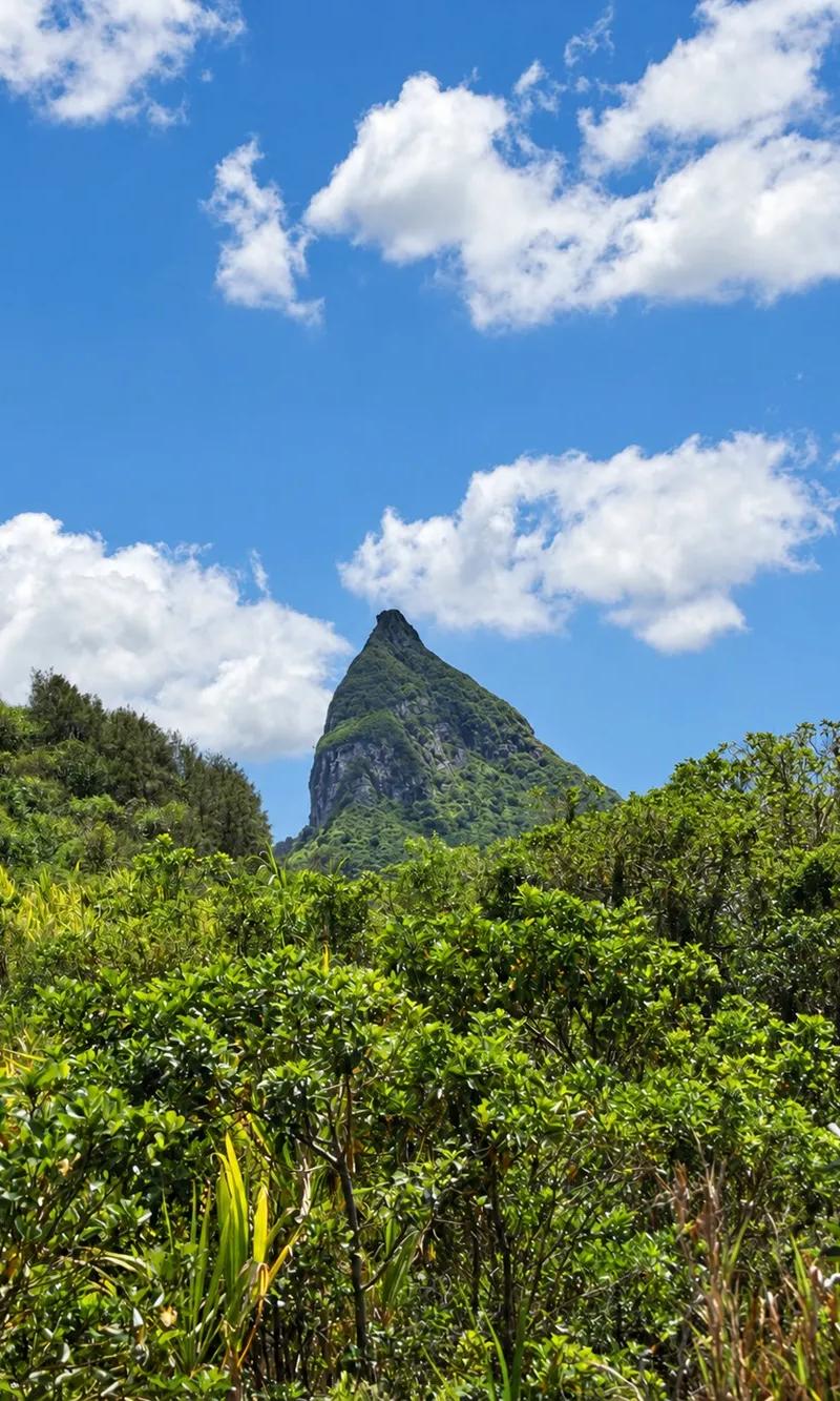
Before the hike starts, the mountain announces itself. From the road out of Saint-Pierre the thumb of Le Pouce stands over the countryside — dark rock above green slopes, cane fields and small-holdings running right up to its foot — and it stays in view for the whole approach, growing larger with every bend. Take a minute to look at it. The grassy shoulder, the bare summit block, the line of the final scramble: everything you are about to walk is visible from here.
Starting the hike
The surfaced lane gives out among the fields and a track takes over; this is the trailhead. Leave the car where it blocks nothing — a gate, a driveway, a turning space — because there is no car park, and walk the last few minutes to the start. Tie your laces, check your water, and note the time. The lane is the last flat ground for a while.
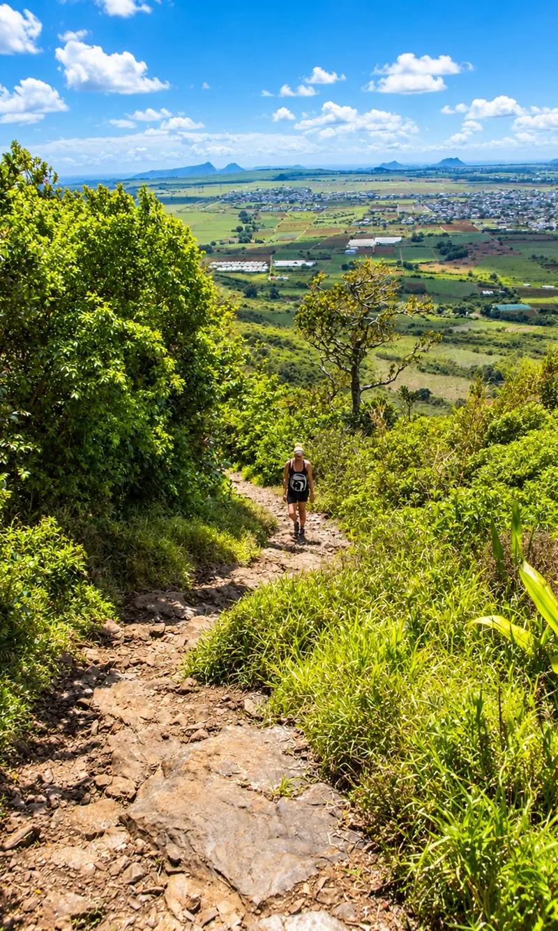
Entering the forest
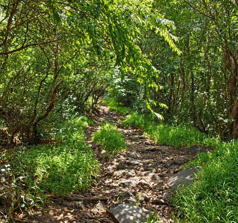
Within a few hundred metres the track leaves the open fields and slips into the trees, and the mountain disappears behind them. The temperature drops a degree or two as soon as you are under the canopy. The sound changes too — the road and the village fall away and what is left is birdsong, wind in the leaves and your own feet on the path. The lower trail runs under a close roof of branches, the leaves overlapping so thickly in places that the sky is only a suggestion. It is the gentlest walking of the day: a soft earth path, a mild gradient, shade the whole way. Walk it slowly; it is also the prettiest part of the forest and the part you will be too tired to notice on the way down.
The path soon shows its character — a tangle of tree roots polished smooth by years of boots, with loose volcanic stones wedged between them. Look where you put your feet. The roots are slippery even when dry, the rocks rock underfoot, and this is where ankles get turned by people looking up at the trees instead of down at the trail.
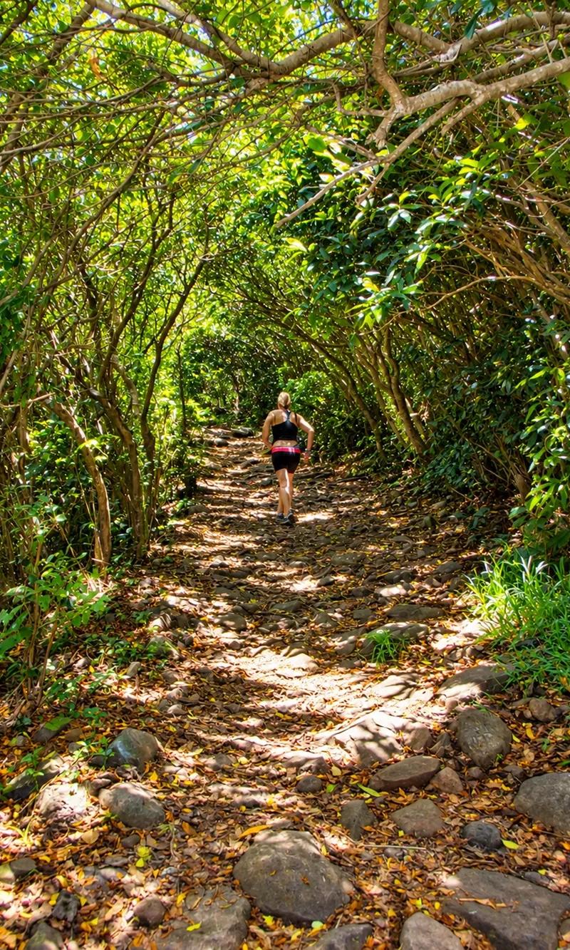
Beneath leafy branches
Sunlight through the leaves
Where the canopy thins the morning sun comes through in shafts and patches, lighting the ferns and catching the drifting insects. If you have started early enough, the light is low and golden and the forest glows with it. It is the moment to take the camera out, and a good reason to be walking by seven rather than nine.
Winding forest trail
The trail does not go straight at the mountain; it zigzags up through the trees in long, easy bends, each one gaining a little height. The switchbacks are your friend. They let you find a rhythm, keep the gradient kind, and give you a reason to stop at every corner and look back at the one before. The forest presses in close on both sides: ferns at knee height, shrubs at shoulder height, the occasional liana looped across the path, and the deep green of the native reserve beginning to show through the exotic growth. Keep to the track. The plants beside it are the reason the upper mountain is protected, and some of them grow nowhere else on earth.
Climbing through the trees
Somewhere in the middle of the forest the gradient tightens and the walk becomes a climb. The zigzags shorten, the path steps up over roots and rock ledges, and you feel the mountain in your legs for the first time. It is steady rather than hard — a pace you can hold while talking — but it is the point at which the easy stroll ends and the hike begins.
The trail opens, briefly, into a small clearing under the trees: a flat patch of earth, a fallen trunk to sit on, a gap in the leaves with a glimpse of the valley. It is exactly the right size for a drink of water and a breather. Take it. The next stretch is the last of the shade, and after it the sun has you until the summit.
Walking through undergrowth
Above the clearing the path narrows and pushes through undergrowth that stands taller than you are — long grass, ferns, scrub closing over the trail so that you part it with your hands. It is damp in the mornings and leaves your legs wet, and it is the stretch where the forest feels wildest, a few minutes before it ends.
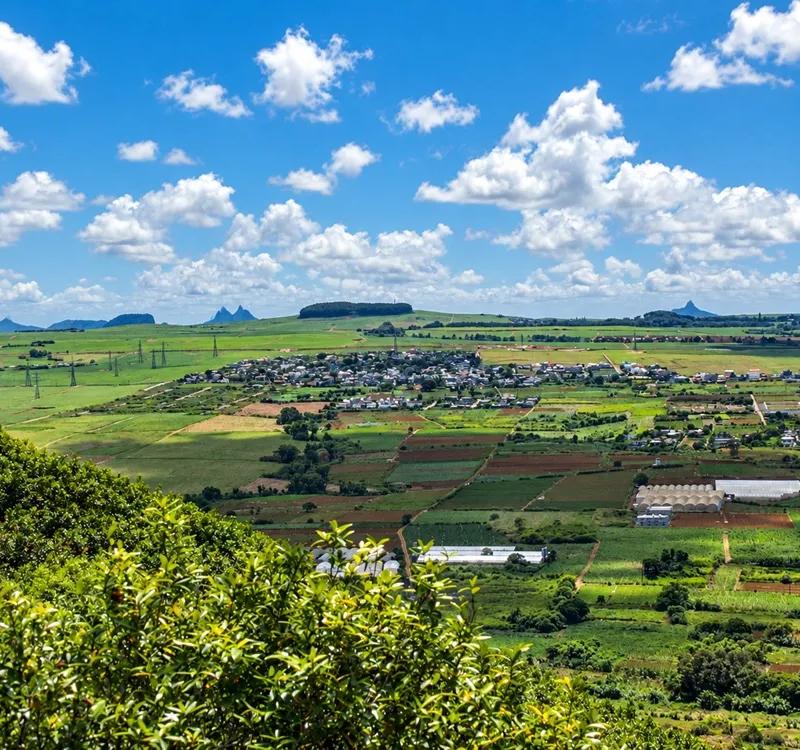
First valley views
Then a gap in the branches, and the first proper view of the valley you have climbed out of: the fields you walked through an hour ago now a patchwork of green far below, the roofs of Saint-Pierre among them, the road a thin line between the cane. It stops everyone. It is the first measure of how far up you are, and it is only the beginning.
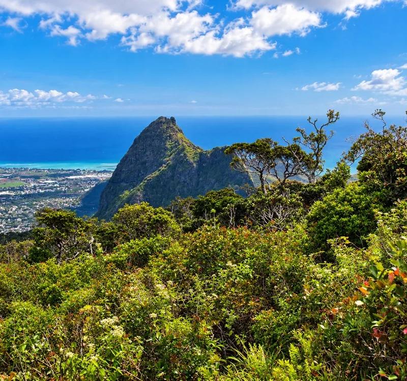
Reaching the open slopes
A few more bends and the trees are gone. You step out of the forest onto open hillside — grass, low shrub, a stunted tree here and there, and sky — and the mountain is in front of you again, close now, the summit block standing over the slope. The change is sudden and total, and it is the moment the hike earns its reputation.
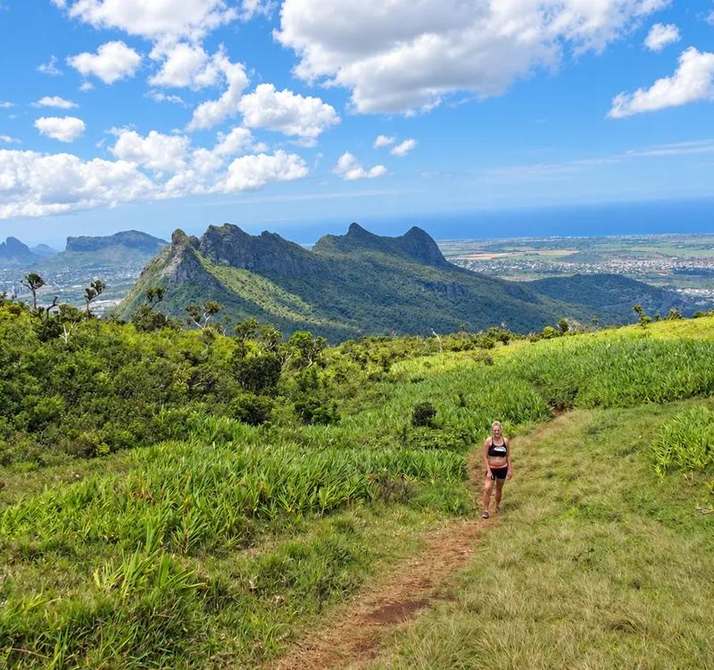
Views beyond the trees
With the canopy behind you the whole southern half of the view opens: the forest you came through dropping away below, and beyond it the long green floor of the plateau. Turn around. From here on the view is behind you as you climb, and the trick to enjoying Le Pouce is to keep stopping and turning around.
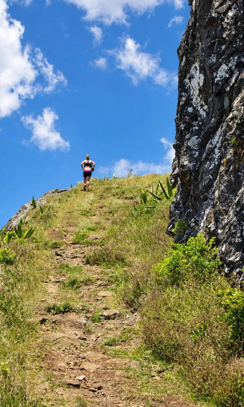
Crossing the grassy hillside
The path crosses the open slope on a long rising traverse, stony and exposed, cut across grass that is gold in winter and green after rain. There is no shade at all. The sun is on your back, the wind is in your face if there is any, and the gradient is steeper than it looked from the trees. Walk it in short stages.
Looking towards Moka
To the south the plateau towns spread out below — Moka first, with its gardens and the campus and the heritage houses, then Saint-Pierre, Quatre Bornes and the towns of the highlands fading into haze. Eureka House is down there somewhere among the trees. This is the view of inland Mauritius that nobody gets from the coast.
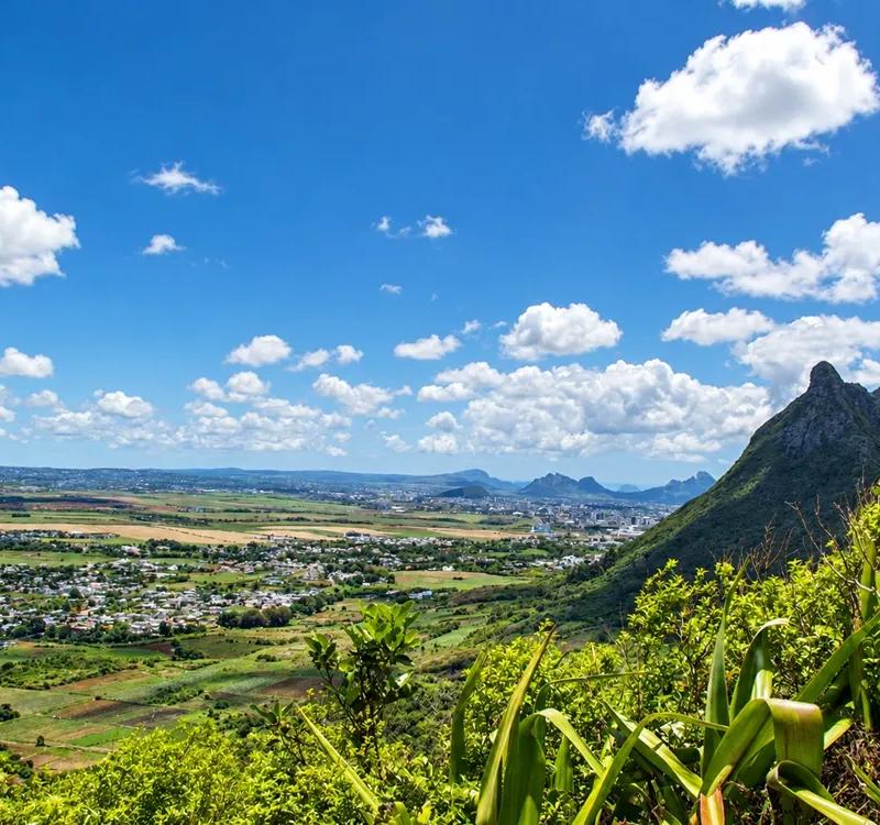
Distant mountain ridges
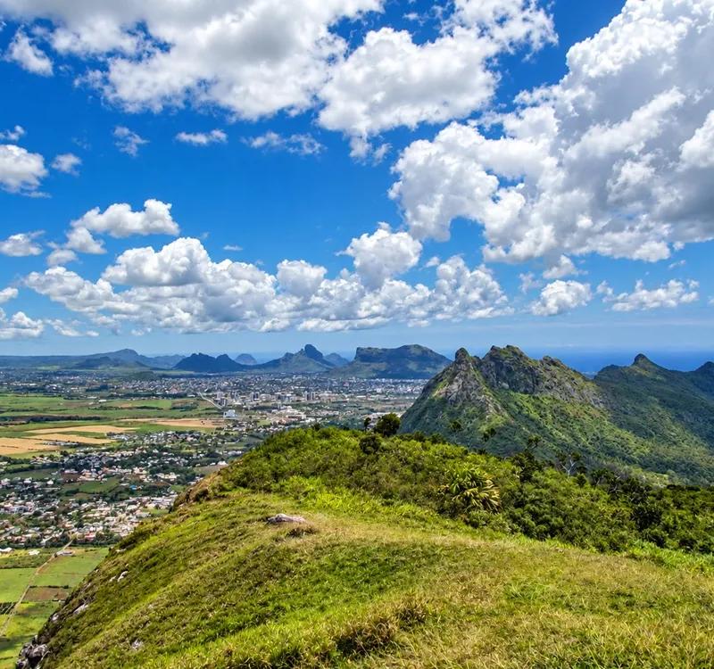
Beyond the towns the ridges of the Moka Range run away to the south and east, one behind another, the nearer ones sharp and green, the further ones blue and soft. Pieter Both is hidden by the bulk of Le Pouce itself for now; you will meet it at the top. The ridges give the view its depth and the island its shape.
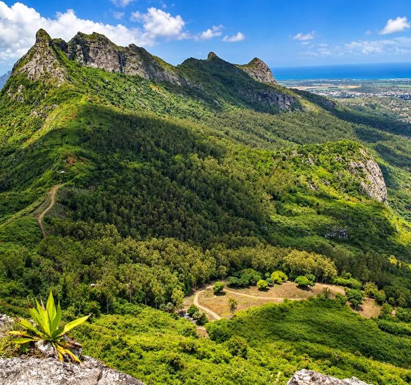
Fields and towns below
Directly below the slope the cane fields are laid out in their neat rectangles, roads threading between them, villages tucked into the folds, a church spire here and there, the whole country arranged like a map at your feet. It is the view people photograph most and remember longest, and you are still a quarter of an hour from the top.
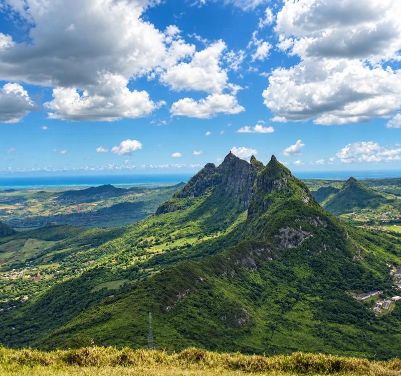
Approaching the summit
The traverse steepens toward the summit block and the thumb of rock that gives the mountain its name stands directly above you, bare and dark and much bigger than it looked from the road. The path narrows. The grass gives way to stone. You are about to arrive at the one place on the mountain where you need to make a decision.
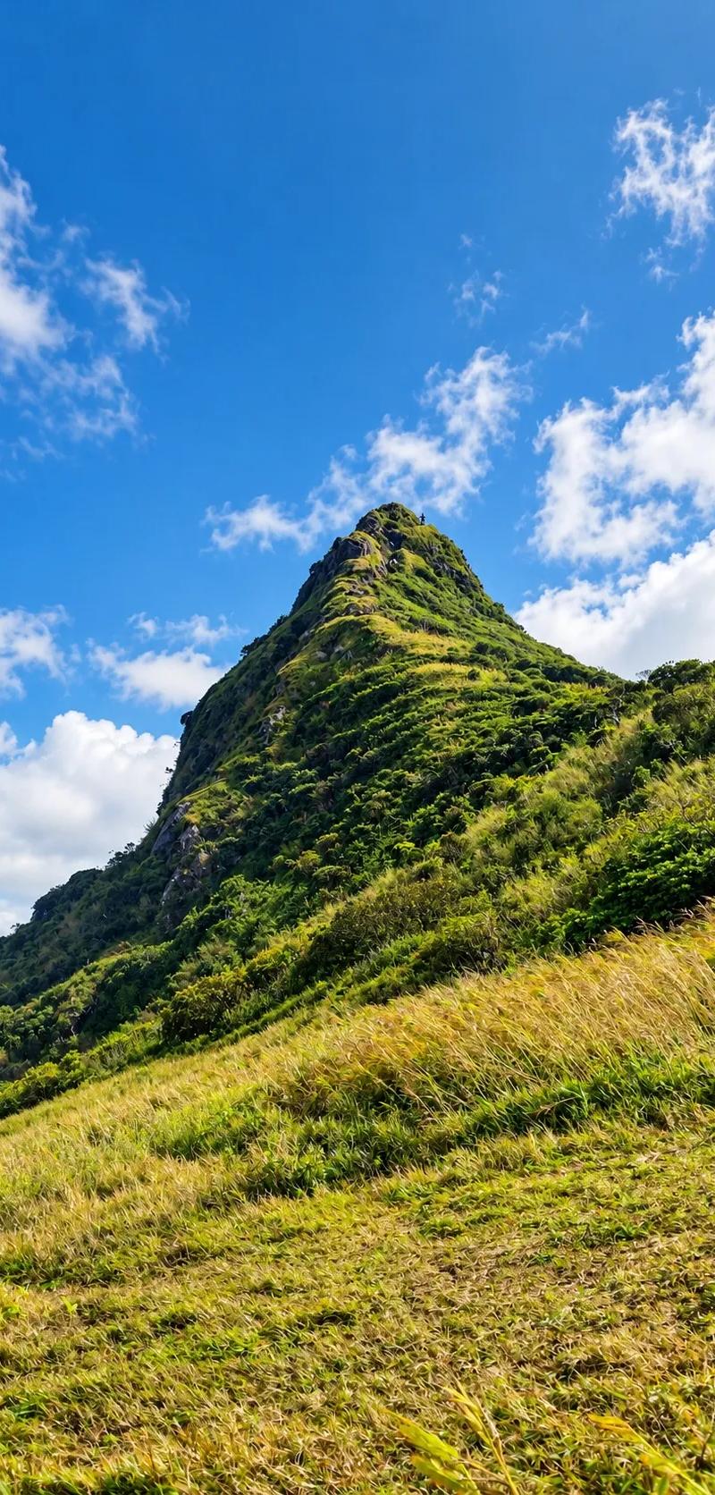
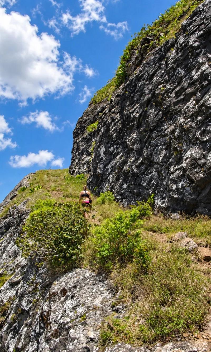
Beside the rock face
The path reaches the broad grassy shoulder below the summit and runs along the foot of the rock face itself — a wall of volcanic stone with the worn line of the route climbing it. Stop here. This is the decision point. Look up at the final section, look at the open air to one side of it, and decide whether it is for you today. If it is not, you have arrived: the shoulder has the view, and it is a fine one.
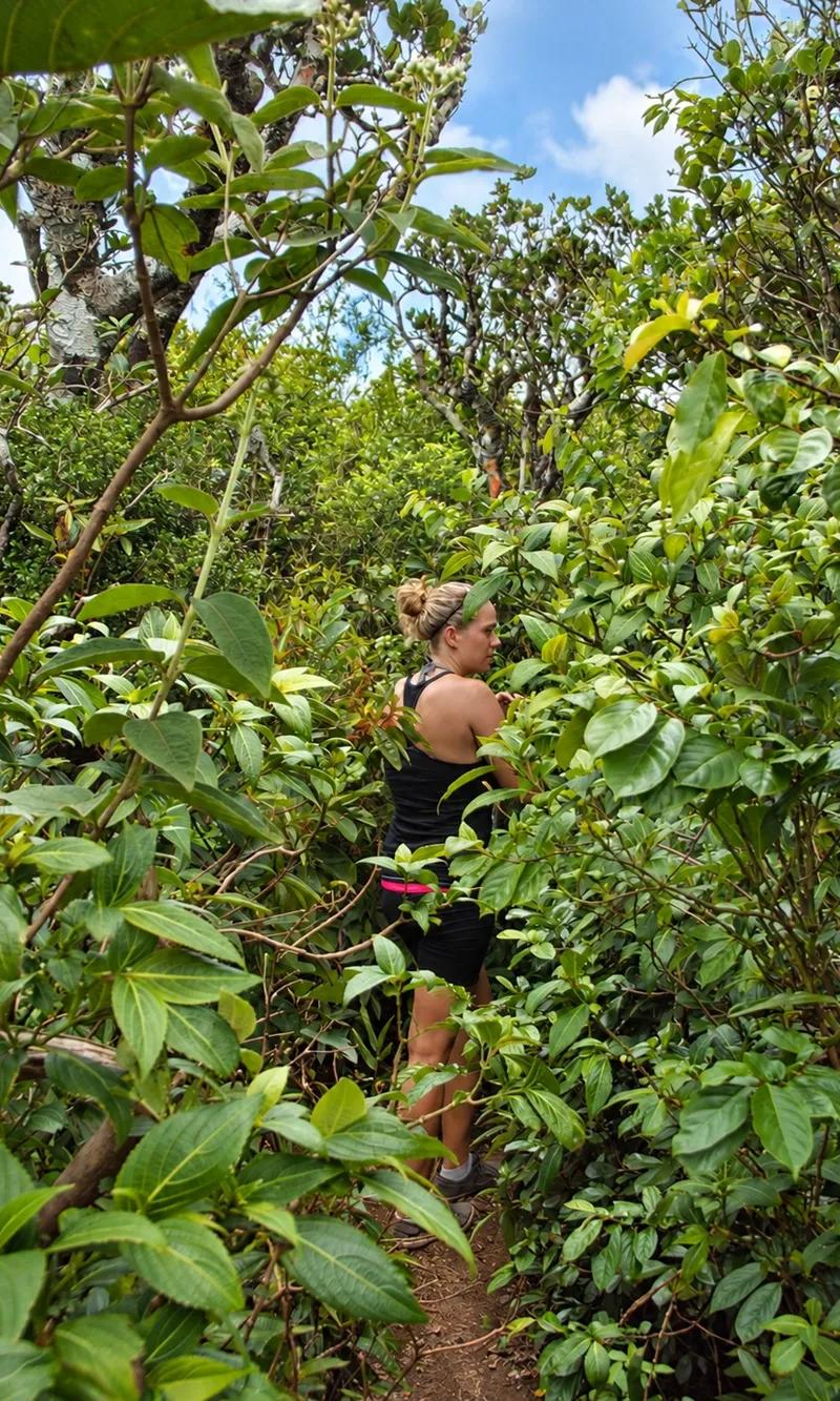
Narrow mountainside path
For those going on, the path leaves the shoulder and narrows to a thread along the mountainside, rock on one hand and the slope falling away on the other. It is not difficult walking, but it is the first place where the exposure is real, and it sets the tone for what comes next. Take it steadily and keep your eyes on your feet rather than the drop.
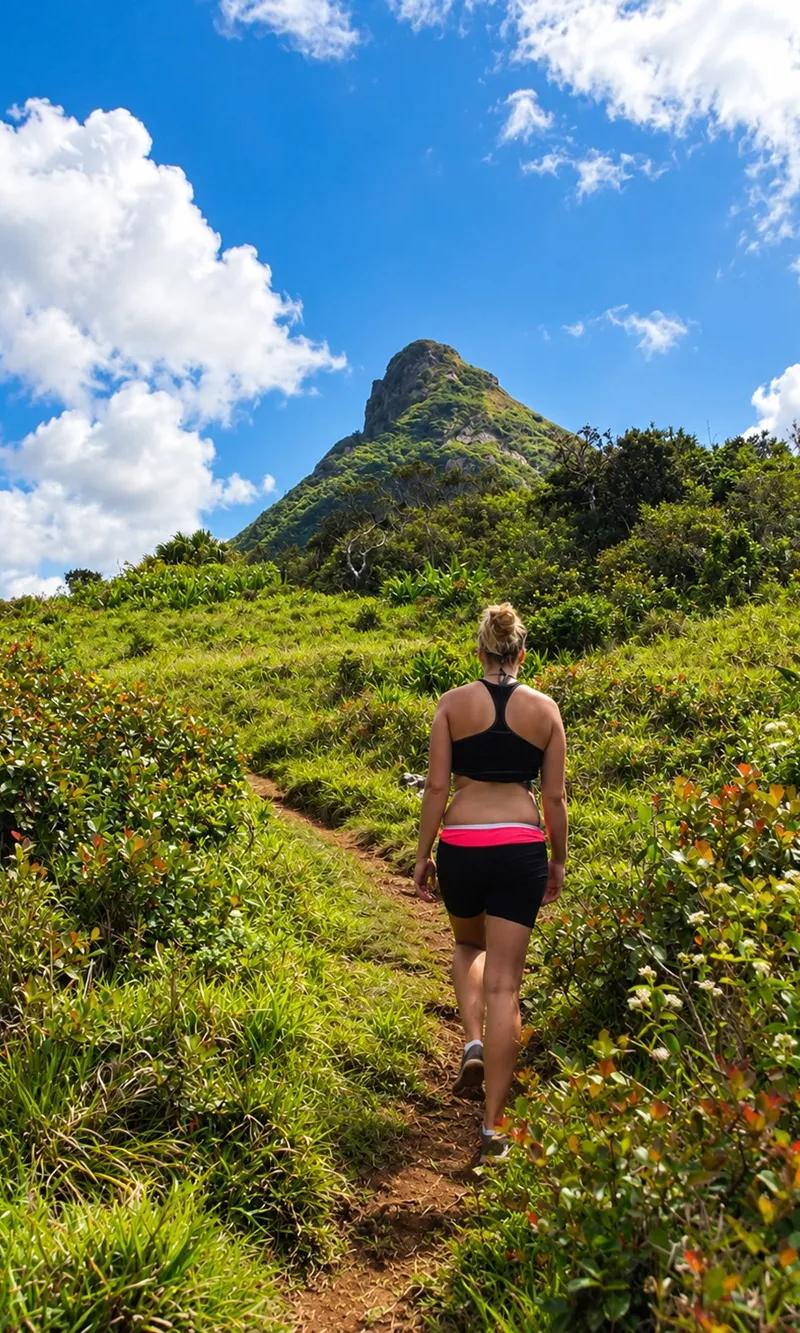
Reaching the rocky section
The path runs out and the rock begins, without ceremony. One moment you are walking on earth; the next you are standing at the foot of a steep slab of bare volcanic stone with the route up it worn pale by generations of boots. Put your hands on it. From here to the top, this is a scramble, not a walk.
Scrambling upwards
Hands and feet, three points of contact, face the rock. The scramble goes up in short steps between ledges, steep enough that you lean into the mountain and use your arms, with a stretch in the middle where the ground falls away beside you. It is over in a few minutes. It is also the part that decides whether Le Pouce was “easy” for you — and the part to turn back from if the rock is wet or the wind is strong.
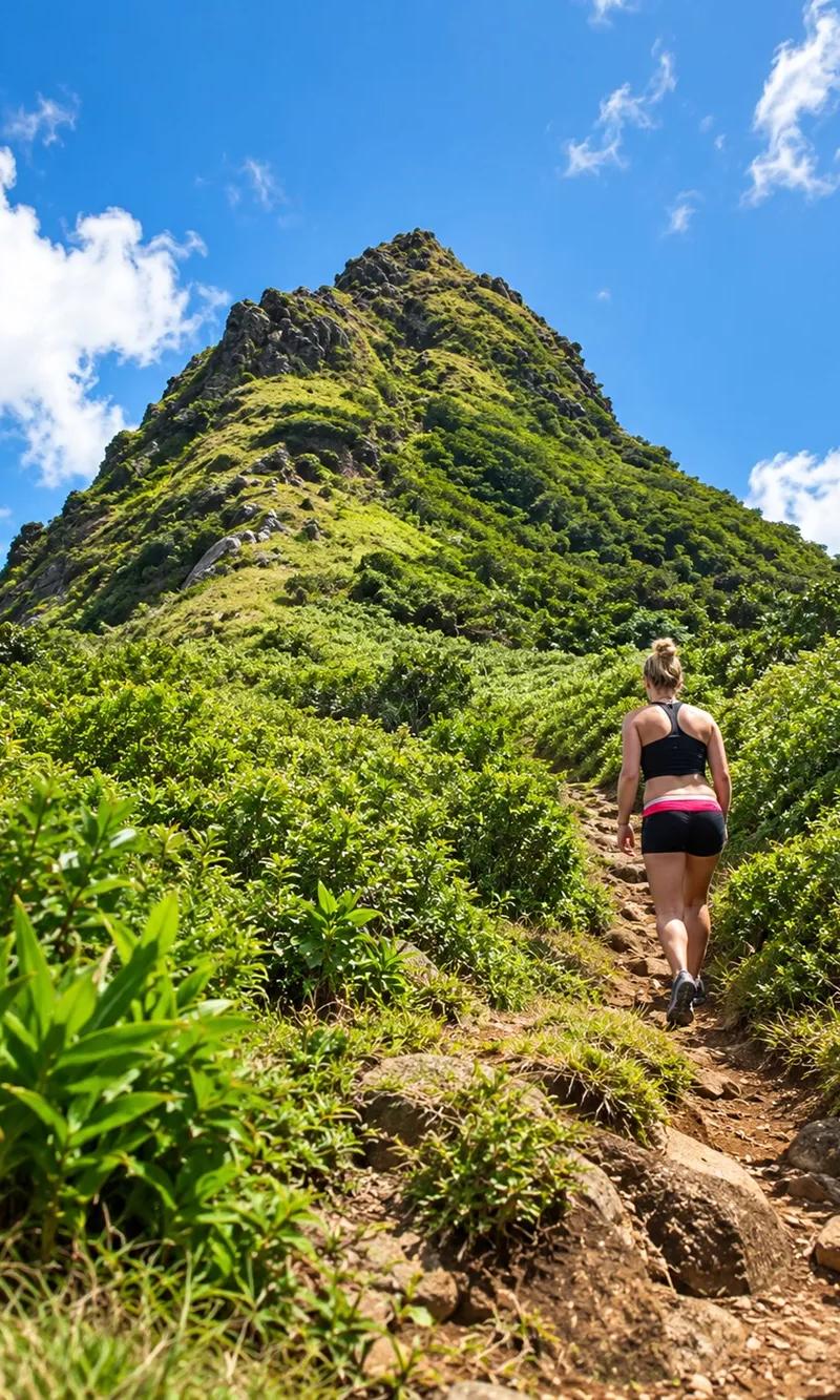
Rocky footholds
The holds are there and they are good. The route is so well used that the footholds are obvious once you are on the rock — small ledges, a crack for a hand, a step worn into the stone — and the sequence is the same for everyone. Test each one before you trust it. In the dry it is straightforward; after rain the same holds are glass.
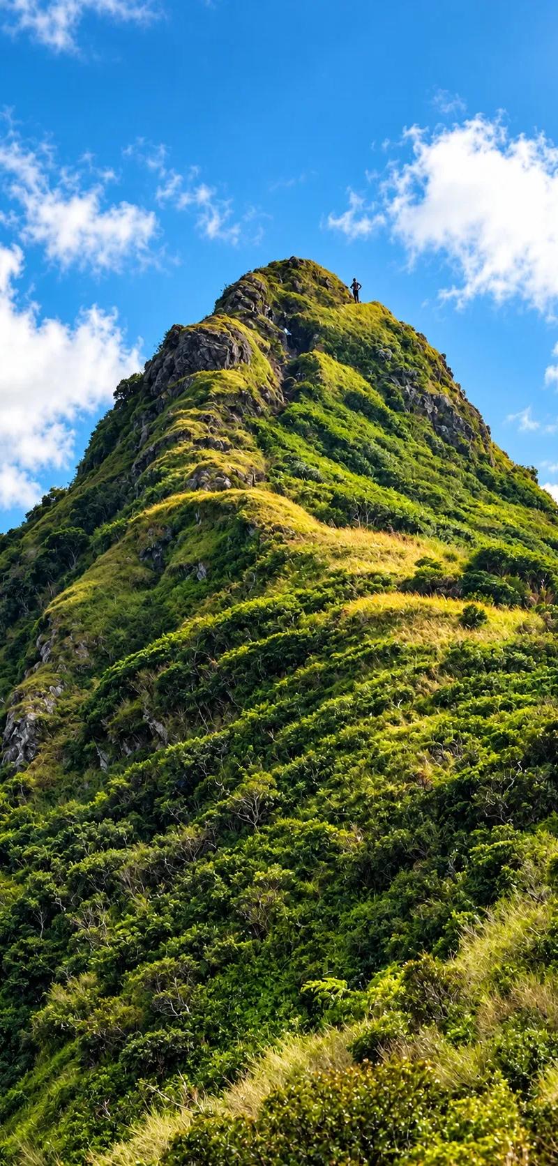
The final ascent
The last few metres steepen, the holds thin, and then the rock levels out under your hands and you pull up onto the top. There is a moment, standing up on the summit after the scramble, when the whole island arrives at once. Give yourself that moment before you look for somewhere to sit.
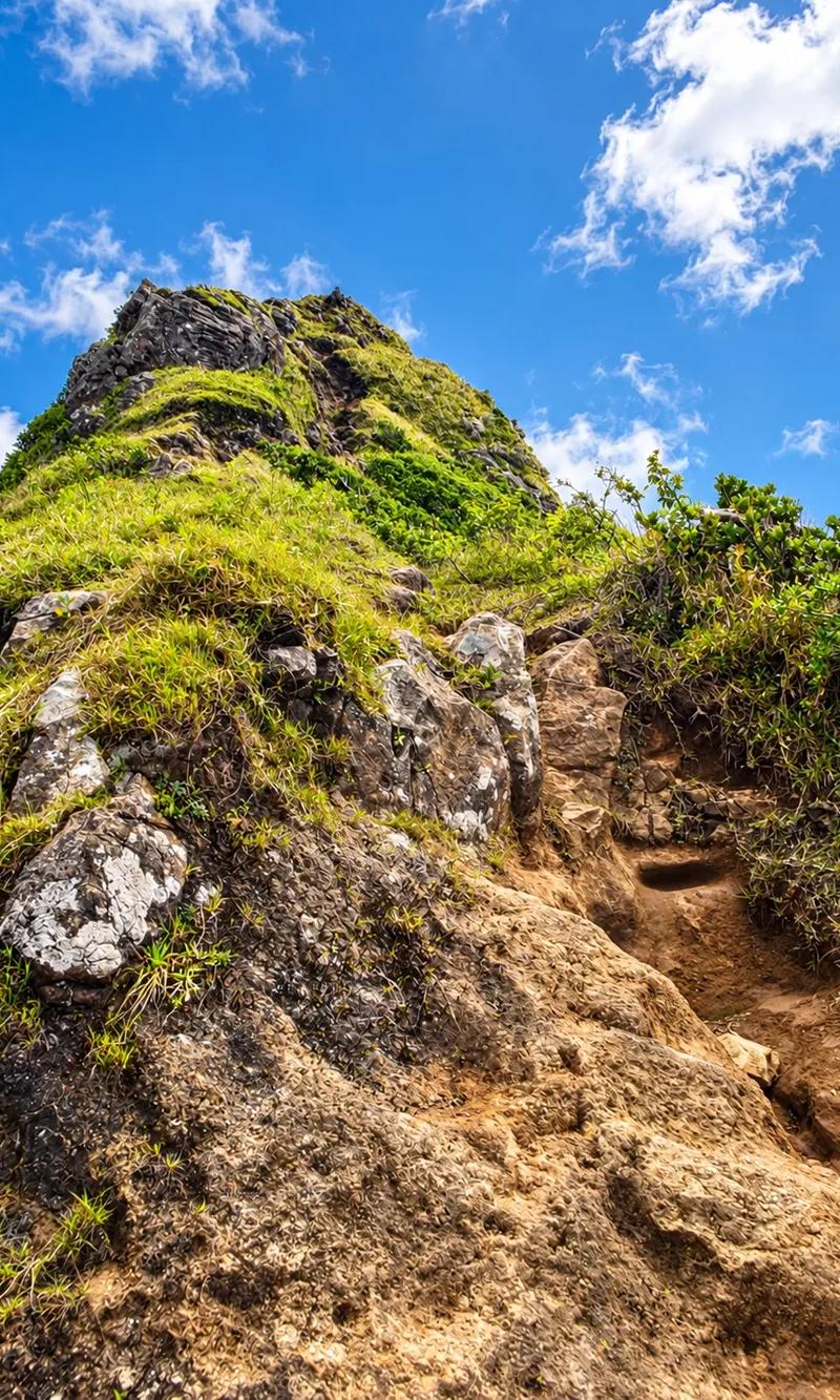
Summit panorama
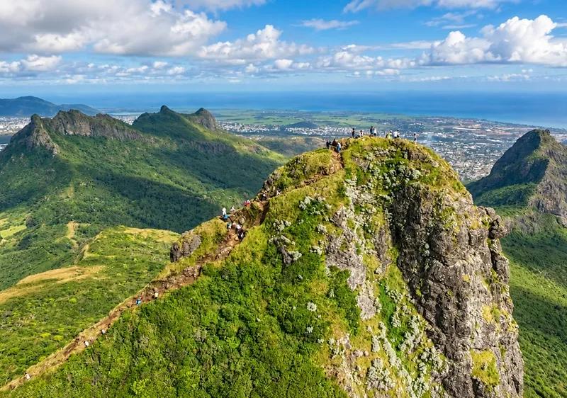
The summit is a small, uneven platform of rock with room for a handful of people, and the view goes all the way round. The whole north-west of Mauritius is below you — capital, harbour, plain, plateau, mountains and sea — in one unbroken circle. Turn slowly. Every direction has something in it.
Views towards Port Louis
Straight below, the city: Port Louis spread between the mountains and the harbour, the ships and the cranes at the docks, the racecourse of the Champ de Mars a green oval among the roofs, the roads running out of town toward the north. On a clear morning you can pick out the market, the waterfront and the mosque. This is the view Darwin climbed up for in 1836.
Overlooking the Moka Range
Beside you, close enough to study, the strange top-heavy spike of Pieter Both, its boulder balanced on the summit like a head on a neck, and beyond it the rest of the Moka Range marching away along the ridge. From here the two mountains look like neighbours, and they are — but Pieter Both is a roped climb, and Le Pouce is the one you walk up.
Central plains in view
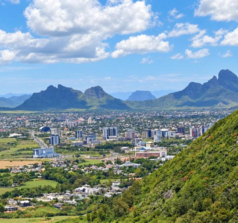
Behind you the central plateau stretches away to the south — Moka, Quatre Bornes, Curepipe, the towns running into each other between the cane, the forested highlands and the reservoirs beyond. It is the inhabited heart of the island, and this is the only place you see it whole.
Distant ocean views
And beyond everything, the sea. To the north the plain runs out to the coast and the ocean lies along the horizon in a long blue line, with the outline of the northern islands on a clear day. To the west, the harbour opens into the Indian Ocean. The island is small from up here, and the water is everywhere around it.
A summit pause
Sit down. Eat something, drink, let your legs recover and let the view do its work. This is the pause the whole morning was for, and nobody should rush it. Take the photographs, then put the phone away and simply look for a while before you start down.
Descending the rocks
Going down the scramble is harder than coming up, because you cannot see the footholds below you as easily. Face inward, feel for each hold with your feet before you commit your weight, go slowly, and let a companion go first so they can call the holds up to you. This is where Le Pouce catches people out, and where care matters most.
Back on the shoulder the hard part is over, but not the careful part. The traverse across the grassy hillside is downhill now, on loose stone, with tired legs and the sun full on the slope. It felt easy on the way up; it asks for attention on the way down. Keep stopping to look at the view, which is the whole point, and which you will not see again until next time.
Back beneath the canopy
Then the trees close over you and the shade and the cool return — back under the canopy, into the forest, the light falling in patches again on the roots and stones. It is a relief after the open slope, and it is a trap: the volcanic soil is slick after rain, the polished roots are as slippery as ice, and this is the stretch where most slips on the mountain happen, in the last half-hour, when people stop concentrating.
Following the downhill trail & Finishing the hike
The forest trail unwinds below you through the same zigzags you climbed, past the clearing, through the undergrowth, under the leafy branches. Your knees will feel it. Keep your eyes on the path and your hands free; a walking pole, if you carry one, earns its place here.
The trees thin, the lane appears, and you step out into the fields with the mountain behind you — standing over the countryside exactly as it was when you arrived, except that now you have been to the top of it. Look back once. Then find the car, change your shoes, and go and have the second half of the day in Moka or Port Louis.
How Long Does Le Pouce Take?
Three to four hours return from the Moka side at a comfortable pace, which includes time on the shoulder and the summit. Fit walkers who do not linger can do it in two and a half; families, photographers and anyone who stops to look at the plants should allow four. Add the time to reach the trailhead — about twenty minutes from Moka, thirty from Port Louis, an hour or more from the north and west coast resorts — and it is a morning. Plan to be walking by seven and back at the car before midday, and the heat, the cloud and the afternoon showers of the highlands are all somebody else’s problem.
Best Time to Hike Le Pouce
The central highlands are not the coast. Le Pouce sits above the plateau, where it is a few degrees cooler, noticeably wetter and far more often in cloud than the beach you left that morning. That shapes the whole answer.
Cooler, drier months (May–October)
Winter is hiking season in Mauritius and the best time for Le Pouce: cooler air, lower humidity, less rain, and the clearest skies of the year for the view. The trade wind can be strong on the summit — carry a layer — but the ground is drier and the scramble is at its most straightforward. July and August are the pick; May, June, September and October are nearly as good.
Warm, humid months (November–April)
Summer is hotter, wetter and cloudier on the plateau, and the mountain can be in mist by mid-morning when the coast is in sunshine. The hike is still possible — on a dry morning it is lovely — but the margins narrow: start at first light, check the forecast and the previous day’s rain, and be willing to turn back if the summit is in cloud or the rock is wet. January to March also bring the cyclone season; nobody should be on the mountain with a warning in force.
Why morning is usually better
Three reasons. The air is cooler and the open slope has not yet been in the sun for hours. The view is clearest before the convection cloud builds over the plateau, which it does most days from late morning. And you have the whole afternoon in hand if something slows you down. The practical rule, in any season: check the Mauritius Meteorological Services forecast the evening before, look at the summit from the road, and if it is wet, windy or in cloud, go to Moka or Port Louis instead and come back tomorrow.
What to Bring for Le Pouce
Shoes with grip — trail or hiking shoes, closed, with a sole that holds on wet rock. Not sandals, not fashion trainers.
Water — at least a litre and a half per person; there is nowhere to fill up.
Sun protection — hat, sunscreen, sunglasses; the upper half of the route is fully exposed.
A light windproof layer — the summit is often windy even when the valley is still.
A small snack for the shoulder.
An offline map of the route saved to your phone, and a charged battery; do not count on signal.
A rain shell in summer, and the willingness to use it as a reason to turn back.
Nothing you would mind carrying down — every wrapper comes with you.
Do You Need a Guide?
No. The trail is marked and well walked, and an experienced hiker with an offline map and a weather check will find the way without difficulty.
That said, a guide is worth it for more people than usually admit it. If you are new to hiking, uncertain about finding the trailhead on unsigned country lanes, walking with children, or simply want someone to name the plants, point out Darwin’s route and tell you when the rock is fine and when it is not, a guided outing takes the planning out of the morning and often includes a transfer from your hotel. The route is the same; the day is easier. If that sounds like you, compare a guided Le Pouce hike on our Mauritius activities pages.
Le Pouce with Children, Beginners or a Fear of Heights
Children. Active children of about eight and up who are used to walking will enjoy the lower hike and the open slope; the shoulder is a fine objective for a family. The summit scramble is a separate decision, made at the bottom of it, child by child — some will scamper up, some should not try, and a parent who stays on the shoulder with one while the other goes up with the second adult has done it right.
Beginners. Le Pouce is a good first Mauritian mountain precisely because the hard part is short and optional. Walk the lower trail, enjoy the slope, reach the shoulder, and treat the summit as a bonus.
Fear of heights. The lower trail and the shoulder involve no exposure worth the name. The final scramble does: a few metres with open air beside you. If that is not for you, stop at the shoulder without a second thought. The mountain does not care, and the view is the same.
What Can You See from the Summit?
On a clear morning, the whole north-west of the island. Directly below, Port Louis — the harbour with its ships and cranes, the Champ de Mars racecourse, the dense streets of the capital running down to the sea. To the north, the coastal plain and the sugar fields reaching toward Grand Baie and the islands offshore. To the east, the astonishing silhouette of Pieter Both, its boulder-topped summit a short distance along the ridge. Behind you, the central plateau: Moka, Quatre Bornes, the towns of the highlands and the forest and lakes beyond. On an exceptional day you can see most of the north and west coasts at once. On an ordinary one, cloud drifts across the plateau side and the harbour view holds. Nothing is guaranteed; go early and take what the morning gives.
Le Pouce Nature Reserve and Responsible Hiking
The upper slopes of the mountain are a nature reserve, part of the Moka Range that conservation scientists classify as a Key Biodiversity Area. The reason is the plants. Most of Mauritius’s native forest is gone, and the steep ground of the Moka peaks is one of the places where fragments survive: the Mauritian Wildlife Foundation records rare native and endemic species on Le Pouce, among them the strange climbing shrub Roussea simplex and Pandanus pseudomontanus, a screw-pine so rare it is known from only a handful of plants. You will walk past them without knowing, which is exactly the point.
Look, don’t touch. Stay on the established track; the vegetation beside it is the reason the mountain is protected. Do not pick, cut or trample plants, even for a better photograph. Carry every scrap of waste down. Leave the summit as you found it. The reserve has survived two centuries of clearing on the slopes below; it should not be worn away by its admirers.
Turn the Hike into a Full Day: Moka or Port Louis
You will be off the mountain by late morning with the rest of the day in hand and two very different afternoons within twenty minutes.
Moka — heritage and the plateau. Ten minutes from the trailhead, Eureka House in Moka is the island’s finest surviving Creole plantation house — a 109-door mansion from the 1830s with its gardens, its waterfall walk and a good lunch in the old kitchen. Combine it with a slow drive through the plateau towns and you have the quiet, green, cooler version of the day. The Central Mauritius travel guide has the rest of the region.
Port Louis — food, history and the city you just looked down on. Twenty minutes the other way, the capital is at its best in the afternoon: the Central Market for lunch, Chinatown, the waterfront, and Aapravasi Ghat, the World Heritage immigration depot by the harbour. Having seen the city from 812 metres, walking its streets a few hours later is a particular pleasure. Our guide to spending the rest of the day in Port Louis maps it.
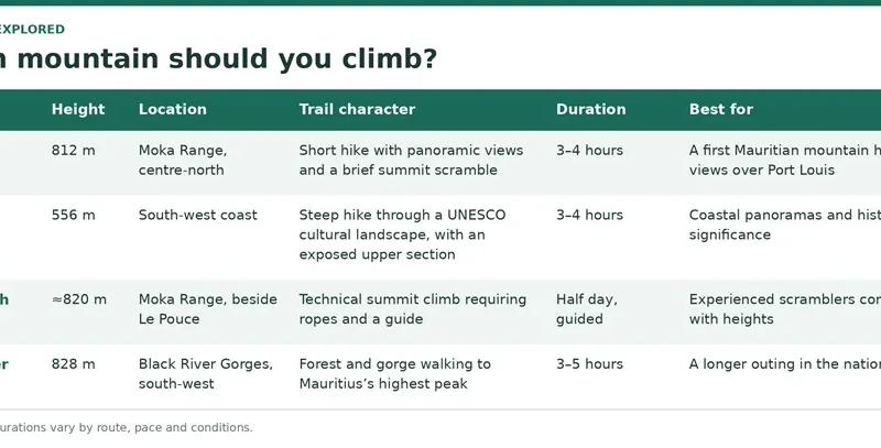
Le Pouce vs Le Morne vs Pieter Both vs Black River Peak
FAQ: Le Pouce Hike Mauritius
How high is Le Pouce? 812 metres — the third-highest mountain in Mauritius, behind Piton de la Petite Rivière Noire and Pieter Both.
How long does the Le Pouce hike take? About 3–4 hours return from the usual Moka-side start, including time at the top. Fast walkers can do it in under three; families should allow four.
How hard is Le Pouce? Moderate for active walkers. The trail is a steady hike with some steep, stony stretches; the final few metres to the summit are a short scramble on bare rock that needs hands and a head for heights.
Do I need a guide? No — the trail is marked and well used. A guide is worth considering if you are new to hiking, unsure about finding the trailhead, walking with children or want the natural history explained.
Where does the trail start? On the inland side of the mountain above Saint-Pierre, in the Moka district, where the lane ends and the track begins. A longer route climbs from the Port Louis side; the times in this guide are for the Moka approach.
Is Le Pouce safe after rain? The volcanic soil and summit rock become slippery when wet. After heavy rain, or in strong wind or low cloud, postpone — the mountain will be there tomorrow.
Can children hike Le Pouce? Active older children can enjoy the lower trail and the open slope to the shoulder. The summit scramble is a separate, case-by-case decision.
Can I stop before the summit? Yes, and many people should. The grassy shoulder below the summit block has nearly the same view and no exposure.
What can you see from the summit? Port Louis and its harbour, the north coast, Pieter Both and the Moka Range, and the central plateau — on a clear morning, most of the north-west of the island.
Did Charles Darwin climb Le Pouce? Yes, on 2 May 1836, during the Beagle’s visit to Mauritius. He was not the first to climb it.
Le Pouce or Le Morne? Le Pouce for the central panorama and the shorter, more accessible outing; Le Morne for the coastal view and the cultural landscape. They are different days.
Le Pouce or Pieter Both? Le Pouce is a hike with a short scramble; Pieter Both is a roped, guided climb. Do Le Pouce first, and look across at Pieter Both from the top before deciding whether you want it.
Ready to go? Read the Le Pouce Mountain overview for the place itself, compare it with the best hikes in Mauritius, or browse guided hikes and other land activities in our things to do in Mauritius hub.
Esplora questo argomento
Ricevi nuove guide di Mauritius via email
Unisciti alla lista Mauritius Explored per idee di viaggio, aggiornamenti pratici e aiuti scaricabili per pianificare.

Scritto dal team editoriale di Mauritius Explored, una guida mauriziana dedicata a spiagge, attività, luoghi locali e pianificazione pratica.
Ricerca locale su Mauritius, pianificazione itinerari e copertura della destinazione dal 2011.