Hidden Beach Access in Mauritius: Access Paths & GPS Points
Hidden Beach Access Points in Mauritius: Small Alleys to the Coast
Updated 25 October 2026
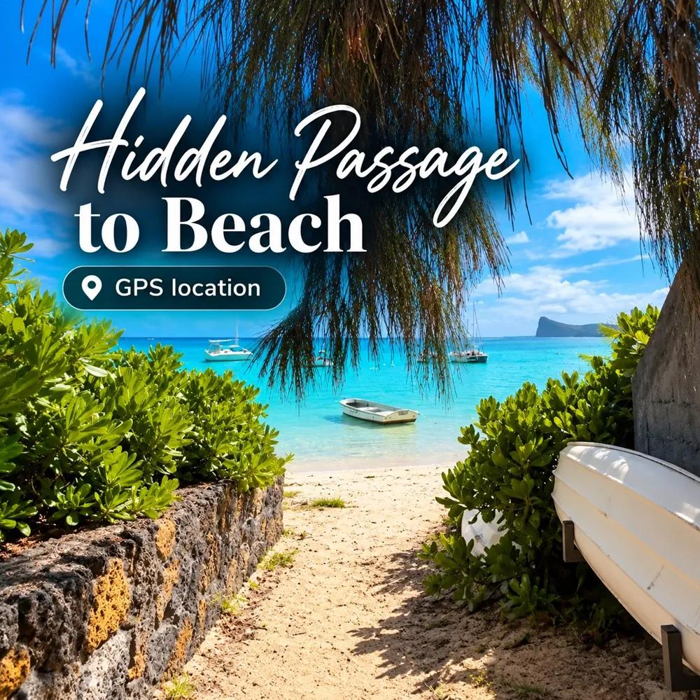
Every visitor to Mauritius runs into the same small frustration sooner or later. You can see the lagoon on the map. You can see it from the car, flashing turquoise between two villa walls. And you can drive the whole length of a coastal road without finding an obvious way down to it. The big public beaches have signs and car parks; the quieter stretches in between are reached through the kind of gap you would never spot unless someone pointed at it — a two-metre alley between garden walls, a sandy track beside a bus stop, a concrete footpath with a faded sign at the top.
This is a guide to those hidden passage. Twelve of them, around the whole island, each with a GPS point you can tap, a description of what the passage leads to, where to leave the car without annoying anyone, and the honest truth about what the beach at the end is like. It is not a ranking of beaches — we already have that in our best beaches in Mauritius guide — and it is not a list of hidden gems, which lives in our secret places in Mauritius article. This is about finding the door.
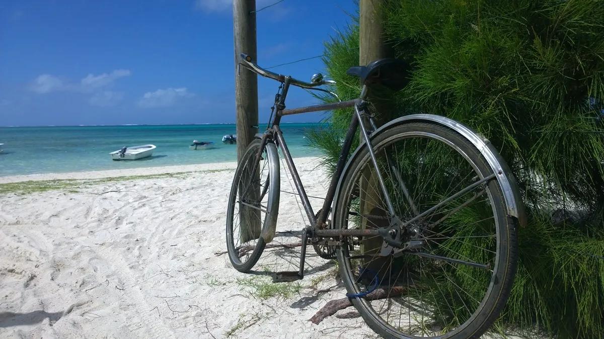
Pointe d'Esny Beach Access
Can You Legally Access Beaches in Mauritius?
Yes. Beaches and the seashore in Mauritius are public domain, and in June 2026 the Government said so again in plain terms, asking anyone who finds a passage blocked to report it. In September 2026 the Ministry of Housing and Lands launched an online map of public beaches and sea-access routes, starting with the west coast and expanding from there, and new access signboards have been going up at Pointe d’Esny, La Preneuse, Tamarin and La Mivoie.
The part worth understanding is that the beach being public does not make the land behind it public. A villa garden, a hotel lobby, a driveway or a gated compound is still private, and the way to the sand is always through a public passage, a public road or a signed access — which is exactly what the twelve points below are. Use them, and you are on the right side of the line.
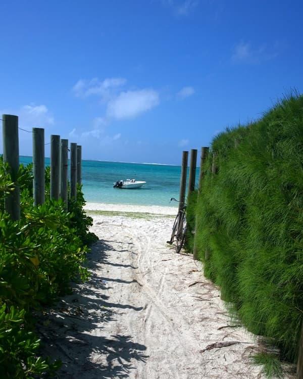
Pointe d'Esny Access
The 12 Access Points at a Glance
Pointe d’Azur, Pereybere
· Region: North
· Reaches: Reef-edged coast beside Pereybere
· Best for: Swimming and snorkelling when calm
Pointe d’Esny
· Region: South-East
· Reaches: Pointe d’Esny lagoon
· Best for: A quiet swim and photography
Pointe d’Esny, Pointe Jérôme side
· Region: South-East
· Reaches: Lagoon toward Pointe Jérôme
· Best for: Quiet beach
Butte à L’Herbe
· Region: North-East
· Reaches: Very shallow lagoon
· Best for: Picnics
Trou aux Biches
· Region: North-West
· Reaches: Trou aux Biches beach
· Best for: Snorkelling and sunsets
Hibiscus Beach, Pereybere
• Region: North
• Reaches: Small sandy cove between Pereybere and Grand Baie
• Best for: Calm swimming, easy snorkelling, a quiet morning
Albion
· Region: West
· Reaches: Shallow lagoon near the lighthouse
· Best for: Sunsets and tide-dependent swimming
Grand Baie
· Region: North
· Reaches: Grand Baie public beach
· Best for: A short swim combined with a town visit
La Preneuse
· Region: West
· Reaches: La Preneuse beach
· Best for: Sunsets and visiting the Martello Tower
La Preneuse, La Mariposa / Allée des Pêcheurs
· Region: West
· Reaches: Southern end of La Preneuse
· Best for: Coastal walks & Sunsets
South coast, unnamed
· Region: South
· Reaches: Open south coast
· Best for: Snorkelling and secluded beach
Pomponette
· Region: South
· Reaches: Pomponette beach
· Best for: Walks, picnics and photography
North Mauritius: Where the Villa Walls Run Longest
The north is where most visitors stay and where the coast is most built up, which is exactly why the small accesses matter here. Between the big public beaches the shoreline is almost continuous private frontage, and the gaps are the only way to the water.
Pointe d’Azur, Pereybere
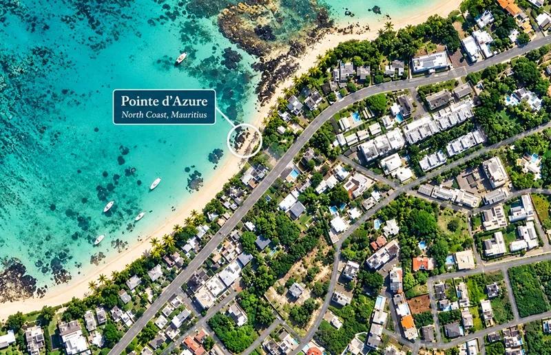
Pointe d’Azur Beach Access
Pointe d’Azur is the rocky point on the Grand Baie side of Pereybere, and the passage down to it is a narrow lane between properties off the coastal road — easy to drive past, obvious once you know. It does not lead to a sandy beach. It leads to something better on the right day: a shelf of dark rock and small sandy pockets with the reef close in, water that goes from knee-deep to swimming depth within a few strokes, and a view back along the Pereybere coast that the main beach never gives you. Locals use it as a morning swim spot and a quick snorkel — there is coral and reef fish a short way out, and the water is clearer here than in the sandy bay next door because nothing stirs the bottom.
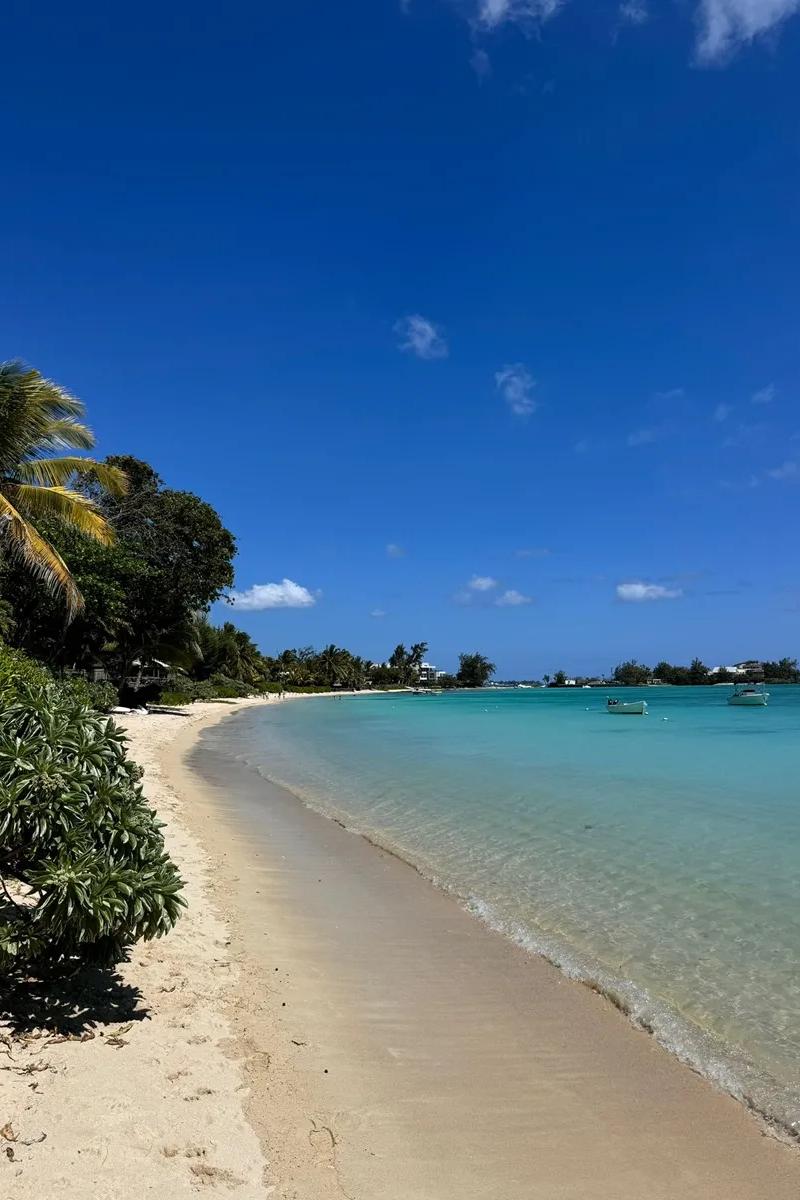
Go early and go on a calm day. The reef is shallow at low tide and the boats working between Pereybere and Grand Baie pass close, so look for the channel before you swim out. There is no shade and no facility of any kind — bring water and leave the car on the public road without blocking a gate. When you want the sand, the lawn and the snack bars, the main public beach is a few minutes’ walk along the road; our Pereybere beach guide has all of it, and the best snorkelling spots in Mauritius guide ranks the reef against the rest of the island.
Grand Baie - The unknown cove
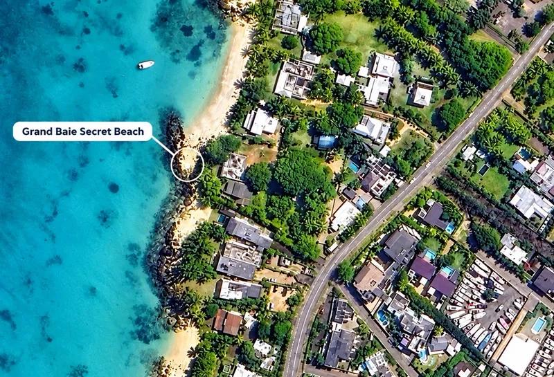
Grand Baie’s public beach and la Cuvette runs along the inside of the bay below the town, and most people reach it from the waterfront. This passage comes in from the town side, a short walk between buildings that drops you on the quieter stretch away from the jetties and the catamaran moorings — a strip of sand with the whole horseshoe of the bay in front of you, the boats swinging at anchor and the restaurants of the front a few minutes away.
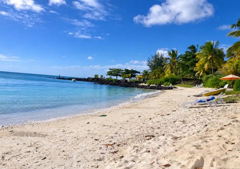
Grand Baie secret Beach
It is not a long-beach-day beach and it does not pretend to be. The water is calm and shallow, the bottom is sand and weed, and there is boat traffic across the bay, so this is a short swim before lunch, a sunset dip after shopping, or the easiest way to get your feet wet in the twenty minutes before a boat trip leaves. Use the town’s public parking rather than hunting for a space at the passage, and treat the beach as part of a Grand Baie day rather than a destination — the Grand Baie beach guide and our page on exploring Grand Baie put it in context.
Trou aux Biches
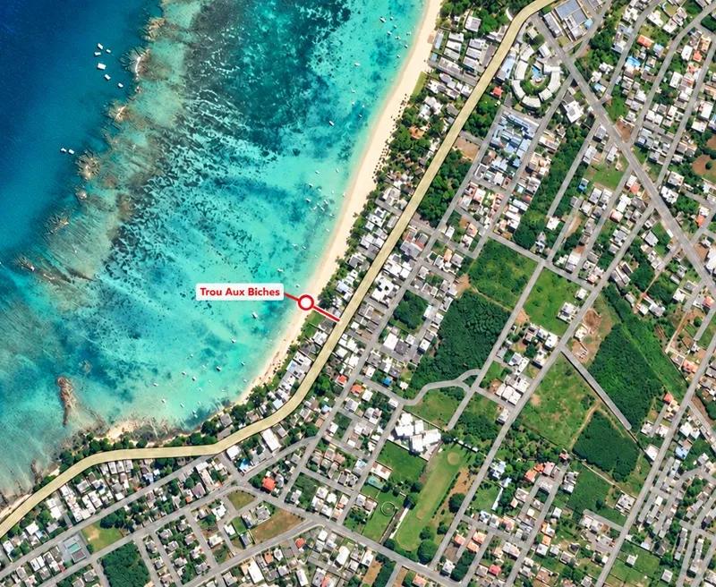
Trou aux Biches is one of the best public beaches in the north and one of the busiest, and the trick is to come in at the right end. This passage leaves the coast road between properties and puts you on the beach well away from the main car park, where the sand is wider, the casuarinas lean over the water and the crowds thin to a few families and the odd kayak.
The beach itself is a long, gentle curve of white sand facing west-north-west, with a lagoon that stays shallow and glassy for a hundred metres before it deepens toward the reef. It is the north’s classic swimming beach — warm, calm, safe for children — and it is also a genuine snorkelling beach: seagrass meadows start close to shore, and early in the morning, before the glass-bottom boats and the jet-skis are out, green turtles graze there. That is the reason to arrive at seven. By mid-morning the water-sports traffic picks up and you need to find the marked swimming zone; by the afternoon the main beach is full. Sunset here is one of the north’s best, straight down the beach into the sea.
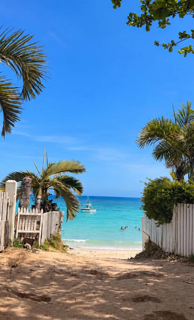
There is no shade beyond the trees and no facility at this end; the main beach has showers, food and parking ten minutes along the sand. Park on the public road. The Trou aux Biches beach guide has the full picture.
Butte à L’Herbe
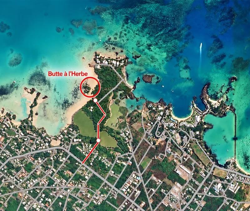
On the north-east coast near Calodyne, Butte à L’Herbe is the beach most visitors drive straight past on the way to Cap Malheureux, and the small passage from the road is why. It is a narrow track between fields and houses that opens, with no warning, onto one of the prettiest small beaches in the north: a crescent of pale sand under a line of casuarinas, a lagoon so shallow and sheltered that it looks like a swimming pool, and the outer islands — Coin de Mire, Flat Island, Round Island — standing on the horizon.
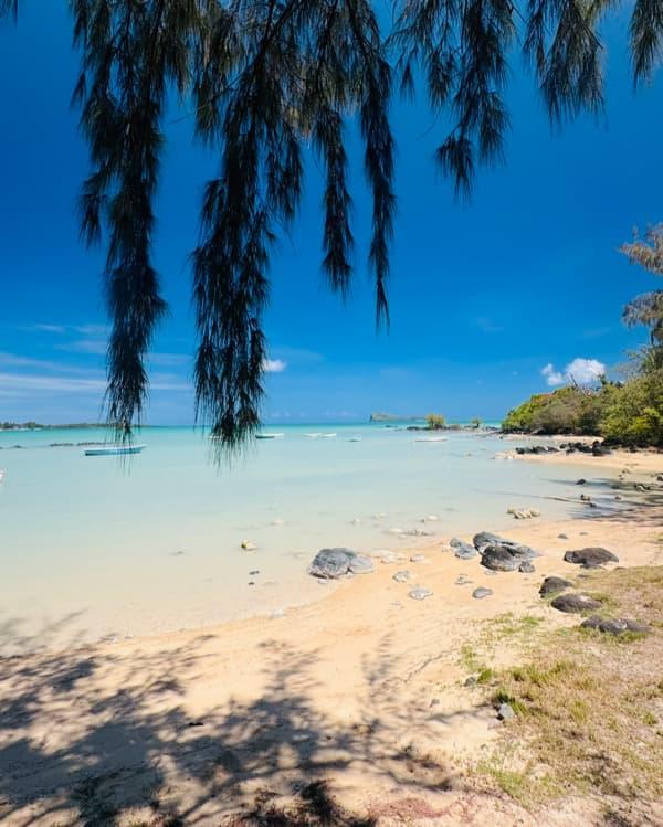
This is a sitting beach, not a swimming beach. At high tide you can float in warm water that barely reaches your waist; at low tide it drains back to ankle depth for a long way out and the bottom shows through in patches of sand and seagrass. Come for a picnic under the trees, a slow walk along the shore, and the photographs — the view north is the one you came to the island for. On weekends it is a local family beach with music and lunch under the casuarinas; on a weekday morning you may have it to yourself.
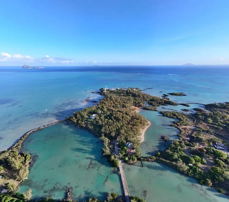
Butte a l'Herbe and the small passage over the barachois
No facilities, no shop, no lifeguard. Bring everything. Park on the roadside at the top of the track. The Butte à L’Herbe guide has tide and timing detail.
Hibiscus Beach, Pereybere
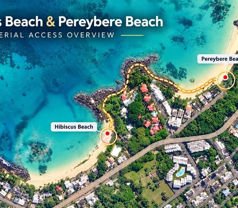
Foot path to access Hibiscus Beach from Pereybere
Hibiscus Beach is the small cove that most people see only from a hotel balcony. It sits in the stretch of coast between Pereybere’s public beach and the point at Pointe d’Azur, tucked behind the hotels and villas that line the road, and the way down to it is a short walk beside the hotel wall that drops you onto a pocket of sand you would never guess was there from the traffic above. The cove faces north-west into a sheltered corner of the lagoon, with low black rock closing it off at both ends and the reef far enough out that the water inside stays flat on all but the windiest days.
It is a swimmer’s beach rather than a sunbather’s. The sand is a few dozen metres wide and goes quickly into clear, sandy-bottomed water that is waist-deep within a short wade and comfortably deep a little further out, with no boat traffic to speak of this close to the rocks. The rocky ends are where the snorkelling is: small coral heads and reef fish in a metre or two of water, easy enough for children and first-timers, and clearer than the main Pereybere bay because the sand here is rarely stirred up. Early in the morning the cove is in shade and glassy; by mid-morning the sun is on it and the hotel guests have claimed the loungers on their side of the sand. The public sand and the water are yours at any hour.
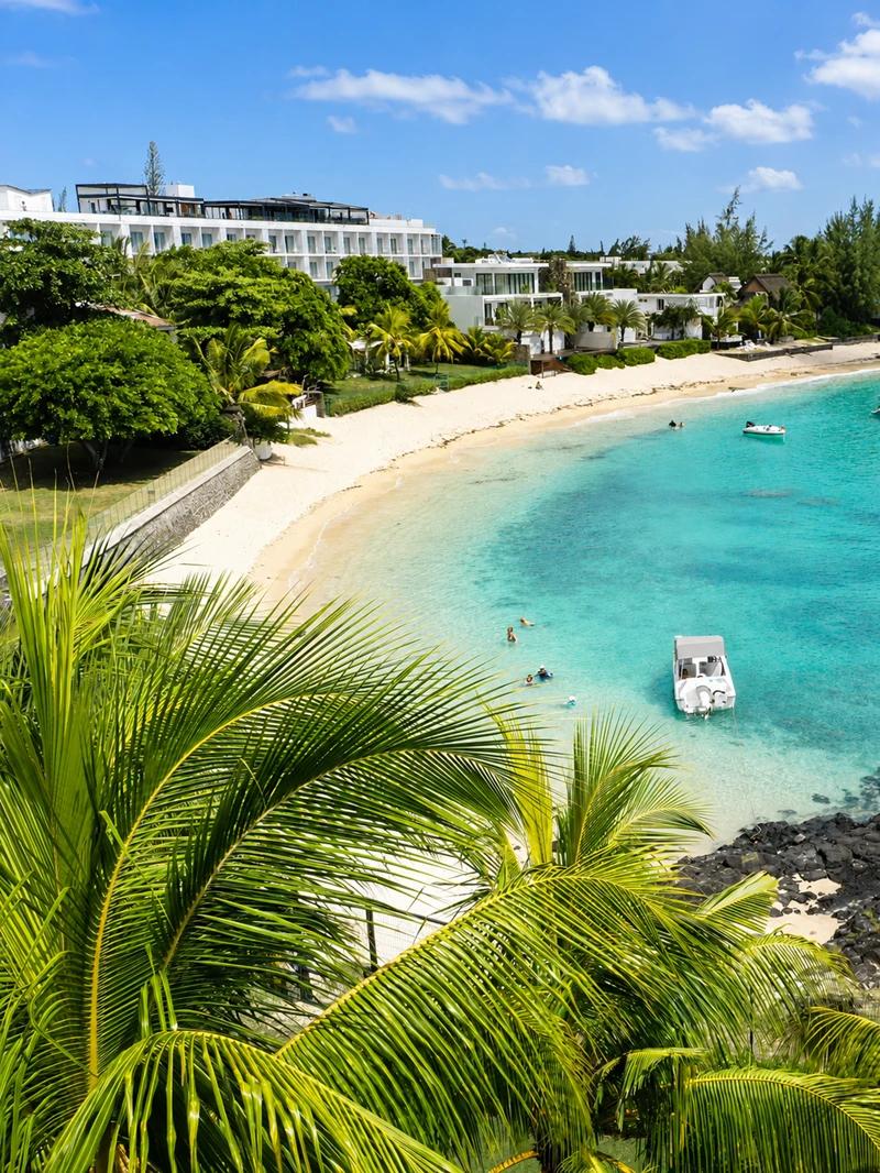
The Hibiscus Beach near Pereybere
There is no public facility here — the hotel’s bar, showers and loungers are the hotel’s — so bring water and a towel, and leave the car on the public road near the hotel entrance without blocking it. Pereybere’s main beach, with its lawn, food stalls and parking, is a few minutes’ walk along the road, and the Pereybere beach guide covers the whole stretch. If the cove is your style, Pointe d’Azur (access 1) is the rockier, wilder version a few hundred metres along the same shore.
Note: Follow map after accessing Pereybere beach
South-East Mauritius: The Beach That Changed the Law
Pointe d’Esny is the reason this article exists. For years it was the textbook case of a beautiful public beach hidden behind an unbroken wall of private villas, and in 2026 it became the textbook case of the fix: in August the Ministry of Housing and Lands put up signboards marking the two public access routes and cleared the vegetation that had been choking one of them. Both are here.
Pointe d’Esny — the signed public access
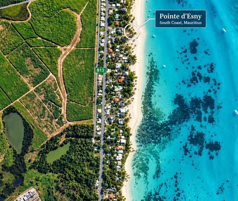
Pointe d'Esny North Access
Look for the Ministry signboard on the coastal road between Blue Bay and Mahébourg. The passage runs between two villa plots, a short, straight walk from the road to the sand, and the first sight of the lagoon at the end of it is the reward: a sheet of pale, milky turquoise over white sand, so shallow and so still that the boats moored off the villas look as if they are floating on air, and Île aux Aigrettes lying green and low across the water.
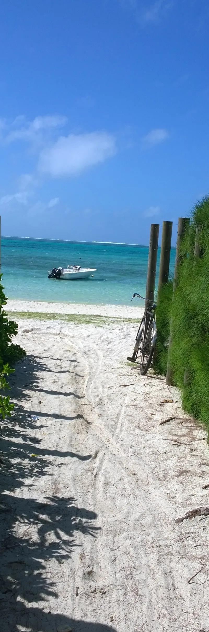
Pointe d'Esny Beach Access passage
Pointe d’Esny is the south-east’s gentlest beach. The sand is fine and white, the water warms up fast in the morning sun, and the reef is far enough out that the lagoon is calm even when the trade wind is blowing — which is why, from May to October, the kitesurfers of the south-east launch from further along the shore, their kites hanging over the lagoon like coloured flags. Watch them from the sand and keep clear of the launch area. For swimmers and floaters there is nothing to worry about; for photographers the morning light here, with the island and the mountain behind Mahébourg in the frame, is the best on this coast.
There are no facilities along this villa shoreline, so bring water, shade and whatever you want to eat. Parking on the narrow coastal road is roadside only — pull fully off the carriageway and never across a gate. Our Pointe d’Esny beach guide covers the rest.
Pointe d’Esny — Pointe Jérôme side
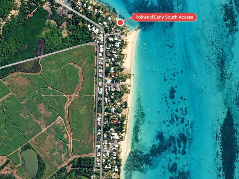
A few hundred metres north along the same road, the second signed passage drops you onto the upper end of the lagoon, closer to Pointe Jérôme and the little jetty where the boats leave for Île aux Aigrettes. The beach is the same pale sand and the same impossibly shallow water, but the feel is different: fewer villas behind you, more fishing boats, and the lagoon narrowing toward the point so that the island feels close enough to swim to (do not — there is a channel and boat traffic in between).
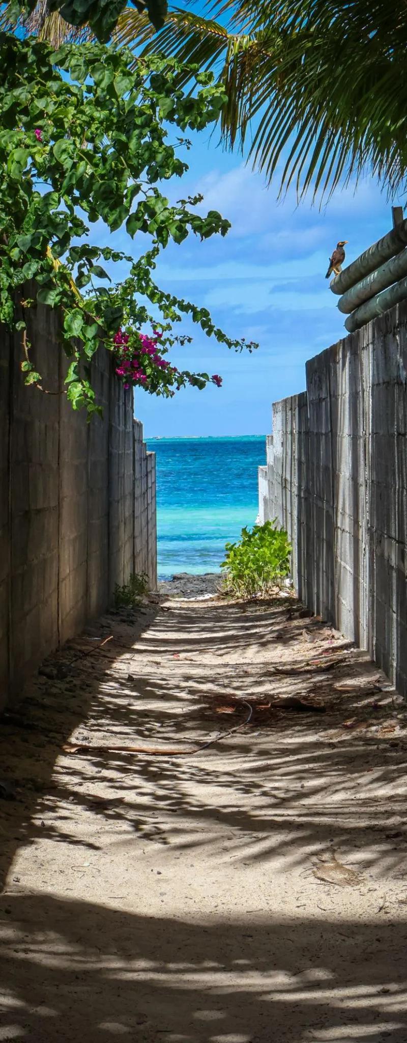
Pointe d'Esny Beach Access
This is the access to use if you are combining the beach with the south-east’s best half-day: a morning on the sand, the Île aux Aigrettes nature-reserve boat from Pointe Jérôme to see the giant tortoises and the ebony forest, and lunch in Mahébourg afterward. Keep an eye on the boat movements around the point when you swim. Again no facilities and roadside parking only. The Pointe d’Esny beach guide and the south-east coastal road trip have the day mapped.
The West Coast: Sunset Side
The west is where the Government began its 2026 access-mapping programme, so the passages at La Preneuse are now on an official map as well as in this guide. It is also the coast of calm water and long sunsets, and the small accesses here lead to some of the best evening beaches on the island.
Albion
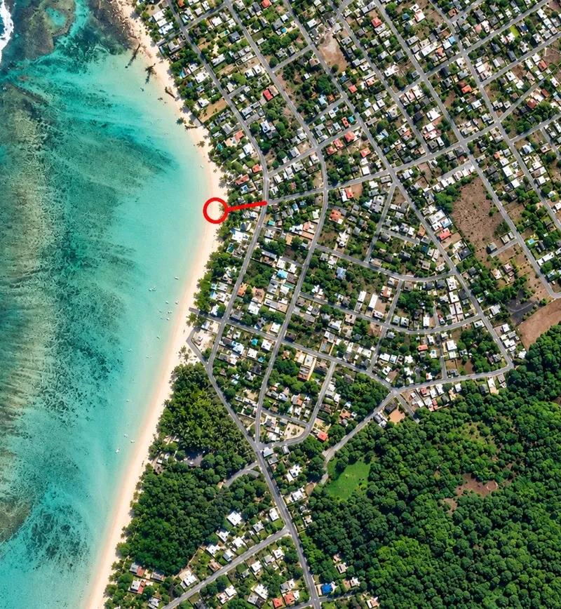
Albion Beach Access
Albion’s public beach has a main entrance that everyone uses and a couple of quieter ways in that almost nobody does. This one brings you down between properties to the southern part of the beach, where the sand gives way to the dark volcanic rock of Pointe aux Caves and the white lighthouse stands on the headland above.
Albion is a beach of two moods, and the tide decides which one you get. At high water it is a shallow, reef-sheltered lagoon with soft sand underfoot, good for a long float and a gentle snorkel over the coral patches toward the reef. At a low spring tide the water drains off the flats until the coral heads sit just under the surface and the swimmable depth shrinks to a few channels — beautiful to look at, useless for a swim. Check the tide before you come if swimming is the point, and never walk on the exposed coral; it is alive, and a footstep kills what took decades to grow.
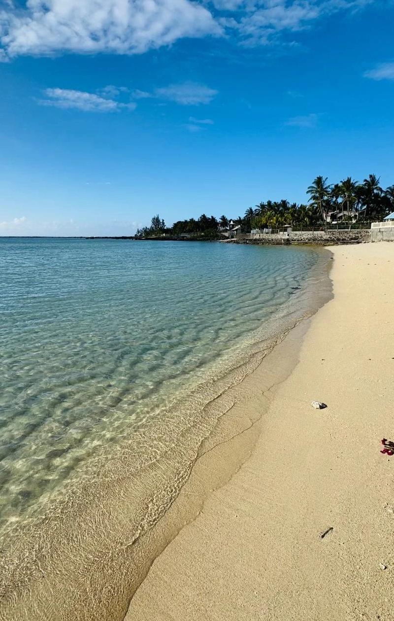
Albion Beach after the access Point
What Albion always has is the evening. The beach faces due west, the sun goes down behind the reef with the lighthouse in silhouette, and the rock shelf at the southern end is the place to sit for it. The main beach has parking and a few vendors; this end has nothing, so bring water. Park on the public road at the top. Our Albion beach guide has tide tables and the lighthouse walk.
La Preneuse
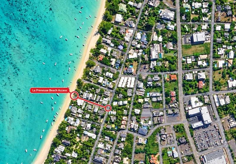
La Prenesuse beach access near The Bay hotel
La Preneuse is the beach of the Black River coast, a long strip of sand and casuarinas below the old Martello Tower, and this passage from the coastal road — now part of the Ministry’s official access map — puts you on it a short walk from the tower. The beach is quieter and more local than Flic en Flac to the north: fishermen’s pirogues pulled up on the sand, a few families under the trees, and the great wall of Le Morne mountain rising across the bay to the south.
The lagoon here is calm and sandy, pleasant for swimming without being spectacular; the reason to come is the view and the light. At the end of the day the sun drops into the sea with Le Morne in the frame, and the whole bay turns copper — it is one of the finest sunsets on the island and far less crowded than the ones at Flic en Flac. Before it, the Martello Tower is worth the twenty minutes: a small, round British fort from the 1830s, now a museum, with the story of the coast’s defence and the end of slavery told inside.
Boats from the Black River estuary use the lagoon, so swim close in. The village has shops and a couple of restaurants; the beach itself has shade and little else. Park on the public road near the tower. The La Preneuse beach guide and our coastal villages guide cover the rest of the Black River shore.
La Preneuse — Allée des Pêcheurs
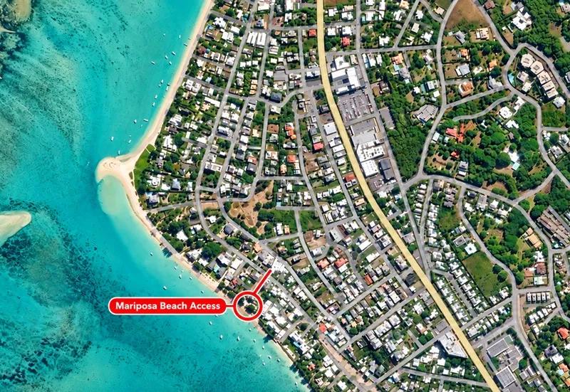
La Preneuse beach access near Mariposa hotel
This is the historic one. The passage at Allée des Pêcheurs, beside the La Mariposa hotel, was once the subject of a question in the National Assembly after it was narrowed almost to nothing — a reminder that these small public lanes can quietly disappear if nobody uses them. It is open, signed and on the official map now, and it leads to the southern end of La Preneuse beach, a stretch most visitors never reach because the main access is at the tower end.
The beach here is narrower and more natural: a band of sand under casuarinas and sea-almond trees, rocks at the tideline, the hotel’s lawn behind one side and the fishermen’s boats on the other. It is the end to choose for a quiet walk along the water, for an hour with a book, or for the sunset without anyone else in the photograph. The lagoon is the same calm, sandy water as the rest of La Preneuse, and the Le Morne view is, if anything, better from here because the mountain is closer. The hotel’s sunbeds and bar are the hotel’s; the sand and the sea are everyone’s.
No public facilities at this end. Park on the public road, not in the hotel’s spaces. Full beach detail is on the La Preneuse beach guide.
The South Coast: Wild, Open and Yours on a Weekday
The south is emptier and more exposed than the rest of the island. The reef sits further out or breaks altogether, the swell rolls in, and the beaches are long, windswept and often deserted. That is the attraction and the warning: a secluded south-coast beach is for walking and looking first, and swimming only when the sea is clearly calm.
South coast cove, Saint Félix side
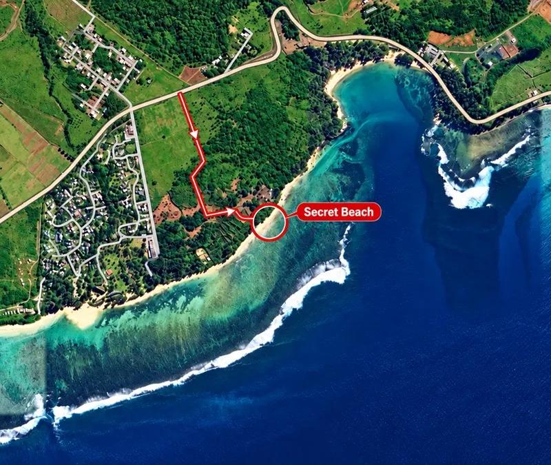
Secret Beach in the South
Between Bel Ombre and Pomponette the coast road runs a little inland through cane fields, and a sandy track off it leads down through the filao trees to a small cove that has no sign, no name on the tourist maps and, on most days, nobody on it. The beach is a short arc of coarse golden sand between black rock, with the surf breaking on the reef well out and the long sweep of the wild south stretching away to the west toward Baie du Cap.
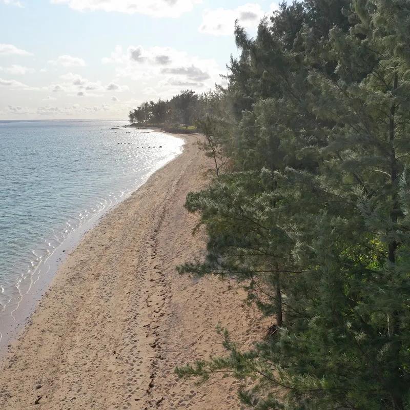
Secluded beach in the south near Outrigger resort
It is a place for a slow hour: a walk along the rocks at low tide, the photographs the south coast is famous for — dark rock, white surf, cane fields running down to the sea — and a picnic under the trees. The water is shallower and calmer inside the reef than it looks, but this is the open south, and a swim is for calm, settled days only; when the swell is up, stay on the sand. There are no facilities, no shade beyond the trees and no lifeguard, and the track is for a car with reasonable clearance or a short walk from the road. Leave nothing behind; small coves like this one show every piece of litter.
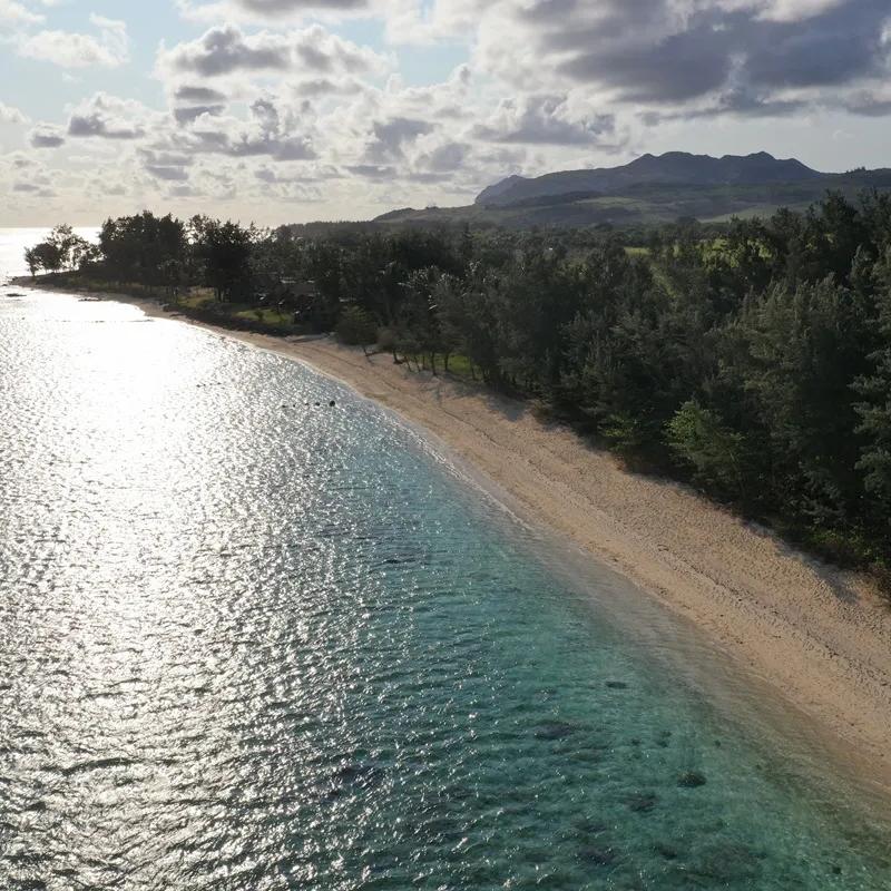
Important Note: This is Off road access
Pomponette
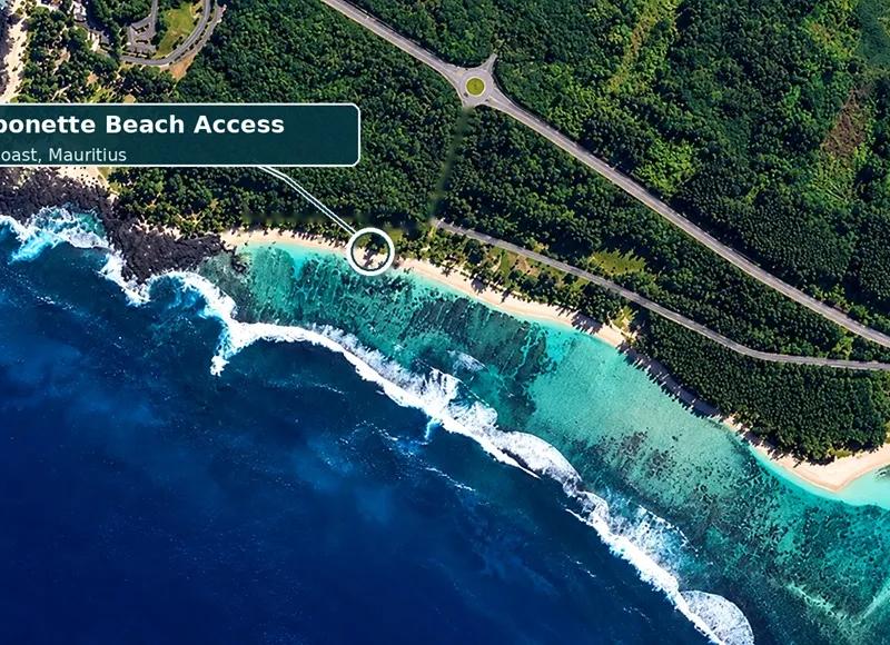
Pomponette is the south’s great wild beach — a long, straight, casuarina-backed strand near Rivière des Galets that has fought its own battle to stay public, and won. The narrow way in at this point leaves the coast road through the trees and comes out on the sand with the whole beach in front of you: a kilometre and more of pale sand, the surf breaking white on the reef far out, the wind off the sea, and very often not another person in sight on a weekday.
Pomponette is for walking. The beach runs long and open, the casuarinas give shade along the back, the light in the late afternoon is the best in the south, and the feeling of space is something the north simply cannot offer. Swim with respect: the lagoon is wider and calmer than at the cove to the west, and on a settled day the inner water is fine, but the south coast carries swell and currents that the lagoon coasts do not, there is no lifeguard, and in the winter trade winds it blows hard. Judge the sea when you arrive, and if in doubt, walk instead.
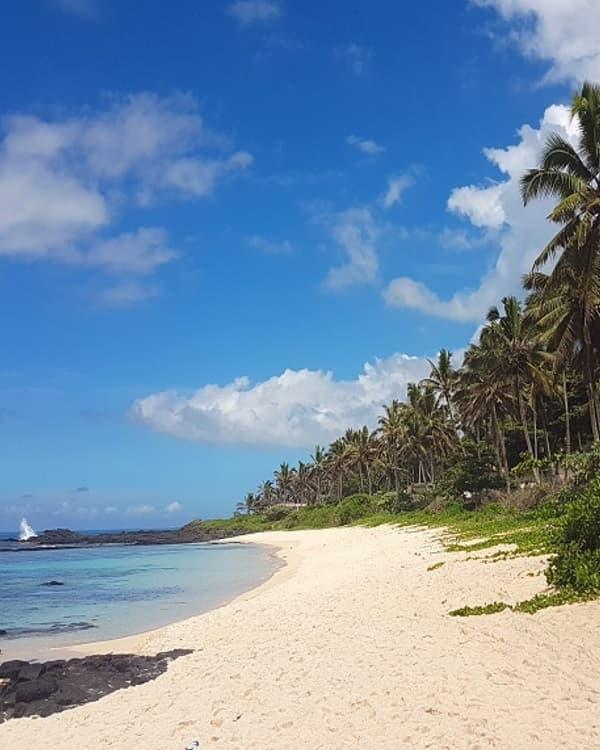
On weekends and public holidays Pomponette becomes a local picnic beach — families, music, lunch under the trees — and that is a good day to see it too. No facilities; bring water, shade and food, and park under the trees at the top of the track without driving onto the sand. The Pomponette beach guide has the full story of the beach and its access.
Four Easy Mini-Routes Using These Access Points
These are half-days built from the accesses above; our road-trip pages do the full day properly.
North: Trou aux Biches at seven for the turtles and the swim → Grand Baie for the market and lunch → Pointe d’Azur late in the afternoon if the sea is flat. The full route is our road trip north.
South-East: the Pointe d’Esny signed access for a morning swim → the Pointe Jérôme access and the Île aux Aigrettes boat → Mahébourg for the market and lunch. Full route: road trip south-east.
West: Albion at high tide for a swim and the lighthouse → La Preneuse for the Martello Tower and the Le Morne sunset. Full route: south-west coastal discovery.
South: the Saint Félix cove for the rocks and the photographs → Pomponette for the long walk and the late light. Day-length versions are on the Mauritius itinerary planner.
Best Time to Explore: Season, Weekdays, Weekends and Tides
Mauritius Meteorological Services calls November to April the warm, humid summer and June to September the cooler, drier winter, with May and October in between. For small beach accesses that means:
Summer brings the warmest, clearest water and the hottest walk down the alley. Carry more water than you think you need, keep an eye on the afternoon showers, and check the cyclone bulletins before a long coastal drive.
Winter is road-trip weather, but the south-east trade winds make Pointe d’Esny and the whole south coast blustery, and the sea on the exposed sides can still be rough.
Tides decide whether Albion and Butte à L’Herbe are swimming beaches or wading flats. Check the MMS tide tables and aim for the two hours either side of high water.
Weekends and public holidays turn a quiet weekday beach into a Mauritian family’s living room — picnics, music, cousins. That is the island at its best, but it is not solitude. Weekday mornings are when these beaches are yours.
December and January bring festive crowds and parking pressure everywhere; an early start beats a secret every time.
What to Bring When the Beach Has No Facilities
Most of these passages lead to stretches with no toilets, no showers, no vendor and no lifeguard. Plan as if you are going somewhere without a shop, because you are.
The GPS point saved offline before you leave mobile coverage
Water, and food if you are staying
Sun protection and a hat, and shoes that can handle a rough or sandy track — not flip-flops
A dry bag and as few valuables as possible; nothing left visible in the car
A tide check and a look at the sea before you swim
A rubbish bag: what you carry in, you carry out
Beach Access Etiquette: Parking, Private Property and Leaving No Trace
A beach can be public while every metre of land behind it is private. Reach the coast through the passage, the public road or the signed access — never by cutting through a garden, a hotel or a driveway. Everything else follows from that.
Parking. Legal roadside space or a public car park, and only where you block nothing: not a gate, a driveway, a footpath or anything that might be an emergency access. Never on the sand. If there is nowhere to leave a car, walk from further away.
Hotel grounds. The shoreline in front of a hotel is public; the sunbeds, the showers, the bar and the lobby are not. Walk the water’s edge and use nothing you have not paid for.
Residents. These lanes run past people’s homes. Keep your voice down early in the morning, and do not photograph houses, gates or the people who live behind them.
Blocked passages. If you find one of these accesses obstructed, do not force it and do not argue — note the spot and report it on the Ministry’s map; that is what the Government has asked for.
Coral and channels. Do not stand on coral at low tide. Find the boat channel before you swim in any busy lagoon.
Daylight. Narrow passages are for daylight. None of these is a place to find your way down after dark.
FAQs
Are beaches in Mauritius public? Yes. Beaches and the seashore are public domain, reaffirmed by the Government in June 2026. The land behind the beach may be private, so access is by a public passage, road or signed access point.
How do I find public beach access in Mauritius? Use the Ministry of Housing and Lands’ online map of public beaches and sea-access routes, look for the official signboards, and use the GPS points in this guide.
Is there a map of beach access points in Mauritius? Yes — launched in September 2026 at housing.govmu.org, starting with the west coast and expanding around the island.
How do you access Pointe d’Esny beach? By one of the two public passages the Ministry signposted in August 2026, on the coastal road between Blue Bay and Mahébourg. Both GPS points are above.
Can I walk through a hotel to reach the beach in Mauritius? No. Hotel grounds are private. Use a public access, and once on the beach, walk the shoreline.
Can a hotel stop you walking along the beach? Not along the public shoreline itself. It can restrict the use of its own facilities and grounds.
Where can I park for hidden beaches in Mauritius? Legal roadside space or a public car park, and only where you block nothing. Several of these accesses have no reliable parking at all — the entries say so.
What are the quietest beaches in Mauritius? On a weekday: the south coast — Pomponette and the Saint Félix cove — and the small north-east beaches such as Butte à L’Herbe. On a weekend or public holiday, none of them.
Are hidden beaches in Mauritius safe for swimming? Not automatically. The lagoon beaches in this guide are calm; the south coast carries swell and currents, and none of these spots has a lifeguard. Check the sea and the tide before every swim.
What is the best time to visit a quiet beach in Mauritius? Early on a weekday, outside the December–January festive period, at a tide that suits the beach.
Does low tide affect Mauritius beaches? Very much at the shallow lagoons — Albion and Butte à L’Herbe can be ankle-deep for hundreds of metres. Check the MMS tide tables.
Which hidden beach accesses are near Grand Baie? Pointe d’Azur at Pereybere, the Grand Baie passage and the quiet end of Trou aux Biches — all within fifteen minutes.
Which discreet access points are on the west coast? Albion, La Preneuse and the Allée des Pêcheurs passage at the southern end of La Preneuse, the last two now on the official 2026 map.
What should I bring to a beach with no facilities? Water, food, sun protection, proper shoes, a dry bag, a rubbish bag and an offline copy of the GPS point — and the knowledge that there is no lifeguard.
More Mauritius Beaches and Road Trips
Compare the island’s beaches by region and traveller in the best beaches in Mauritius, go beyond the coast with secret places and hidden gems in Mauritius, find the reef with the best snorkelling spots, and plan the full day with the Mauritius itinerary planner.
Dieses Thema entdecken
Neue Mauritius-Guides per E-Mail erhalten
Abonnieren Sie Mauritius Explored für Reiseideen, praktische Updates und herunterladbare Planungshilfen.

Geschrieben vom Redaktionsteam von Mauritius Explored, einem mauritischen Reiseführer für Strände, Aktivitäten, lokale Orte und praktische Reiseplanung.
Lokale Mauritius-Recherche, Routenplanung und Destinationsberichte seit 2011.