Mauritius Through 11 Coastal Villages That Show the Real Island
Explore Mauritius, One Idyllic Coastal Village at a Time
Mauritius is easy to photograph and easy to misread. Seen from a resort terrace, the coast looks like one long ribbon of white sand. Drive it, and the island breaks into pieces that have almost nothing in common: a surf bay under dry mountains, a fishing settlement below a UNESCO monolith, a southern village where the ocean hits bare rock because no reef stands in the way, a working waterfront where boats leave for an island all day.
This is a guide to eleven of those coastal places, ordered as you would actually drive them, from the west round to the north. Some are villages in the ordinary sense. Others are resort areas or small towns, and where that is the case this guide says so rather than dressing them up.
Which Coastal Villages Should You Visit in Mauritius?
The best coastal villages in Mauritius are spread across every coast, and each one offers something different. Tamarin has surf and mountains, Le Morne combines a fishing village with UNESCO heritage, Baie du Cap and Souillac show the wild south, Mahébourg is the island's most historic coastal town, Trou d'Eau Douce is a working boat village, and Grand Gaube stays quiet where Grand Baie is loud.
Why Explore Mauritius Through Its Coastal Villages?
One geographic fact shapes almost everything about these places: most of Mauritius sits behind a coral reef, and part of the south does not. Behind the reef you get shallow, sheltered lagoon water, fishing pirogues pulled up on sand, and villages that face a flat horizon. Where the reef is absent, the open Indian Ocean hits cliffs directly, and the villages there feel completely different.
The second thing that shapes them is history. Some of these settlements were built as ports, some grew around sugar estates, some were founded by freed people after the abolition of slavery in 1835, and some barely existed until tourism arrived in the 1970s. Knowing which is which changes how you see them.
You do not need to visit all eleven. Pick the two or three that match the trip you want, and treat them as regional loops rather than a single marathon drive.
Flic en Flac
Flic en Flac is a west-coast seaside town in the Black River district, and the most developed stop in this guide after Grand Baie. Its name is usually traced to the Old Dutch phrase Fried Landt Flaak, meaning flat or free land. Today it is a wide strip of accommodation, shops and beachfront that runs behind one of the island's longest public beaches.
Why stop here
• The public beach runs for several kilometres, backed by filao trees that give real shade in the middle of the day.
• The lagoon is reef-protected, shallow and calm, which makes it one of the more forgiving swimming beaches on the west coast.
• Accommodation spans budget guesthouses to five-star hotels, so it works as a base at almost any price level.
• It faces west, so sunsets are part of the daily routine rather than an excursion.
What to experience
Spend the afternoon on the public beach and stay for the sunset over the lagoon, with the outline of Le Morne Brabant visible far to the south. The diving off this coast is well established, with sites such as Snake Reef and the Cathedral, and snorkelling inside the lagoon is straightforward. Casela, the nature and adventure park, sits just inland, and the west-coast road trip links Flic en Flac to Tamarin, La Preneuse and Le Morne in one run. Street-food vendors work along the beachfront, and the food is best treated as part of the beach day rather than a separate outing.
Best for: families, first-time visitors, sunsets, swimming, an easy west-coast base.
MauritiusExplored tip: the filao shade thins out at either end of the beach, so if you are staying all day, pick your spot before midday rather than after. More detail is on the Flic en Flac beach guide.
Tamarin
Tamarin is a west-coast settlement built around a bay, a river estuary and a ring of dry hills, about fifteen minutes south of Flic en Flac and immediately north of Black River. It began as a fishermen's village and is now largely residential, with a moderate scale of holiday accommodation rather than a resort strip. The feel is landscape-led: mountains on three sides, a brown-sand beach, and a river that meets the sea in the middle of it.
Why stop here
• Tamarin Bay is one of the island's best-known surf spots, with two named breaks, Dal to the south and Black Stone to the north.
• The bay was made famous internationally by the 1974 surf documentary The Forgotten Island of Santosha, which is why you still hear the name Santosha Bay.
• Spinner and bottlenose dolphins are regularly seen in and off the bay in the early morning, before they move back offshore.
• The Tamarin River estuary, the salt pans and the mountains give the area a texture that a pure beach village does not have.
What to experience
Come early. Dolphin boats leave from this stretch of coast at first light, and Mauritian rules on approach distances, speed and swimming apply to every operator, so a good trip is a quiet one. Later, the Tamarin River is worth a look where it widens behind the beach, and the Tamarin and Black River day route strings the bay, the river and the Black River area together. Salt has been worked on this coast for generations, though most of the west-coast pans have closed and been built over; some salt working survives near Tamarin on a reduced, seasonal scale, and visitor access depends on the operator, so check locally rather than turning up.
Best for: surfing, photography, early mornings, travellers who want landscape over resort polish.
MauritiusExplored tip: do not judge Tamarin by its sand. The beach is darker and coarser than the postcard beaches of the north, and that is the point, because the setting is the bay and the mountains behind it. See the Tamarin beach guide.
Le Morne Village
Le Morne is two places at once. There is the peninsula of luxury resorts and kite lagoons, and there is the village itself, a small fishing community living below the mountain. Both sit beneath Le Morne Brabant, a 556-metre basaltic monolith that is one of the most significant heritage sites in the Indian Ocean. This is the section of the coast where scenery and history carry equal weight.
Why stop here
• UNESCO World Heritage. Le Morne Cultural Landscape was inscribed on the World Heritage List in 2008, a property of about 349.6 hectares with a much larger buffer zone, recognised for its association with maroons, the people who escaped slavery.
• Through the eighteenth and early nineteenth centuries, maroons sheltered in the caves and on the wooded summit, protected by cliffs that made the mountain nearly inaccessible. Oral tradition turned Le Morne into a symbol of the fight for freedom.
• The village of Trou Chenille, at the foot of the mountain, is regarded as the cradle of settlement in the south-west after abolition in 1835. An open-air museum opened there on 1 February 2020, with five traditional huts covering cooking, sega, crafts such as charcoal and salt making, fishing and traditional healing, alongside a twentieth-century lime kiln.
• The lagoon here is among the most striking on the island, and the peninsula is one of the world's better-known kitesurfing areas.
What to experience
Walk or drive out to the public beach for the classic view of the mountain across the water, then go south to La Prairie, a quieter sheltered beach where the reef sits close in and the snorkelling is good on a calm day. Hiking Le Morne Brabant is a serious half-day undertaking rather than a stroll, and it is done with registered guides on the heritage site. If you are here for wind rather than water, the kite season runs roughly April to November, and the famous One Eye break is an experts-only wave, not a place to learn. The so-called underwater waterfall seen in aerial photographs is an optical effect created by sand moving over the seabed.
Best for: culture and history, mountain-and-sea scenery, kitesurfing, photography, couples.
MauritiusExplored tip: treat the village and the resorts as separate visits. Sega tipik, the Mauritian musical tradition inscribed by UNESCO in 2014, belongs to this community's heritage, and the Le Morne Heritage Trust Fund manages the cultural site, so a guided visit there tells you far more than the view from the beach.
Baie du Cap
Baie du Cap is a small fishing village on the south-west coast, set between the lagoon and the hills, and most people drive straight through it. That is a mistake, because the road here is the experience: this is the stretch where the mountains come down to the sea and the coastal road bends around the rock at Macondé.
Why stop here
• Macondé is the rocky promontory at the western edge of the village, a cliff-side lookout reached by a hairpin on the coast road, with views along a coastline that has almost no development on it.
• The village itself is Creole in character, with small coloured houses, boats pulled up on the shore and nets drying along the beach.
• The Matthew Flinders monument stands on the shore a short distance west of the village. It was put up in 2003 for the bicentenary of the navigator's arrival in Mauritius, where he was then held for six years, unaware that Britain and France were at war.
• It is the natural link between Le Morne and the wild south, which makes it a stop rather than a destination.
What to experience
Park at the Macondé viewpoint, climb the steps and look both ways along the coast. Then drive slowly. Fishermen sell the day's catch at the roadside, and the rhythm of the village is entirely unhurried. The south coastal road trip runs through here on its way between Le Morne and Souillac.
Best for: road trips, photography, wild coastal scenery, a break between the south-west and the south.
MauritiusExplored tip: this is a viewing and driving stop, not a swimming one. Conditions along this stretch are not documented the way the lagoon beaches are, so if you want to get in the water, do it at Le Morne or further east.
Souillac
Souillac is a south-coast village and the administrative seat of the Savanne district, with over six thousand residents. It was founded in 1787 as a port serving the south, chosen because the Savanne River forms a deep estuary here and no coral reef blocks the way in. Its port role faded after the railways reached the south in 1877, but the village kept growing, and it remains the best single introduction to the Wild South.
Why stop here
• No reef means no lagoon. The waves hit the cliffs directly, which is why the coast here looks and sounds nothing like the rest of the island.
• Gris Gris and La Roche qui Pleure sit just east of the village, where one rock appears to weep when the waves break across it. Swimming is dangerous here and is not permitted.
• Telfair Garden is a seaside public garden of banyan and almond trees, named after the naturalist Charles Telfair, with a coastal path beside it.
• Rochester Falls, on the Savanne River near the village, drops around ten metres over unusual columnar basalt, the vertical volcanic columns of an old lava flow.
What to experience
Start at Gris Gris for the cliffs and the open-ocean swell, walk through Telfair Garden, then go inland to Rochester Falls. The Robert Edward Hart Memorial Museum occupies La Nef, the coral-stone bungalow by the shore where the Mauritian poet lived; it became a museum in 1967 and holds his letters, manuscripts and personal belongings. Access and opening arrangements at all of these change, so check locally on the day rather than planning to the hour.
Best for: wild coastal scenery, photography, literature and history, a contrast day away from the lagoon.
MauritiusExplored tip: go when the swell is up if you want the drama, and keep well back from the wet rock. The same waves that make Gris Gris worth the drive are the reason nobody swims here. The Souillac beach guide covers the coast either side of the village.
Mahébourg
Mahébourg is a south-east coastal town of more than fifteen thousand people, the main town of the Grand Port district, and the strongest place on the island for travellers who want to see everyday Mauritius rather than resort Mauritius. It sits on a very large lagoon, its grid of straight streets reflects early nineteenth-century French planning, and its name was already on a map by 1804.
Why stop here
• History you can stand in. The Battle of Grand Port was fought offshore from 20 to 27 August 1810 and ended in a French victory, the most significant defeat for the Royal Navy of the Napoleonic Wars and the only naval battle commemorated on the Arc de Triomphe.
• The National History Museum occupies Château Gheude, a French colonial house built around 1772 that served as a field hospital during the battle. It opened as a museum in 1950 and holds naval artefacts from the wrecks, early maps, and a near-complete dodo skeleton.
• The waterfront is a genuine local promenade: fishermen working, families out in the late afternoon, an islet offshore, and a market beside it.
• Île aux Aigrettes lies about a kilometre offshore, a coral limestone islet of some 26 hectares, a nature reserve since 1965 and managed by the Mauritian Wildlife Foundation. It holds the last remaining fragment of Mauritian dry coastal forest, along with pink pigeons, Telfair's skinks and Aldabra giant tortoises introduced to replace the extinct Mauritian species.
What to experience
Walk the waterfront first, then the streets behind it, then the museum. Blue Bay and Pointe d'Esny are a short drive south, and Blue Bay Marine Park, 353 hectares, has been a marine park since 2000 and a Ramsar wetland of international importance since 2008, which is why the snorkelling there is regulated. Inland, Lion Mountain rises above Vieux Grand Port at around 450 metres. The Mahébourg and surroundings route and the south-east coastal road trip both build a day around the town.
Best for: local life, history, food, families, photography, culture.
MauritiusExplored tip: museum access in Mauritius changes without much notice, so confirm the National History Museum is open before you build a day around it. The Mahébourg village guide covers the market and waterfront in more detail.
Trou d'Eau Douce
Trou d'Eau Douce is an east-coast fishing village whose name means fresh-water hole, after a spring where fresh water meets the sea. Dutch ships took on water here on the way to the East Indies, and people were camped on the site as early as the seventeenth century. Today it is the main departure point for Île aux Cerfs, which has turned a small village into a busy waterfront without erasing the fishing life behind it.
Why stop here
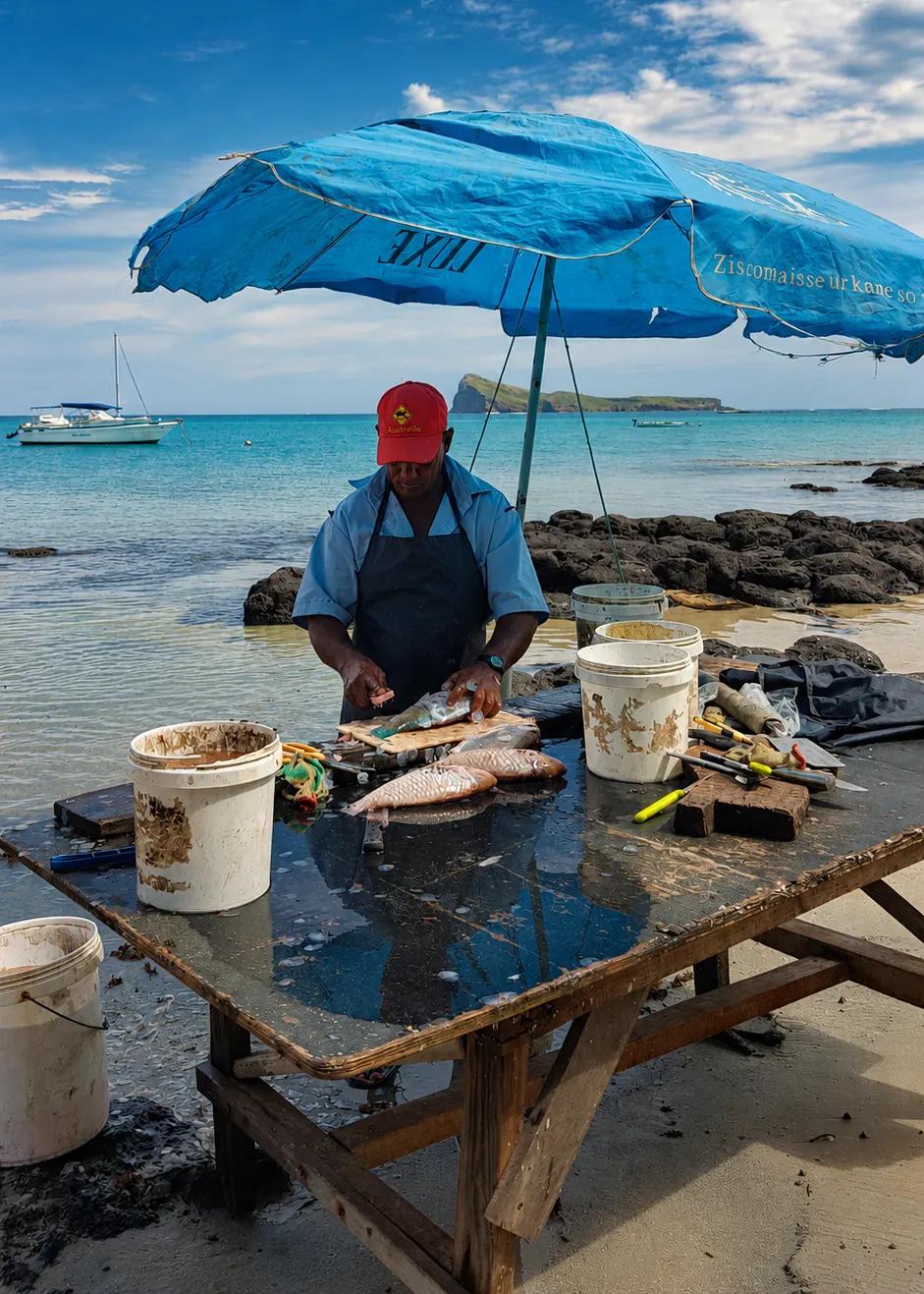
• The Débarcadère, the fish landing station, is still worked early in the morning, with nets and gear untangled on the quay before the day's boat traffic starts.
• It is the standard departure point for Île aux Cerfs, the east-coast island with its own golf course, reached by speedboat or catamaran.
• Boat trips from this coast also run to the Grand River South East waterfall, where the river meets the tide among ravines. Flow depends on recent rainfall and is much weaker in the dry months.
• The village keeps a genuine working character: narrow streets, corrugated-iron houses, a small beach, and a centre used by residents as much as by visitors.
What to experience
Arrive early enough to see the boats before the excursions leave, then take the lagoon trip if the weather is settled. What any given trip includes varies by operator, so confirm the route, the stops and the return time when you book rather than assuming. Afterwards, the east-coast beaches north of the village are the quieter half of the day.
Best for: lagoon excursions, working-waterfront atmosphere, photography, families.
MauritiusExplored tip: the village is at its most interesting in the hour before the tour boats fill the jetty. See the Trou d'Eau Douce guide for what is around the waterfront.
Belle Mare
Belle Mare is an east-coast settlement fronting one of the longest beaches in Mauritius, a run of powder-white sand and filao trees that stretches south towards Trou d'Eau Douce. It is more resort coast than village: hotels of three to five stars sit along it, interspersed with family-run bungalows, apartments and public stretches of sand.
Why stop here
• The reef sits roughly a kilometre offshore, so the lagoon here is wide, shallow and unusually clear.
• The coast faces east, which makes it one of the best places on the island to watch the sunrise over the Indian Ocean.
• There is a designated public beach with facilities among the resort frontages, so the coast is not closed off to non-residents.
• The east takes the trade winds directly, with stronger and more consistent wind from around May to October, and a cooling breeze through the summer months.
What to experience
Walk the sand early, when the light is low and the lagoon is glassy. The flat coastal road behind the beach suits a slow cycle or a long walk. Palmar, the neighbouring public beach, continues the same stretch of coast towards Trou d'Eau Douce, and Sundays are when Mauritian families arrive with picnics and the beach is at its most local.
Best for: swimming, sunrise, couples, families, long beach walks, a resort-led stay.
MauritiusExplored tip: the water on this coast feels cooler in the winter months, and the wind that makes it refreshing in summer is the same wind that kitesurfers come for in winter. Pick your month to match. The Belle Mare beach guide has more on the coastline.
Grand Gaube
Grand Gaube is a fishing village on the north-east coast, roughly fifteen minutes from Grand Baie and a world away from it in pace. The name is traced to a Gascon or Béarnais word for water or current, and the village first appears on the Descubes map of 1880. It grew in the early nineteenth century around the Belle-Vue Cugnet sugar estate, and after the abolition of slavery in 1835 freed people settled here and took up fishing.
Why stop here
• Pirogues. Grand Gaube became known across the island for building wooden pirogues, the boats used for artisanal lagoon fishing, and fishermen elsewhere commissioned boats from its carpenters for decades. Fibreglass hulls have largely displaced the craft, which makes the surviving wooden boats on the shore worth a proper look.
• The fishing identity is still visible: boats on the water, fishermen working, and the catch sold on the waterfront.
• The view offshore takes in Coin de Mire, also called Gunner's Quoin, along with Île Plate, Round Island and Serpent Island.
• Butte à l'Herbe, just along the coast, is a quiet spot for a walk or a picnic with Coin de Mire in front of you.
What to experience
This is a place to slow down rather than tick off. The main beach is used more by residents than by visitors, parts of the shore are rocky, and the pace is set by the boats. Historically the coast here is significant too: the Saint-Géran sank in August 1744 in the pass south of the village, the wreck that inspired the novel Paul et Virginie. The north road trip links this coast with Cap Malheureux and the beaches west of it.
Best for: quiet village life, fishing culture, photography, slow mornings, a calmer northern base.
MauritiusExplored tip: if you want the northern islands in the background of your photographs without the crowds in the foreground, this coast gives you the same view as Grand Baie with a fraction of the traffic. See the Grand Gaube beach guide.
Grand Baie
Grand Baie is the most developed coastal place in Mauritius and the busiest tourism centre in the north, with a resident population of around twelve thousand. It began as a fishing village on a large natural harbour, and seventeenth-century Dutch settlers are recorded as calling it the bay without end. It is not a quiet traditional village today, and pretending otherwise helps nobody. What it is, is the island's most convenient base.
Why stop here
• The bay is a natural harbour with several beaches along it, including La Cuvette, a small sheltered stretch of shallow water.
• It is the main departure point for northern-island excursions, to Coin de Mire, Flat Island, Round Island and Îlot Gabriel, on catamarans and speedboats.
• Watersports are concentrated here: sailing, windsurfing, water-skiing, parasailing, diving and undersea walks.
• It has the island's densest choice of restaurants, shopping and nightlife, which is the practical reason many people base themselves here even if they spend their days elsewhere.
What to experience
Use it as a hub. Take a boat out to the northern islands on a settled day, come back for the evening, and use the mornings for the rest of the coast: Pereybère with its clear swimming water is a few minutes north, and Cap Malheureux, named unlucky cape after British troops landed in the north in 1810 and took the French by surprise, sits at the tip of the island. Landing permissions and routes for the northern islets vary by operator and weather, so confirm before you pay. The Grand Baie village guide and the beach guide cover the bay itself.
Best for: nightlife, restaurants, boat excursions, shopping, a convenient first-time base.
MauritiusExplored tip: the bay is at its best early. Boats are loading, the water is flat, and the village looks like the fishing harbour it used to be before the day gets going.
Trou aux Biches
Trou aux Biches is a north-coast settlement in the Pamplemousses district that was a fishing village in the nineteenth century and appears on maps under French rule as early as 1807. Its first major hotel was built in 1971, and unlike Grand Baie it still keeps a village layout, with small shops and everyday facilities along the coast road. It is explicitly the calmer alternative on the same coast.
Why stop here
• The public beach runs for about two kilometres, with white sand shaded by filao trees.
• The lagoon is reef-protected, shallow and calm, with coral gardens close enough to snorkel from the beach.
• It faces west, so it is a sunset beach as much as a swimming one.
• Mont Choisy is next along the coast, Grand Baie is a short drive north, and Pamplemousses with its garden and sugar museum is inland, which makes this a practical base without the noise.
What to experience
Snorkel in the morning when the lagoon is at its clearest, walk the beach in the afternoon, and stay for the sunset. The Maheswarnath Mandir, founded in 1888, stands inland at Triolet and is one of the most significant Hindu temples on the island. The north road trip ties this coast to Pamplemousses, Grand Baie and Cap Malheureux in a single loop.
Best for: quiet stays, snorkelling, families, couples, an easy northern base.
MauritiusExplored tip: this is the north coast's compromise beach. You get the lagoon and the sunsets of the north without Grand Baie's traffic, and Grand Baie is still close enough for dinner. See the Trou aux Biches beach guide.
Which Mauritius Coastal Village Is Right for You?
• For sunsets: Tamarin, Flic en Flac and Le Morne, all west or south-west facing.
• For local history: Mahébourg, without question.
• For wild coastal scenery: Souillac and Baie du Cap, where the reef stops protecting the shore.
• For quieter village life: Grand Gaube.
• For nightlife and restaurants: Grand Baie.
• For lagoon excursions: Trou d'Eau Douce.
• For mountain-and-sea scenery: Le Morne.
• For an easy northern base: Trou aux Biches.
Coastal Villages for Food and Local Life
Mahébourg is the strongest choice, because its market and waterfront serve the town rather than the visitor. Baie du Cap sells the day's catch at the roadside, Grand Gaube's fishmongers work the waterfront, and Flic en Flac has street-food vendors along the beach. Grand Baie has the widest choice of restaurants on the island, though that is a different experience from eating where the village eats.
Coastal Villages for Beaches and Swimming
The reef decides this. Trou aux Biches, Flic en Flac, Belle Mare and Le Morne all sit behind a reef with shallow, sheltered lagoon water. Grand Baie has small sheltered beaches around the bay. Grand Gaube is rocky in places and is better for looking than for swimming. Souillac and Gris Gris are not swimming places at all, and the signs there are not decorative.
Coastal Villages for Photography
• Tamarin: the bay with the mountains behind it, early morning.
• Le Morne: the mountain from the water, and the village at its foot.
• Baie du Cap and Macondé: the coastal road curving between rock and sea.
• Souillac: waves breaking on black cliffs with no reef to soften them.
• Grand Gaube: wooden pirogues with Coin de Mire behind them.
• Mahébourg: the waterfront in the late afternoon and the streets behind it.
Coastal Villages for Couples
Le Morne for scenery and heritage, Belle Mare for a quiet lagoon and sunrise walks, Trou aux Biches for sunsets without the crowds, and Tamarin if you would rather have mountains and surf than a resort strip. Grand Baie works if you want dinner and a bar afterwards.
Coastal Villages for Families
Flic en Flac and Trou aux Biches have the easiest combination of shallow lagoon water, shade and facilities. Belle Mare has the space. Trou d'Eau Douce gives children a boat day. Mahébourg is the one that will teach them something, with the museum, the waterfront and the islet reserve offshore.
Can You Explore Mauritius' Coastal Villages by Road Trip?
Yes, but not all eleven in one day. Mauritius is small, and it is still a full day's driving to go round it properly, which leaves no time to stop. These places work as regional loops, one coast at a time.
• North: Grand Baie, Trou aux Biches and Grand Gaube sit on the same coast but on different sides of the cape, so treat them as two short outings rather than one line. The north road trip covers the western half.
• West: Flic en Flac to Tamarin to Le Morne is the natural run, and it is the one drive where the landscape changes completely from start to finish. See the west road trip.
• South: Le Morne to Baie du Cap to Souillac, along the coastal road through Macondé. The south coastal route follows it.
• South-east: Mahébourg on its own, with Blue Bay and Pointe d'Esny nearby, using the south-east coastal road trip.
• East: Trou d'Eau Douce and Belle Mare, which are close enough to combine with a lagoon excursion in the same day.
More routes, distances and maps are in the road-trip collection, and the places to visit hub has the individual stops.
Where Should You Stay to Explore the Coast?
• North base: Trou aux Biches for calm, Grand Baie for convenience and choice. Both put the north and Port Louis within easy reach.
• West base: Flic en Flac or Tamarin, which are the best starting points for the west coast, the south-west and the interior.
• South-west base: Le Morne, the strongest scenery on the island and the natural start for the south coastal road.
• East base: Belle Mare or Trou d'Eau Douce, for lagoon days and the south-east.
• South-east base: Mahébourg and Pointe d'Esny, closest to the airport and to the most local atmosphere of any coastal town.
Once you know your base, a car makes the difference between seeing one coast and seeing the island. Car rental in Mauritius covers vehicle options and driving on the left, and the beach finder matches a beach to the kind of day you want.
Frequently Asked Questions
What are the best coastal villages in Mauritius?
Tamarin, Le Morne Village, Baie du Cap, Souillac, Mahébourg, Trou d'Eau Douce, Grand Gaube, Flic en Flac, Belle Mare, Trou aux Biches and Grand Baie cover every coast between them. The best one depends on what you want: history at Mahébourg, wild coast at Souillac, fishing life at Grand Gaube, heritage and scenery at Le Morne.
What is the prettiest village in Mauritius?
There is no single answer, because the island's coasts look nothing alike. Le Morne has the most dramatic setting, with the mountain above the lagoon. Baie du Cap has the best coastal road. Grand Gaube has the most photogenic working boats. Souillac has the most powerful coastline. Choose by the kind of beauty you want.
Which fishing villages can you visit in Mauritius?
Grand Gaube on the north-east coast has the strongest surviving fishing identity, including a tradition of building wooden pirogues. Trou d'Eau Douce on the east coast still works its fish landing station each morning. Baie du Cap in the south-west sells its catch at the roadside, and Le Morne Village keeps a small fishing community below the mountain.
Where can I experience local life in Mauritius?
Mahébourg is the clearest choice, a district town of more than fifteen thousand people where the market, the waterfront and the streets serve residents first. Grand Gaube and Trou d'Eau Douce offer village-scale versions of the same thing. Sunday afternoons on any public beach are when Mauritian family life is most visible.
Is Mahébourg worth visiting?
Yes, particularly if you want history. The Battle of Grand Port was fought offshore in August 1810, the National History Museum occupies a 1772 colonial house that served as a field hospital during it, and Île aux Aigrettes offshore protects the last fragment of Mauritian dry coastal forest. The waterfront and market are the everyday counterpart.
Is Tamarin worth visiting?
Yes, if you like landscape over resort comfort. Tamarin Bay has two well-known surf breaks, dolphins are regularly seen offshore in the early morning, and the setting of river, estuary and mountains is unlike anywhere else on the west coast. The beach is darker and coarser than the northern lagoon beaches.
Is Grand Gaube worth visiting?
Yes, if you want the quiet version of the north. It is a working fishing village known historically for pirogue building, with views out to Coin de Mire and the northern islands, and a shoreline used mainly by residents. It is about fifteen minutes from Grand Baie and far slower in pace.
Is Trou d'Eau Douce worth visiting?
Yes. It is the main departure point for Île aux Cerfs, so most visitors pass through, but the village itself rewards an earlier arrival: the fish landing station is worked at dawn and the streets behind the waterfront are still a fishing village rather than a resort strip.
Is Le Morne Village worth visiting?
Yes, and it deserves more than a photo stop. Le Morne Cultural Landscape was inscribed by UNESCO in 2008 for its association with maroons who escaped slavery, and the Trou Chenille open-air museum at the foot of the mountain, opened in February 2020, sets out the settlement's history through five traditional huts.
Is Souillac worth visiting?
Yes, as a contrast rather than a beach day. Souillac shows the coast without a reef, where waves break directly on the cliffs at Gris Gris and La Roche qui Pleure. Telfair Garden, Rochester Falls and the poet Robert Edward Hart's coral-stone house are all within a short drive.
Is Grand Baie a village?
It began as one, on a large natural harbour the Dutch are recorded as calling the bay without end, but it is now the island's most developed northern tourism centre, with around twelve thousand residents, malls, restaurants and nightlife. Grand Gaube and Trou aux Biches are closer to what people picture when they say village.
Which coast of Mauritius has the best villages?
The south-west and south, from Le Morne through Baie du Cap to Souillac, have the most distinctive coastal settlements and the most dramatic landscape. The south-east has the best town in Mahébourg. The north has the most convenience, and the east the best combination of lagoon and working waterfront.
Can you drive around the coast of Mauritius?
Yes. The island is small enough to circle, but doing it in one day means driving rather than stopping. Regional loops work far better: west, south, south-east, east and north, each as its own outing, with a day or half a day for each.
How many coastal villages can you visit in one day?
Two or three in the same region is realistic if you actually want to look around. Flic en Flac, Tamarin and Le Morne make one good day. Le Morne, Baie du Cap and Souillac make another. Trying to cross from the north to the south and back in a day leaves you with photographs of the road.
Where should I stay to explore Mauritius by car?
The west, around Flic en Flac or Tamarin, gives the best access to the west, the south-west and the interior. The south-east, around Mahébourg, is closest to the airport and the south-east coast. The north is the most convenient for restaurants and boat trips but the furthest from the south.
Explore this topic
Get new Mauritius guides by email
Join the Mauritius Explored list for trip ideas, practical updates and downloadable planning help.

Written by the Mauritius Explored editorial team, a Mauritian travel guide focused on beaches, activities, local places, and practical island planning.
Local Mauritius travel research, itinerary planning, and destination coverage since 2011.