15 Places in Mauritius Tourists Rarely Find
The Mauritius Most Visitors Drive Past: 15 Places Beyond the Postcards
Last updated: 27 September 2026
Almost every first trip to Mauritius runs on the same short list. Le Morne, Chamarel, Île aux Cerfs, Grand Baie, the Black River Gorges viewpoint, three or four famous beaches. Those places deserve their reputation. The problem is that the road between them passes a second island that almost nobody stops for: a lava cave system under the north-east, a national park most visitors have never heard of, a poet's coral-stone house in Souillac, the excavated foundations of a Dutch fort, a wetland beside Port Louis where migratory birds arrive every southern summer.
None of this is secret. Most of it is officially managed, signposted and open to the public. It is simply not on the standard itinerary, which is a different thing entirely. This guide covers fifteen of those places, grouped as regional detours rather than a list of pins, with what is actually verified about each one and what you need to check before you go.
Quick Answer: What Are the Best Off-the-Beaten-Path Places in Mauritius?
The strongest detours are the Roches Noires lava tubes and Bras d'Eau National Park in the north-east, Vieux Grand Port and the Frederik Hendrik Museum in the south-east, the Vallée d'Osterlog endemic forest, the Robert Edward Hart Memorial Museum and Cascade Léon in the south, Le Souffleur and the Ruines de Savinia on the volcanic south coast, and Case Noyale in the south-west. Treat them as additions to a regional road trip rather than as separate must-sees.
Why the Best Detours Sit Between the Famous Places
Three things keep these places off itineraries, and none of them is quality.
• They are not promoted. A forest trail run by the Forestry Service has no marketing budget. A resort excursion desk does.
• They are small. Several of these are twenty-minute stops, not half-day destinations, and tour operators build days around bigger units.
• They are between things. Case Noyale is the village you drive through on the way from Le Morne to Chamarel. Vieux Grand Port is the bay you pass on the road out of Mahébourg.
So the useful way to plan is not to add fifteen stops to your week, but to pick the two or three that lie on routes you are already driving. Our road-trip routes show those routes, and the places directory has the individual entries. If you want the island's classic short list instead, the top 15 things to do is the place to start.
One note on language. This guide avoids calling these places secret or undiscovered, because most of them are public sites with published visitor information, and a few are getting busier every year. Where that is happening, it says so.
North and North-East: Forest Loops, Lava Tubes and a Shipwreck Coast
The north beyond Grand Baie and Cap Malheureux empties out quickly. Drive twenty minutes east of the resort strip and the traffic thins, the coast turns rockier, and the interior becomes sugar cane and state forest.
1. Belle Vue Forest Trail, Daruty
What it is: a network of flat forest loops at Petit Raffray, in state planted forest created during the French and British colonial period in the eighteenth century.
Why visitors miss it: it is a Forestry Service site with no promotion, on a road most tourists never take, and it looks like nothing from outside.
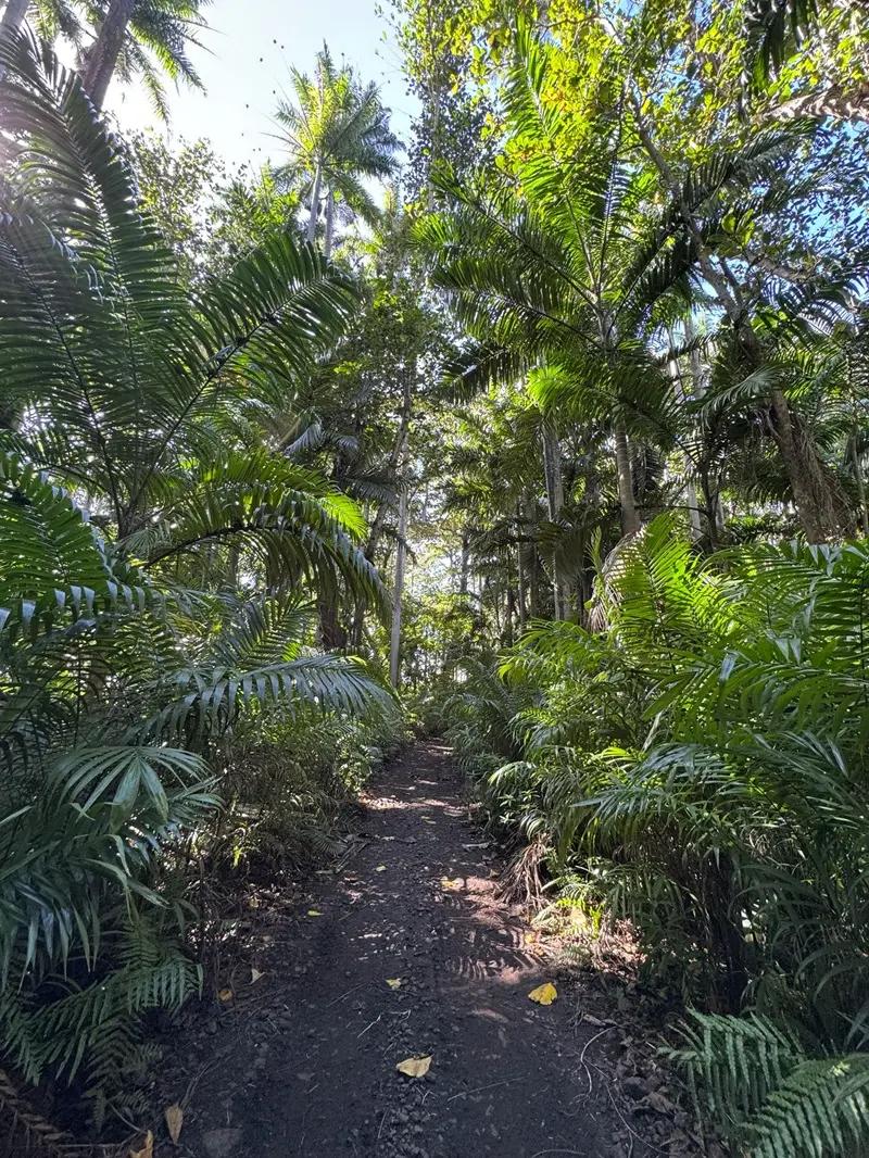
Why it is worth the detour: the official description puts the site at 9.2 hectares within a larger 108.22 hectares of state forest, with loops from about 500 metres up to around 3 km, and calls the trails attractive for their flatness. There are mature planted trees, an outdoor gym and the vestiges of an early sugar mill model in the forest. Vale Road, the B12, crosses it.
• Worth the detour: a 45-minute to 90-minute stop. Best for: a repeat trip, or a first trip with time to spare.
• Who it suits: walkers who want greenery without a climb, families, photographers, anyone staying in the north on a hot afternoon.
• Pair it with: Cap Malheureux or the north-east coast road towards Poudre d'Or.
• Check before going: current access and whether the gates are open, since no opening hours are published. Official description.
2. Roches Noires Lava Tubes
What it is: a lava cave system under the north-east coast, formed by flowing lava that drained and left tunnels behind. Named caves in the area include Princess Margaret Cave, Bassin Lave and Trou Diable.
Why visitors miss it: almost nobody associates Mauritius with caving, and the entrances are inconspicuous.
Why it is worth the detour: it is the most unexpected landscape on the island. A 1998 survey recorded 114 lava caves and about 12.8 km of surveyed passage in Mauritius, with one cave at Roches Noires measuring around 810 m. The caves matter ecologically too: the survey found Mascarene cave swiftlets in 35 caves and free-tailed bats in at least eight, and noted that none had statutory protection at that time. Inside there are chambers, freshwater pools and water deep enough to wade.
• Worth the detour: one to two hours. Best for: either a first or a repeat trip. This is the one place on the list that could justify its own morning on a first trip.
• Who it suits: geology enthusiasts, photographers with a light source, repeat visitors, anyone bored of lagoons.
• Pair it with: Bras d'Eau National Park, which is nearby, or the east-coast beaches.
• Check before going: go with a guide. When the site was inaugurated in 2015, the then Prime Minister publicly advised against visiting the caves unaccompanied, and guided tours that include transfer are sold commercially. The land status is not clearly published anywhere, so do not assume open access, and expect low ceilings and some scrambling. Guided products typically exclude young children, pregnant travellers and older visitors, which tells you something about the terrain. Cave survey.
3. Bras d'Eau National Park and Mare Sarcelle
What it is: Mauritius' second terrestrial national park, proclaimed on 25 October 2011, covering 497.2 hectares in the north-east.
Why visitors miss it: Black River Gorges takes all the attention, and the name is confusing, because Bras d'Eau is also a beach. Many people go to the beach and never realise the park is inland.
Why it is worth the detour: it is a working forest rather than a showpiece. The park service describes mainly mahogany, araucaria, tecoma and eucalyptus plantations that also harbour patches of native vegetation and endemic birds. The main walk is the Coq des Bois Trail, fairly easy and published as about 5 km return from the visitor centre, ending at the Mares Chevrettes, with a loop extension. Mare Sarcelle, 89.37 hectares within the park, holds mangroves, native plants and migratory birds, and is noted for birdwatching.
• Worth the detour: half a day with the trail, or an hour if you only walk in. Best for: a repeat trip, unless you are a birder.
• Who it suits: birders, walkers, anyone staying on the east coast who wants shade.
• Pair it with: Bras d'Eau beach, Roches Noires, or Poste de Flacq.
• Check before going: no opening hours, fees or permit rules are published, and the trail's stated distance is inconsistent on the official page. The National Parks and Conservation Service takes visitor enquiries by phone. Official park page.
4. Poudre d'Or and the Saint-Géran
What it is: a quiet north-east fishing village, and the coast where the French East India Company ship Saint-Géran was wrecked in 1744.
Why visitors miss it: there is no attraction as such. There is a village, a church, a small seaside park and a monument.
Why it is worth the detour: the story. The Saint-Géran, built in 1736 and carrying more than two hundred people, struck a reef off this coast on the night of 17 to 18 August 1744. Most of those in the water drowned; around nine reached Île d'Ambre, offshore. The monument in the seaside park was erected by the Society of Mauritian History in August 1944, on the two-hundredth anniversary, and looks towards the island where the survivors landed.
The wreck also became literature. Bernardin de Saint-Pierre's Paul et Virginie, published in 1788, ends in a shipwreck, and the author had witnessed one during his time on the island. Paul and Virginie are fictional characters, so the wreck is history and the lovers are not.
• Worth the detour: a 20-minute stop. Best for: a repeat trip.
• Who it suits: history readers, photographers who like working harbours, anyone driving the north-east coast.
• Pair it with: Bras d'Eau, Roches Noires, or a kayak trip to the Île d'Ambre mangroves.
• Check before going: nothing, beyond ordinary respect for a village going about its day. This is a public park by a church.
East and Grand Port: A Temple, an Excavation and an Endemic Forest
From the east-coast resort strip at Belle Mare and Trou d'Eau Douce, the interesting detours are cultural and forested rather than coastal.
5. Sagar Shiv Mandir, Poste de Flacq
What it is: a Hindu temple built on an islet at Poste de Flacq, surrounded by the lagoon and mangroves, with a tall bronze-coloured statue of Shiva visible from the coast road.
Why visitors miss it: it sits just off a road that resort traffic uses to get somewhere else, and it is a working temple rather than an attraction.
Why it is worth the detour: the setting is genuinely unusual, water on three sides and mangrove edges, and it connects the east coast to the island's living Hindu culture rather than its colonial history. It is a place of worship first.
• Worth the detour: 20 to 30 minutes. Best for: either a first or a repeat trip.
• Who it suits: photographers, travellers interested in Mauritian religious life, anyone staying at Belle Mare.
• Pair it with: Bras d'Eau, or the coast road north to Roches Noires.
• Check before going: the temple publishes no visiting guidance, dress code or photography policy of its own, so ask on arrival, dress modestly, and do not photograph people at prayer. Our temple page has more on the setting and etiquette.
6. Vieux Grand Port and the Frederik Hendrik Museum
What it is: a national heritage site on the bay where the Dutch first settled Mauritius, with a small museum beside the ruins.
Why visitors miss it: it is signposted, free and five minutes from Mahébourg, and still most visitors drive past it towards Blue Bay.
Why it is worth the detour: this is the oldest layered history on the island, and the museum is precise about it. The structures above ground are French, built after 1753 on the ruins of the Dutch Fort Frederik Hendrik: a lodge, a prison, a bakery, a bancassal and a blacksmith's workshop. The Dutch remains were excavated in 2000 and lie about 50 cm below ground. The site also holds the ruins of the first Catholic church, established by Mahé de Labourdonnais in 1737, and a French-period powder house. The museum displays what the digs produced, from musket and cannon balls to clay pipes, ceramics, coins and food remains, and a two-month excavation continues each year with Dutch researchers.
• Worth the detour: one to two hours. Best for: either a first or a repeat trip. This is the strongest history stop on the list.
• Who it suits: history lovers, families with curious children, anyone staying in the south-east.
• Pair it with: Mahébourg's waterfront, Lion Mountain from the road, or Blue Bay.
• Check before going: the Mauritius Museums Council publishes hours of 09:00 to 16:00 on Monday, Tuesday, Thursday, Friday and Saturday, 11:00 to 16:00 on Wednesday and 09:00 to 12:00 on Sunday, closed on public holidays, with free entrance, as published at the time of writing. Museum hours change, so confirm by phone. Official museum page and our site guide.
7. Vallée d'Osterlog Endemic Garden
What it is: 275 hectares of sub-humid mountain forest in the Grand Port range, between Mountain Lagrave and Mountain Laselle, managed by a foundation established in 2007 to restore native forest.
Why visitors miss it: it is not on any excursion circuit, and it asks visitors to register rather than simply turn up.
Why it is worth the detour: it shows what Mauritius looked like before sugar. The foundation describes the forest as part of the two per cent of native and endemic forest that remains, naming species including bois clou, vacoas and tambalacoque. A pair of pink pigeons lives in the restored forest alongside four Aldabra giant tortoises, and the Mauritius black bulbul and grey white-eye have been recorded. The published visit is a 1 km trek, with viewpoints, streams and waterfalls.
• Worth the detour: half a day including the drive. Best for: a repeat trip, and worth planning around.
• Who it suits: conservation-minded travellers, birders, slow walkers, families with older children.
• Pair it with: Vieux Grand Port, or the road south towards Souillac.
• Check before going: the foundation asks visitors to complete a registration form, publishes hours of 9 to 16 every day including Sundays and public holidays at the time of writing, and states that the visit is not suitable for pregnant women or children under five. It recommends hiking shoes, sun protection and repellent. Waterfall and swimming access is not promised, so do not plan on it. Official page.
The Wild South: A Poet's House, a Waterfall, Ruins and a Blowhole
The south coast is where Mauritius stops being a lagoon. There is no reef for long stretches, the swell hits the cliffs directly, and the landscape turns black and green. Most visitors see Gris Gris and drive on. The detours here are better than the headline.
8. Robert Edward Hart Memorial Museum, Souillac
What it is: the seaside home of the Mauritian poet Robert Edward Hart, a coral-stone bungalow known as La Nef, preserved as a museum since 1967.
Why visitors miss it: a small literary museum in a village does not appear on excursion lists, and the building is easy to walk past.
Why it is worth the detour: it is the most intimate historical site on the island. Four rooms laid out as the poet's home, with his furniture, personal library, manuscripts and published work, his desk with the ink blotter and pen, his violin, his typewriter, his spectacles and medals. There is a 2003 painting of La Nef by Roger Charoux and a documentary in an annexed room. Twenty minutes inside, then the wild coast outside the door.
• Worth the detour: 30 to 45 minutes. Best for: either a first or a repeat trip.
• Who it suits: readers, culture travellers, photographers who like interiors, anyone touring the south.
• Pair it with: Telfair Garden a short walk away, the Souillac coast, and Cascade Léon inland.
• Check before going: published hours at the time of writing are 09:00 to 16:00 Monday, Tuesday, Thursday and Friday, 11:00 to 16:00 on Wednesday, 09:00 to 12:00 on Saturday, closed Sunday and public holidays, with free entrance. Confirm by phone, because hours change. Official museum page and our museum guide.
9. Cascade Léon, also called the Exil waterfall
What it is: a forest waterfall in the south, inland of Rivière des Anguilles, reached on foot through woodland.
Why visitors miss it: Chamarel and Rochester Falls absorb almost all waterfall traffic, and this one has no roadside viewpoint.
Why it is worth the detour: it is a walk to water rather than a photo stop, in forest rather than on a viewing platform, and it is quiet by comparison with anything on the standard circuit.
• Worth the detour: half a day with the walk. Best for: a repeat trip.
• Who it suits: hikers, photographers, travellers who prefer earning the view.
• Pair it with: the Hart museum and the Souillac coast, or the Royal Palm Forest further east.
• Check before going: the documented way in is a guided hike run from a private lodge in the area, with a minimum age and a fitness requirement, which tells you the route is not a marked public path. Water levels and rock conditions change with rainfall, and swimming or cave access is not something to assume. Our Cascade Léon guide has the practical detail.
10. Royal Palm Forest, near La Cambuse
What it is: a quiet forest and coastal walk in the south-east, near Plaine Magnien and the La Cambuse coast.
Why visitors miss it: it is minutes from the airport road and still almost nobody stops, because there is nothing to tell you it is there.
Why it is worth the detour: palms and coastal forest rather than lagoon, and a different photographic palette from everything else on a Mauritius camera roll.
• Worth the detour: one to two hours. Best for: a repeat trip, or a clever use of a departure day.
• Who it suits: walkers, photographers, anyone with a late flight and a spare morning.
• Pair it with: the south-east coast, or Vieux Grand Port.
• Check before going: access and trail condition, since this is not a formally promoted site. Our Royal Palm Forest page covers the route.
11. Ruines de Savinia
What it is: the remains of an old sugar estate on the south coast, reached from L'Escalier: a roofless building, stone chimneys with trees growing out of them, former offices, a rusting iron footbridge and an overgrown football field.
Why visitors miss it: it is reached by a dirt track through cane fields, it is not signposted as an attraction, and nothing is sold there.
Why it is worth the detour: Mauritian press coverage describes an estate that once had 65 houses for factory workers, with a mill that stopped operating in the 1800s. It is the clearest physical reminder on this coast of what sugar meant to these villages, and the setting of white sand, black rock and rock pools is unlike the west. Litter has become a problem, which local groups have tried to tackle with signage, so take your rubbish out.
• Worth the detour: one to two hours combined with Le Souffleur, which lies about a hundred metres further along the coast. Best for: a repeat trip, for travellers comfortable with an unmarked route.
• Who it suits: photographers, industrial-heritage enthusiasts, road-trippers in the wild south.
• Pair it with: Le Souffleur, the Souillac coast, Gris Gris.
• Check before going: the route crosses a working sugar estate, and no permission procedure or ownership statement is published. Ask locally before driving in, do not enter the ruined structures, and treat the masonry as unstable, because no authority has assessed it. Our Savinia page has more.
12. Le Souffleur
What it is: a blowhole on the volcanic south coast near L'Escalier, where the sea is forced through a cavity in the cliff, with a natural land bridge beside it formed when a grotto roof collapsed.
Why visitors miss it: the access route, and the fact that it only performs when the sea is rough.
Why it is worth the detour: on the right day, water is reported to spout as much as twenty metres. Even when it is quiet, the black cliffs, the land bridge and the open Indian Ocean make this one of the most dramatic pieces of coast on the island.
• Worth the detour: 30 to 45 minutes, combined with Savinia. Best for: a repeat trip, with local guidance.
• Who it suits: photographers, geology enthusiasts, travellers already exploring the wild south.
• Pair it with: Ruines de Savinia, and the coast road east or west.
• Check before going: access has historically been across private sugar-estate land, guidance is to seek permission before crossing it, and a rough-track vehicle and local knowledge help. There is no official government page for the site. Most important: stay well back from the edge and the blowhole itself. Drownings have been reported here, and a spout that looks spectacular from a distance is a serious hazard up close. Our Le Souffleur page has the context.
Together with the Hart museum and Cascade Léon, these two make a wild-south day that has almost nothing in common with the resort version of Mauritius. Our hiking spots guide covers routes in the same area, and the Andrea Lodge coastal walk is the natural extension if you want a route rather than a stop.
South-West: The Village Everybody Drives Through
13. Case Noyale
What it is: a village on the western slopes of the Black River range, between Le Morne and Chamarel, with a large banyan tree, a fishing history and a working waterfront.
Why visitors miss it: it is literally the road between two of the island's most photographed places. Most people pass through it twice in a day and remember neither trip.
Why it is worth the detour: slowing down. Case Noyale sits beneath the island's highest ground, was acquired with Chamarel by the local sugar company in 1961, and its history runs through sisal and aloe turned into jute sacking and coffee processed at Chamarel. It has grown from a small fishing village into a more residential place with shops and restaurants, and it is still an embarkation point for boats to Île aux Bénitiers. The banyan is the landmark people stop for, though no official record of its age or size exists.
• Worth the detour: 20 to 40 minutes, or longer if you eat there. Best for: either a first or a repeat trip, because you are driving past anyway.
• Who it suits: travellers who want ordinary Mauritius, photographers who prefer landscape and boats to portraits, anyone driving between Le Morne and Chamarel.
• Pair it with: Chamarel, Le Morne, La Gaulette, or a boat to Île aux Bénitiers. Our Le Morne and Chamarel guide sets out the wider route.
• Check before going: nothing formal. This is a village where people live and work, so park sensibly and ask before photographing anyone. Our Case Noyale page has more on the tree and the village.
Central and Port Louis: Forest and Birds Where You Least Expect Them
The middle of the island and the edges of Port Louis hold the least likely detours on this list: conservation forests and a Ramsar wetland within minutes of traffic.
14. Monvert Nature Walk, and Powder Mills
What it is: two Forestry Service nature walks in native and planted forest, one at Forest Side near Curepipe and one beside the hospital at Pamplemousses.
Why visitors miss them: they are designed for residents, not tourists, and they are in places visitors pass through rather than stop in.
Why they are worth the detour: Monvert, named after Chevallier Antoine de Mon Vert and opened in 2006, sits on 72 hectares of state land with two main trails of about 2.5 km and 2.8 km, a visitor interpretation centre, an arboretum and a fernery, and natives including bois de natte, manglier vert and bois manioc. The official description calls it one of the most accessible and visited native forests close to an urban area. Powder Mills, beside the hospital at Pamplemousses, covers more than 60 hectares with a 3 km network of trails, an interpretation centre, an indigenous and endemic garden, picnic kiosks and a nursery selling plants. If you are visiting the botanical garden, Powder Mills is ten minutes and a different world.
A third, even smaller option exists for anyone staying in the capital: Le Dauguet, a 2.18 km trail at Tranquebar in Port Louis, planted with endemics including bois d'ébène and bois d'olive, and patrolled by the Forestry Service.
• Worth the detour: one to two hours each. Best for: a repeat trip.
• Who it suits: plant people, walkers, families, travellers in the cooler central highlands on a hot day.
• Pair it with: Curepipe and the plateau for Monvert, the Pamplemousses botanical garden for Powder Mills, Port Louis for Le Dauguet.
• Check before going: no opening hours, fees or permit rules are published for any of the three, and difficulty ratings are not given. The Forestry Service has offered guided tours led by forest officers, which is worth asking about. Monvert, Powder Mills, Le Dauguet and the Forestry Service.
15. Rivulet Terre Rouge Estuary Bird Sanctuary
What it is: an estuary wetland on the edge of Port Louis, proclaimed a wetland reserve in August 1997 and designated a Ramsar wetland of international importance in 2001, covering about 26.4 hectares.
Why visitors miss it: it is beside a port and a main road, it looks like mudflats, and access is by arrangement rather than through a gate.
Why it is worth the detour: birds, in numbers, minutes from the capital. The site is described officially as an important wintering ground for hundreds of migratory birds escaping the northern winter, and the Ramsar listing records it as internationally important for fourteen regularly visiting species. The official timing advice is unusually useful: best between September and March, at low tide, which is exactly when most travellers are here.
• Worth the detour: one to two hours, timed to the tide. Best for: a repeat trip, unless birds are why you travel.
• Who it suits: birders above all, patient photographers with a long lens, anyone curious about what a Ramsar site actually looks like.
• Pair it with: Port Louis, the Pamplemousses forests, or the north-west coast.
• Check before going: visits are arranged through the National Parks and Conservation Service rather than by turning up, and the Ramsar documentation describes a visitor centre as being established rather than complete. The site is a former dumping ground under rehabilitation, so expect a working landscape rather than a manicured reserve, and do not expect guaranteed sightings. Official site page and the Ramsar record.
Which of These Are Worth Adding to a First Trip?
Four of them earn a place in a first week: the Roches Noires lava tubes, because nothing else on the island looks remotely like that; Vieux Grand Port with the Frederik Hendrik Museum, because it is the island's oldest history and it is free; Sagar Shiv Mandir, because it is a twenty-minute stop off a road you will already drive; and Case Noyale, because you are passing through it anyway and you may as well arrive.
Which Are Better for Repeat Visitors?
The forest walks, the wild-south ruins and the wetland. Belle Vue, Monvert, Powder Mills, Le Dauguet, Vallée d'Osterlog, Cascade Léon, Royal Palm Forest, Savinia, Le Souffleur and Rivulet Terre Rouge all reward a second or third trip, when the famous places are behind you and the pleasure is in the detail rather than the highlight. Several also need flexibility with access, which is easier when you are not trying to see the island in a week.
How to Build an Off-the-Beaten-Path Day Without Wasting It Driving
Group by region, not by interest. Five sensible days:
• North-east: Belle Vue Forest Trail, then Poudre d'Or, then Roches Noires or Bras d'Eau. One coast, minimal driving.
• East and Grand Port: Sagar Shiv Mandir, then south to Vieux Grand Port and the Frederik Hendrik Museum, with the Vallée d'Osterlog inland if you start early.
• Wild south: the Hart museum in Souillac, then Cascade Léon inland, then the Savinia and Le Souffleur coast. A full day.
• South-west: Case Noyale slowly, on the way between Le Morne and Chamarel, with a boat to Île aux Bénitiers if the weather suits.
• Central and Port Louis: Monvert on the plateau, Powder Mills at Pamplemousses, and Rivulet Terre Rouge at low tide.
A car makes this much easier, because several of these places have no bus route to the door and the good hours are early. That said, the temple, the museums and the town-edge forests are all reachable without self-drive, so do not assume you need a car for every one of them. Car rental in Mauritius covers the practicalities if you decide to drive.
Summer Notes: October to March
• Forest and museum detours are good hot-afternoon choices. Shade at Monvert, Powder Mills or Belle Vue beats an exposed beach at midday, and the Souillac and Vieux Grand Port museums are indoors.
• Rain changes the risky places first. Waterfall routes, unmarked coastal tracks and cliff-edge viewpoints are the ones to drop after heavy rain, not the forest loops.
• Rain is not island-wide. The plateau can be in cloud while the north-east coast is dry. Our rainy season guide explains the pattern.
• Bird season matches travel season. Rivulet Terre Rouge is officially best between September and March at low tide, which makes it a genuinely seasonal reason to plan this detour now.
• Warnings override plans. During a cyclone warning or a torrential rain warning, none of these places is a good idea. The Mauritius Meteorological Services publishes the warnings and our cyclone guide explains what each class means.
Frequently Asked Questions
Where can I go in Mauritius away from tourists?
The north-east beyond the resort strip, the wild south coast between L'Escalier and Souillac, and the island's Forestry Service nature walks are the quietest options with real substance. Bras d'Eau National Park, Belle Vue Forest Trail, Monvert, Powder Mills and Rivulet Terre Rouge all see mostly local visitors rather than tour groups.
Are there lava caves in Mauritius?
Yes. A 1998 survey recorded 114 lava caves and about 12.8 km of surveyed passage across the island, with one cave at Roches Noires measuring roughly 810 m. Several caves shelter cave swiftlets and bats. Guides are strongly advised, ceilings are low in places, and some passages involve water.
Is Bras d'Eau National Park worth visiting?
Yes, if you like forest walks and birds rather than viewpoints. It is Mauritius' second terrestrial national park, proclaimed in 2011 and covering 497.2 hectares, with the Coq des Bois Trail published as about 5 km return from the visitor centre and Mare Sarcelle's mangroves supporting migratory birds. Hours and fees are not published, so call ahead.
What is there to see at Vieux Grand Port?
The French-period ruins built after 1753 over the Dutch Fort Frederik Hendrik, the excavated Dutch remains found in 2000 about 50 cm below ground, the site of the first Catholic church from 1737, a French powder house, and a museum of excavation finds from musket balls to clay pipes. Entrance is free at the time of writing.
Is there a museum in Souillac?
Yes, the Robert Edward Hart Memorial Museum, in the poet's coral-stone seaside house La Nef, a museum since 1967. Four rooms hold his furniture, library, manuscripts, violin, typewriter and personal effects. Entrance is free, hours vary by day and are shortest on Saturdays, and it closes on Sundays and public holidays.
Where can I go bird watching in Mauritius?
Rivulet Terre Rouge Estuary Bird Sanctuary near Port Louis is a Ramsar wetland recognised as internationally important for fourteen regularly visiting migratory species, and officially best between September and March at low tide. Mare Sarcelle in Bras d'Eau National Park and the restored forest at Vallée d'Osterlog are the other strong options.
What are the best lesser-known walks in Mauritius?
Belle Vue Forest Trail at Petit Raffray for flat loops from 500 m to about 3 km, the Coq des Bois Trail at Bras d'Eau, Monvert's two trails of about 2.5 km and 2.8 km near Curepipe, the 3 km network at Powder Mills, the 1 km trek at Vallée d'Osterlog, and the Royal Palm Forest in the south-east.
Can you explore off-the-beaten-path Mauritius without a guide?
For the museums, temples and official nature walks, yes. For the Roches Noires lava tubes, a guide is strongly advised and was publicly recommended when the site was inaugurated. For Le Souffleur, Savinia and Cascade Léon, local knowledge matters because access crosses private land or is not a marked public path.
Do you need a rental car for these places?
It helps a great deal, because several sites have no service to the door and the best hours are early or tide-dependent. But the museums at Souillac and Vieux Grand Port, Sagar Shiv Mandir and the town-edge forests are reachable by taxi or bus with a little planning, so a car is a convenience rather than a requirement everywhere.
Keep Exploring
• Best places to visit in Mauritius for the full directory of individual places.
• Secret places to discover in Mauritius for a different set of lesser-known spots, including Eau Bleue, Île aux Aigrettes and Bois Chéri.
• Road trips and regional routes for building these detours into a driving day.
• Hiking spots in Mauritius for trails across the island.
• Rainy season guide and cyclone season guide for the seasonal picture.
Recevez les nouveaux guides de Maurice par e-mail
Rejoignez la liste Mauritius Explored pour des idées de voyage, des mises à jour pratiques et des aides de planification à télécharger.

Rédigé par l'équipe éditoriale de Mauritius Explored, un guide mauricien consacré aux plages, activités, lieux locaux et conseils pratiques.
Recherche voyage locale à Maurice, planification d'itinéraires et couverture de destination depuis 2011.