Mauritius Lagoons Explained: Coral Reefs, Tides, Colours & Best Lagoons for...
Mauritius Lagoons Explained: Why Every Coast Looks and Feels Different
Last checked: 25 October 2026.
A Mauritius lagoon is the strip of sheltered water between the shore and the coral reef that rings most of the island — roughly 150 kilometres of reef enclosing about 243 square kilometres of lagoon in total. Its width, depth, colour and behaviour change from coast to coast depending on how far out the reef sits, where the reef is broken by passes, what the seabed is made of and what the tide is doing.
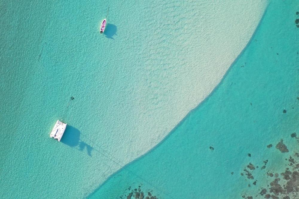
Dual tone lagoon at Pointe d'Esny in the south East
That one sentence is the whole subject of this page; the rest is the detail that makes it useful.
Here is the thing nobody tells you before you arrive. Tamarin and Flic en Flac are a fifteen-minute drive apart on the same west coast, and they are different seas. One has waves breaking on the sand and a river running into it; the other is a flat, reef-protected swimming pool. Drive from Belle Mare to Blue Bay and the lagoon goes from something that stretches two kilometres out to a coral garden you can swim across. Stand at Albion at the wrong hour and you can walk a long way out with the water at your ankles. Stand at Le Morne and look at four kinds of water from one beach. “Lagoon” is not one thing in Mauritius. This guide explains why, coast by coast, and then helps you pick the right one for what you want to do in it.
What Creates a Mauritius Lagoon?
Mauritius is a volcanic island that grew a coral collar. Over thousands of years, reef-building corals colonised the shallow shelf around the shore and built upward to the surface, leaving a band of sheltered water between the beach and the reef. From the air, that band is the pale ring you see around the island; from the beach, it is the line of white water offshore where the swell hits the reef and stops.
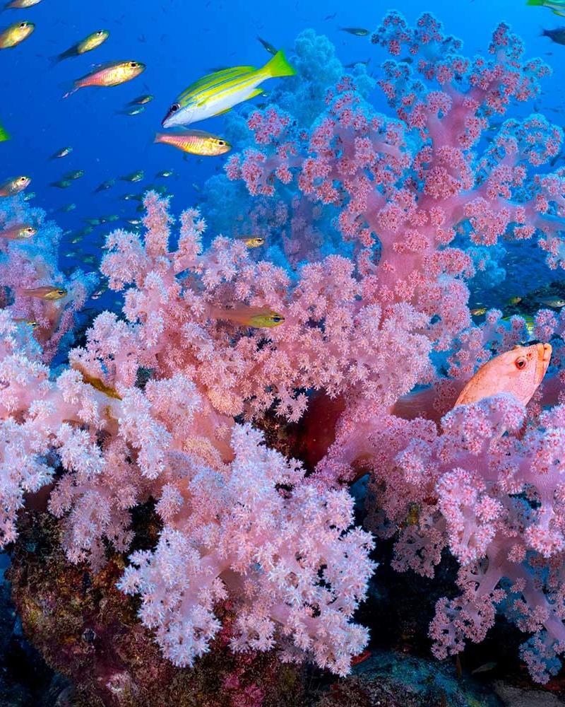
Coral reef ( Credit Gerald Rambert)
Walk out from almost any beach and you cross the same sequence:
shore → shallow sandy lagoon → patches of seagrass and coral → reef flat and crest (where the waves break) → reef pass (a gap) → open Indian Ocean
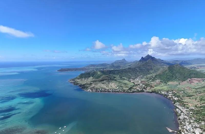
Most of the island’s reef is fringing reef — it grew out from the shore and sits close to it. Around Grand Port in the south-east there is a short stretch of true barrier reef, standing further out with deeper water behind it. And inside many lagoons there are patch reefs: isolated coral heads and bommies rising from the sand, which is where most of the snorkelling actually happens. Everything else on this page — the colours, the shallows, the surf, the kite water — follows from where those three reef types sit and where they leave gaps.
How Big, How Deep, How Shallow
The lagoon is not the same width anywhere twice. Government geomorphology guidance puts many west, north and south sections at a few tens to a few hundred metres wide; the east coast can run more than two kilometres from beach to reef. That is why Belle Mare feels like an inland sea and Flic en Flac feels like a long swimming corridor.
Depth is the other surprise. At low spring tides, many lagoon flats are under a metre deep — which is why you see people standing waist-high a long way from shore — while the channels cut through the reef can exceed twenty metres. The same coastline can show you pale aqua flats on one side of a boat and a dark navy trench on the other, and the difference is simply depth.
Why the Water Changes Colour
The colours are not a mood; they are a map, and once you can read it you know where to swim.
• Pale, milky turquoise is shallow water over bright coral sand. Shin-deep to waist-deep, warm, usually calm. The classic Mauritius colour.
• Teal and olive-green patches are seagrass meadows or coral heads on the bottom. Darker because the seabed is darker, not because the water is deeper — and they are where the fish are.
• Deep blue to navy is depth: a channel, a pass, or open ocean beyond the reef. Current moves through blue water; treat it with respect.
• Brown, grey or cloudy water near a river mouth after rain is sediment, and clarity will be poor until it clears. Tamarin and Rivière Noire show this after a wet night.
• The light then changes all of it — morning sun flattens the colours, midday makes them sing, cloud dulls them, wind puts chop on the surface and hides the bottom. The photograph you saw was probably taken at 10 am on a still, clear day.
The south-east, between Pointe d’Esny and Mahébourg, is where the full palette appears in one view: broad white-sand flats shading to turquoise, dark seagrass patches, patch reefs, and the ink-blue channels that the Grand Port islets sit along. Le Morne is the other great colour lesson, which we will come to.
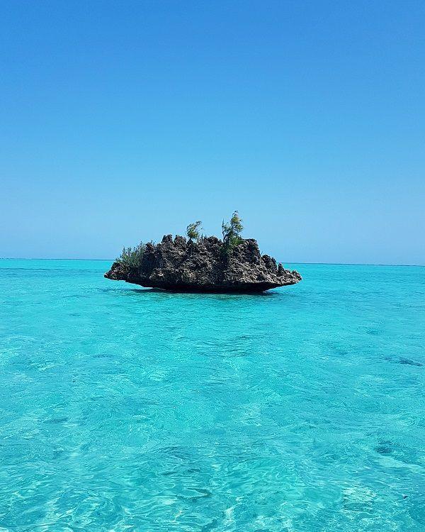
The famous crystal rock at Ile aux Benitiers, West Coast of Mauritius
The Big Lagoons: Where the Scale Is Obvious
Belle Mare and the east coast. This is the widest lagoon system on the island, and the sense of space is the point. The reef is far enough out that the horizon is water, not surf; the shallows go on for a very long way; and the east gets the sunrise and the trade wind. On a calm morning it is the most expansive swim in Mauritius. On a windy winter afternoon it is chop and spray, which is why the kitesurfers and the wind-sports schools are here. Our Belle Mare beach guide has the local detail; the East Mauritius guide has the rest of the coast.
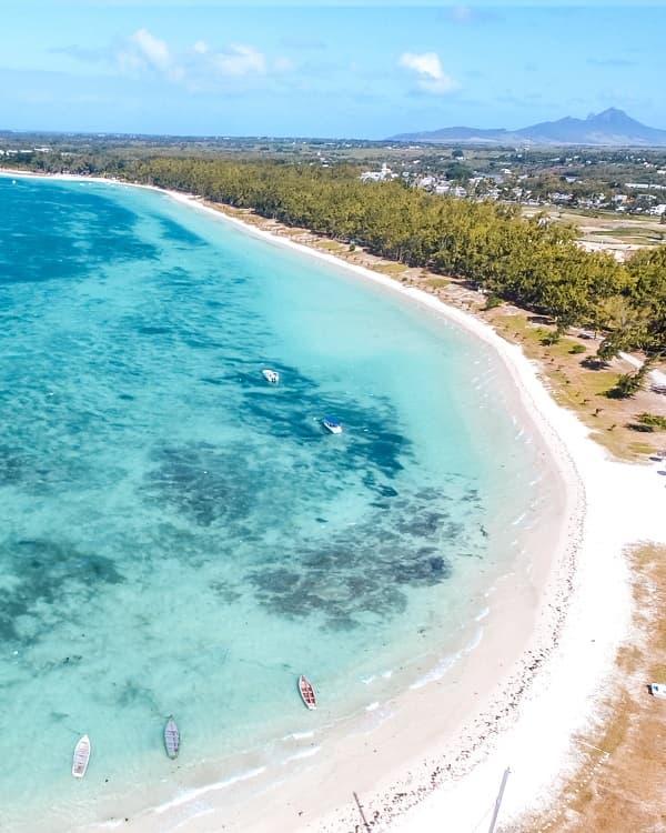
Flic en Flac and Wolmar. The west coast’s long lagoon is narrower than the east’s but runs for kilometres, sheltered by a reef that sits close enough to keep the water flat and far enough to give it some depth. It is the island’s most dependable all-round lagoon — swimming at any tide, snorkelling off the beach, and the dive boats heading out to the wall and the wrecks beyond the reef. Sunset is on the water side. See the Flic en Flac beach guide and the West Mauritius guide.
Le Morne. Not the biggest, but the most varied — a whole page to itself below.
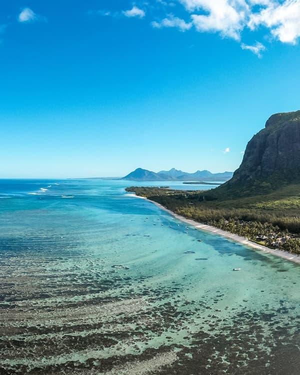
Reef Passes: Where the Lagoon Meets the Ocean
A passe is a gap in the reef — a natural channel through which the lagoon drains and fills with the tide, boats get in and out, and fish move between the sheltered water and the open sea. On the government’s hydrographic charts they have names: Passe Bel Ombre on the south coast, Passe La Prairie and Passe St Jacques in the south-west, and dozens more. From the beach you can spot one by colour — a dark blue cut through the white line of surf — and by the fact that the waves either side of it break and the water in it does not.
Two things to know. First, passes are deep: this is where the twenty-metre channels are, which is why they are the island’s great drift-dive sites. Second, passes move water. Everything the tide pushes into a lagoon has to leave through the gaps, so on an ebbing tide with swell running, a pass can carry a current that will take a swimmer out to sea faster than they can swim back. They are not casual swimming zones. Snorkel the lagoon side; leave the pass to the boats and the divers.
The gap in the reefs is what we called Pass.
Bel Ombre is a good place to see the system whole: a wide, reef-protected lagoon along the south coast with several named passes and channels through its reef, where you can watch the colour shift from flats to channel and see the boats using the gaps. The Bel Ombre beach guide and the South Mauritius guide cover the coast.
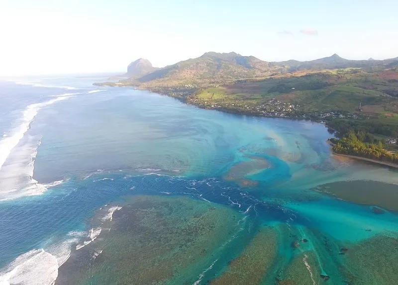
Reef Pass at Bel Ombre
Le Morne: Four Kinds of Water From One Beach
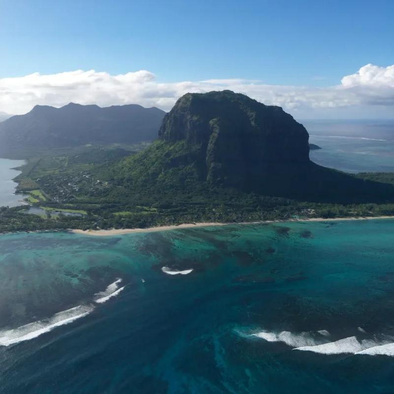
If you want to understand Mauritius lagoons in an afternoon, stand on the beach at Le Morne and look out.
Nearest you is the kite lagoon — shallow, flat, waist-deep over sand, protected by the reef and swept by a steady trade wind from roughly May to October. This is why beginners learn to kitesurf here: the water is flat enough to stand up in and the wind is reliable. Our page on the Le Morne kitesurf lagoon covers that side of it. Beyond the lagoon is the reef line, where the swell breaks — and where, at the south-west corner, One Eye peels off a reef pass over shallow coral: a famous, powerful, expert-only wave with a current and a tide that will hurt you if you do not know what you are doing. Through the reef run the passes — La Prairie, St Jacques — dark channels where the divers go. And beyond all of it, the ocean floor drops away from the island’s shelf into the deep.
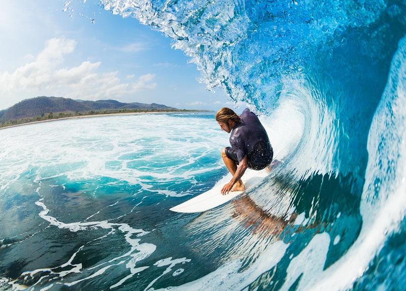
The world famous One Eye Surf spot at Le Morne
That drop is the underwater waterfall. From a seaplane or a helicopter, the shallow shelf south of Le Morne appears to pour over an edge into the abyss — sand and silt, moved by the current, streaming off the lagoon’s pale shelf into deep blue water, with the colour contrast doing the rest. It is an optical illusion, a very good one, and it is only visible from the air; nothing is falling anywhere, and no amount of snorkelling will show it to you. One correction we see constantly: Passe St Jacques is not the underwater waterfall. It is a named reef channel and dive site in the same dramatic south-west reef system, a few kilometres from the illusion. Related landscape, different thing. For how to see the waterfall and what the flights cost, our seaplane flights guide has it; the Le Morne beach guide covers the beach itself, and the surf and kitesurf guide covers the riding.

The iconic underwater waterfall at Le Morne
The Marine Parks: Blue Bay and Balaclava
Mauritius has two marine parks, and they protect two very different lagoons.
Blue Bay Marine Park, on the south-east coast beside Mahébourg, covers 353 hectares and is also a Ramsar wetland of international importance. It is the island’s best-known snorkelling lagoon for a reason: the official inventory records around 38 coral species from 28 genera and 15 families, and roughly 72 fish species, in a small area of patch reef and coral gardens — table corals, cactus corals, staghorn and fire coral in formations you can hover over in two metres of water. Glass-bottom boats run from the beach for people who would rather not get wet. Numbers in an inventory are not a promise of what you will see on a given morning, but Blue Bay delivers more consistently than anywhere else that is this easy to reach. See the Blue Bay beach guide.
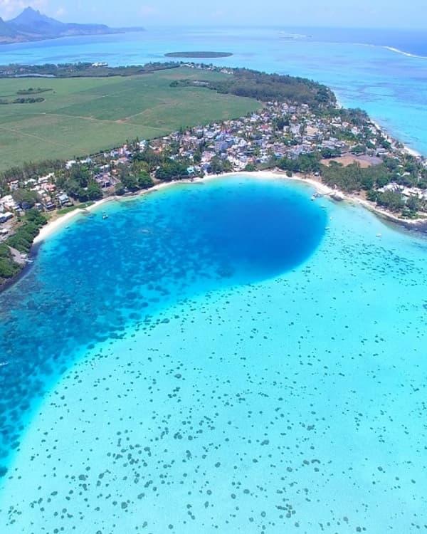
Blue Bay hole
Balaclava Marine Park, on the north-west coast between Port Louis and Trou aux Biches, is larger at 485 hectares and much less visited — a stretch of reef, lagoon and river mouth below the hotels at Turtle Bay that most travellers drive past without knowing it is protected. It is the quieter counterpoint to Blue Bay: less coral drama, more space, and worth knowing about if you are staying in the north-west. The Balaclava beach guide has the detail.
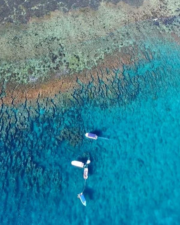
Balaclava Marine Park
Across the whole island, government sources record 43 genera of hard coral and 159 species from 16 families — Acropora, Montipora, Porites and Pavona among the ones you will see most. Both parks have zoning rules (no anchoring, no fishing, no touching) that the boat operators know; follow their lead. For where to put your mask on beyond the parks, our where to snorkel in Mauritius guide has the full list — this page is about why the lagoons differ, not a ranking of spots.
Very Shallow Lagoons and Low Tide: Albion
Albion, on the west coast below the lighthouse, is the place to learn what tide does to a Mauritian lagoon. At high water it is a pleasant, reef-sheltered swimming beach. At a low spring tide the water drains off the flats until the coral heads sit at or just under the surface and the swimmable depth shrinks to a few channels — and people, unforgivably, walk on the reef to get to them. Do not. Coral is an animal, it is slow-growing, and a footstep kills what took decades to build.
The lesson travels: Butte à L’Herbe in the north-east, parts of Pointe d’Esny, the inner flats at Belle Mare and plenty of smaller beaches behave the same way. If swimming depth matters to your day, check the Mauritius Meteorological Services tide tables and go within a couple of hours of high water. The Albion beach guide has the specifics for that beach.
When the Reef Disappears: Tamarin Bay
Tamarin is beautiful, and it is not a lagoon. The protective reef that runs the length of the west coast is interrupted at the mouth of the bay, so the Indian Ocean swell rolls straight in to the beach — which is why Tamarin has been the island’s surf town since the 1970s, why dolphins gather in the deep water off the point in the mornings, and why the water is darker, cooler and murkier than Flic en Flac fifteen minutes up the road. The Tamarin River empties into the bay too, carrying sediment after rain and adding a current at the mouth. A bay with waves and a river is a surf environment, not a swimming lagoon, and it should be treated as one: swim between the flags, respect the rips, and give the surfers their lines. See the Tamarin beach guide.
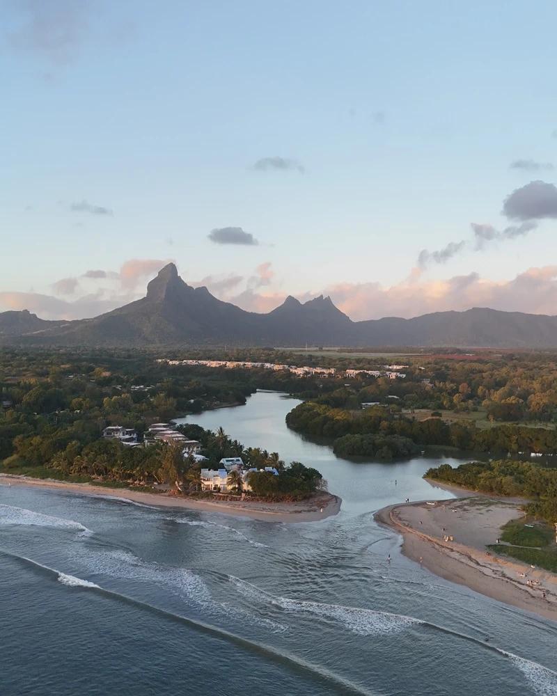
Tamarin beach and its surf waves
East and South-East Colour: Pointe d’Esny, Mahébourg and Trou d’Eau Douce
The south-east lagoon between Pointe d’Esny and Mahébourg is the island’s most painterly water. Broad, shallow sand flats run out to the barrier reef, broken by seagrass beds, patch reefs and the deep channels that give the lagoon its stripes of navy. It is calm, it is sheltered from the worst of the trade wind by the reef’s distance, and it is where the kitesurfers of the south-east launch. The bay is also ringed with history and conservation — the islets of Grand Port sit along the reef edge, and Île aux Aigrettes stands in the middle of Mahébourg Bay. The Pointe d’Esny beach guide covers the beach; the south-east coastal road trip strings the whole coast together.
Further north, the lagoon off Trou d’Eau Douce is the east coast’s boat hub: a wide, shallow sheet of water crossed by the channels the catamarans and speedboats use to reach Île aux Cerfs, with sand flats you can stand on half a kilometre from shore and a reef far out on the horizon. It is a working lagoon — watch for boat lanes — and the island day trip is its reason for being. See the Trou d’Eau Douce beach guide.
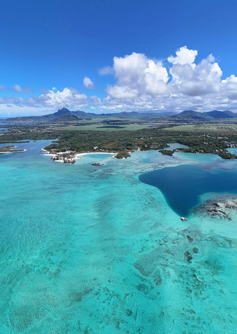
The changing colours of Trou d'eau Douce on the East Coast
Islands, Islets and Sandbanks Inside the Lagoons
Some of the largest lagoon systems hold islands of their own, and each one tells you something about the water around it. These are lagoon islands — inside or along the reef. The northern islands such as Flat Island and Îlot Gabriel are open-ocean trips, outside any reef, and belong to a different story.
Île aux Cerfs
· Lagoon: East, off Trou d’Eau Douce
· What it is: A large, low, wooded island inside the lagoon, ringed by sand flats
· Why go: The classic island day — beach, lagoon swimming, watersports and lunch
· Watch for: Crowds and boat lanes in the shallows; the quieter side is a walk away
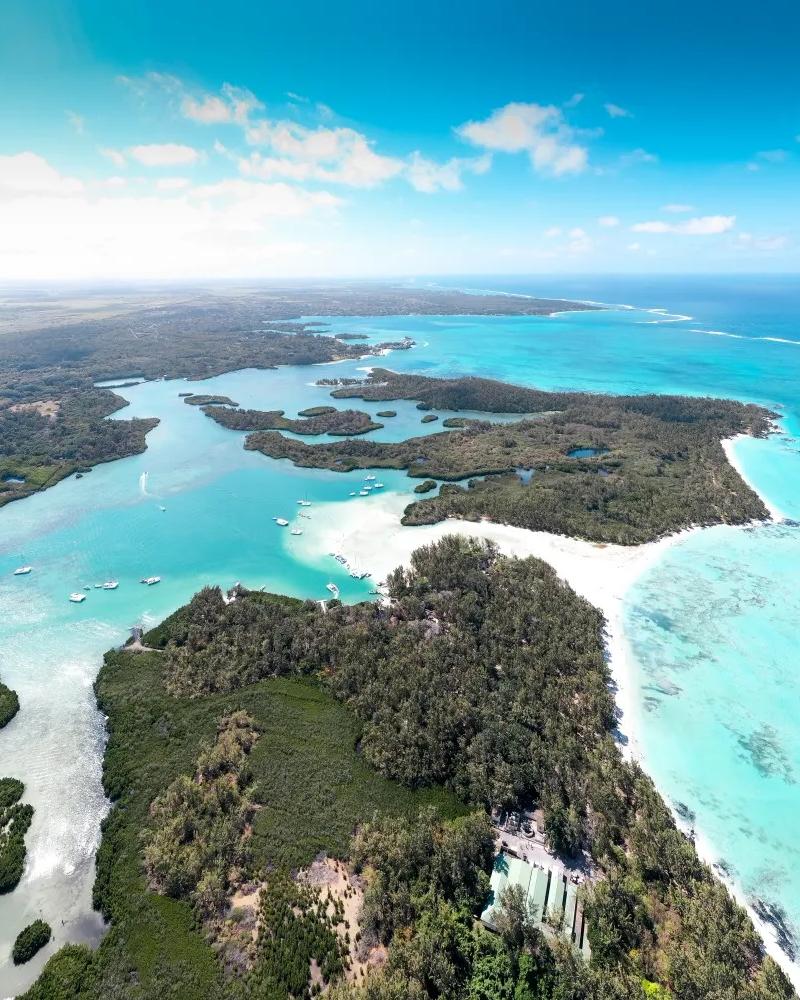
Ile aux Cerfs and Ilot Mangenie on the East Coast
Île aux Bénitiers
· Lagoon: South-west, near Le Morne
· What it is: A long lagoon island, about 2 km by 500 m, with Crystal Rock — a coral boulder standing in the shallows — just offshore
· Why go: Catamaran stops, dolphin mornings and swimming in very pale, shallow water
· Watch for: Tour-boat crowds mid-morning and shallow reef around Crystal Rock
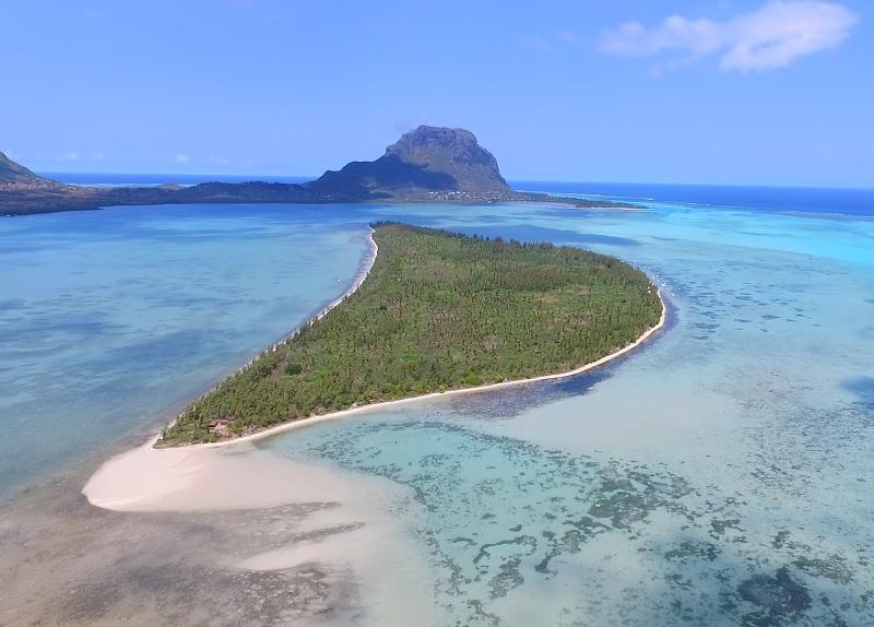
Île d’Ambre
· Lagoon: North-east
· What it is: A 128-hectare protected islet fringed with mangroves and shallow, sheltered channels
· Why go: Kayaking through mangroves, birdlife and a lagoon shaped by wetland rather than sand
· Watch for: Tides determine access through the channels; go with a guide who knows them
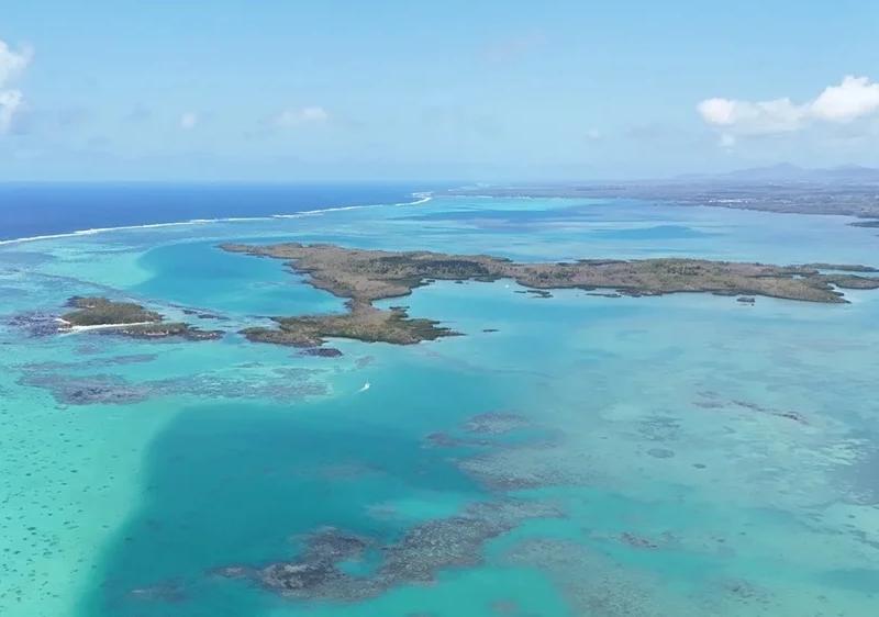
Îlot Flamants
· Lagoon: East
· What it is: A tiny protected islet of about 0.8 hectares — a white sandbank built from reef sand by currents and waves
· Why go: Sandbank photography in the middle of the sea and a swimming stop
· Watch for: Its visible shape and size change with tides and conditions; it may look different from photographs
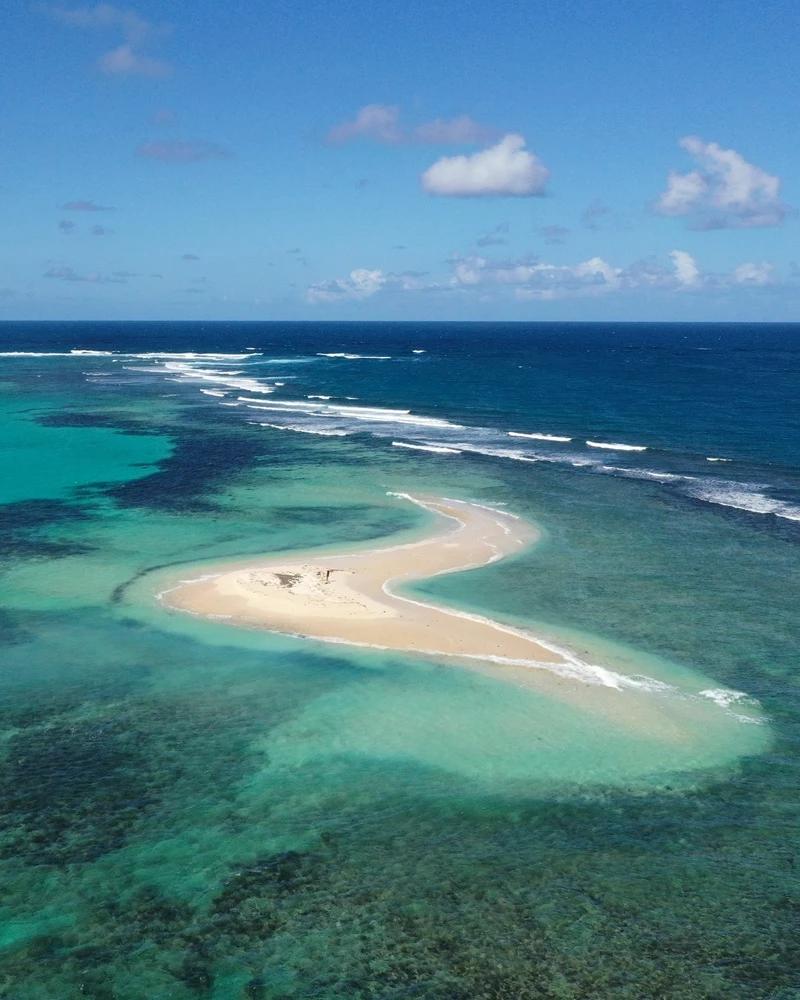
Île aux Aigrettes
· Lagoon: Mahébourg Bay, south-east
· What it is: A 25–26-hectare coralline-limestone nature reserve about 850 m offshore
· Why go: A guided conservation visit featuring ebony forest, giant tortoises, pink pigeons and the geology of a raised reef
· Watch for: Access by the Mauritian Wildlife Foundation’s boat only; this is not a beach island
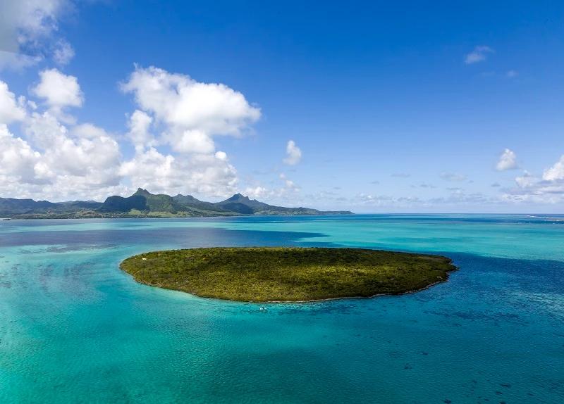
Île aux Fouquets (Île au Phare) and Île de la Passe
· Lagoon: Grand Port, along the reef edge
· What it is: Two separate historic islets — the lighthouse ruin on one and the fortifications associated with the 1810 battle on the other
· Why go: Island-hopping with history and views back across the lagoon
· Watch for: They are not the same island; boats visit both
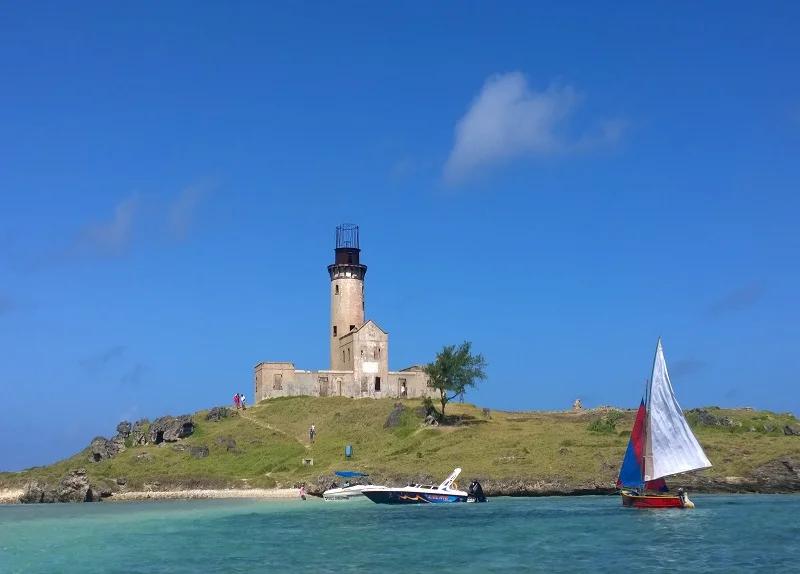
Ile de la Passe in the South East
What the water tells you at each: the mangroves of Île d’Ambre mean a shallow, sediment-rich, sheltered corner; the pale shallows around Bénitiers mean sand over a wide reef flat; the raised limestone of Aigrettes is an old reef lifted out of the sea; and Îlot Flamants is what happens when current and wave pile reef sand high enough to break the surface — temporarily, and never quite the same twice. The place pages have the practical detail: Île aux Cerfs, Île aux Bénitiers, Île d’Ambre, Îlot Flamants, Île aux Aigrettes and Île au Phare.
Which Lagoon for Which Activity?
Every line in this table comes with the same condition: on the day, the sea, the wind and the tide decide. Check the forecast; ask the operator; look at the water before you get in.
Flic en Flac / Wolmar
· Coast: West
· Reef & exposure: Close reef, well protected
· Tide sensitivity: Low — swimmable at most tides
· Best fit: Swimming, family paddling, shore snorkelling, dive departures and sunset
· Watch for: Jet-ski and boat lanes near the hotels
· Read more: Flic en Flac
· Read more: Wolmar
Blue Bay
· Coast: South-East
· Reef & exposure: Marine park, patch reef
· Tide sensitivity: Medium — best around mid to high tide
· Best fit: Snorkelling, glass-bottom boat trips and calm swimming
· Watch for: Park rules; do not touch or stand on coral
· Read more: Blue Bay
Le Morne kite lagoon
· Coast: South-West
· Reef & exposure: Reef-protected flats, steady wind
· Tide sensitivity: Medium
· Best fit: Beginner kitesurfing with a school and flat-water riding
· Watch for: Kite launch zones; stay clear if swimming
· Read more: Le Morne kitesurf lagoon
Le Morne reef & passes
· Coast: South-West
· Reef & exposure: Reef waves, deep passes
· Tide sensitivity: High
· Best fit: Expert surf at One Eye, drift diving and aerial photography
· Watch for: Currents and shallow coral; expert-only conditions
· Read more: Surf & kitesurf guide
Belle Mare
· Coast: East
· Reef & exposure: Very wide lagoon, wind-exposed
· Tide sensitivity: Medium — inner flats shallow at low tide
· Best fit: Space, sunrise, wind sports and long swims on calm mornings
· Watch for: Afternoon chop in winter
· Read more: Belle Mare
Trou d’Eau Douce / Île aux Cerfs
· Coast: East
· Reef & exposure: Wide lagoon crossed by boats
· Tide sensitivity: Medium
· Best fit: Island days, catamaran trips, watersports and sandbank stops
· Watch for: Boat lanes and crowds
· Read more: Trou d’Eau Douce
Pointe d’Esny / Mahébourg
· Coast: South-East
· Reef & exposure: Broad flats, distant barrier reef
· Tide sensitivity: Medium
· Best fit: Quiet swimming, photography, kitesurfing and island-hopping to Île aux Aigrettes and Grand Port
· Watch for: Kite zones and channels
· Read more: Pointe d’Esny
Albion
· Coast: West
· Reef & exposure: Very shallow, close reef
· Tide sensitivity: High — nearly dry at low spring tides
· Best fit: High-tide swimming, sunset and lighthouse walks
· Watch for: Exposed coral at low tide
· Read more: Albion
Tamarin Bay
· Coast: West
· Reef & exposure: Interrupted reef, open bay
· Tide sensitivity: Low sensitivity to tides, high sensitivity to swell
· Best fit: Surfing, dolphin trips and river-mouth stand-up paddleboarding on calm days
· Watch for: Waves, rip currents and murky water after rain
· Read more: Tamarin
Bel Ombre
· Coast: South
· Reef & exposure: Wide lagoon, several passes
· Tide sensitivity: Medium
· Best fit: Calm-water swimming, kayaking and watching water move through the reef passes
· Watch for: Currents near the gaps
· Read more: Bel Ombre
Balaclava
· Coast: North-West
· Reef & exposure: Marine park, reef and river mouth
· Tide sensitivity: Medium
· Best fit: Quiet snorkelling and hotel-based watersports
· Watch for: Park zoning and river clarity after rain
· Read more: Balaclava
Île d’Ambre
· Coast: North-East
· Reef & exposure: Mangrove channels
· Tide sensitivity: High — channels need sufficient water
· Best fit: Kayaking and birdwatching
· Watch for: A guide and suitable tides are essential
· Read more: Île d’Ambre
If what you actually want is a beach rather than a water type, our best beaches in Mauritius guide does the choosing by coast and traveller.
Season, Wind and Tide: What Changes Through the Year
The trade wind blows from the south-east, steadier and stronger in the cooler months from roughly May to October. That is kite season at Le Morne and on the east coast, and it is also the season when east-facing lagoons get choppy by lunchtime while the west stays flat. Mornings are almost always calmer than afternoons, everywhere, which is why the snorkelling boats leave early.
The warm months, November to April, bring warmer water, often glassier lagoons and better visibility on still days — and also humidity, afternoon rain, river run-off that clouds the bays, and the cyclone season. A storm far out at sea can send swell onto the south and west coasts days before any weather arrives, and after heavy rain the lagoons near river mouths take a day or two to clear. None of this makes a month good or bad; it makes the morning’s forecast the thing to read. Our best time to visit Mauritius guide has the month-by-month picture and the cyclone season guide explains how the warnings work.
Tide matters most on the shallow lagoons — Albion, Butte à L’Herbe, the inner flats everywhere — and in the passes, where the ebb runs hardest. The MMS publishes tide tables; two hours either side of high water is the safe default for a shallow-lagoon swim.
People are a season too. A weekday-morning lagoon is a different place from the same lagoon on a Sunday, a school holiday or the fortnight around Christmas and New Year, when the public beaches become the island’s picnic grounds — music, families, football, food. That is Mauritius at its warmest, not a problem to avoid; but if you want the water to yourself, go early midweek. Some religious festivals also bring processions and ceremonies to the shore — the festivals and public holidays guide tells you when.
Before You Enter the Water
Look before you swim. - Is the water in front of you lagoon (pale, flat, reef line visible beyond) or open (dark, moving, waves reaching the sand)? Swim accordingly. - Where is the pass? Find the dark gap in the reef and stay well away from it, especially on a falling tide. - Is there a river mouth? Current and poor visibility after rain. - Is this a kite or boat zone? Launch areas and channels are marked; stay clear. - What is the tide doing? Shallow lagoons at low springs mean exposed coral, not a swim. - What is the wind doing? If the chop is building, the morning window is closing. - Is there a flag or a lifeguard? Secluded sections usually have neither.
Responsible Lagoon Use
The lagoon you came to see is alive, and most of what makes it beautiful is slow-growing and easily broken.
• Never stand on, hold or touch coral; keep your fins up and your feet off the bottom over reef.
• Give turtles, rays and fish room — no chasing, no feeding, no touching.
• Leave shells, coral and sand where they are.
• Respect marine-park zoning and the operators’ rules; they exist so the coral garden is still there next year.
• Keep out of kite launch and landing zones and boat channels.
• Choose licensed operators for boats, dives and lessons.
• Take everything you brought back off the beach.
Coral restoration projects are now running in several Mauritian lagoons, replanting nursery-grown fragments onto damaged reef — a reminder that the reef is not scenery but the structure holding the lagoon, and the beach behind it, in place.
Frequently Asked Questions
Why does Mauritius have lagoons? Because a coral reef grew around the volcanic island’s shallow shelf, enclosing roughly 243 km² of sheltered water behind about 150 km of reef. The reef breaks the ocean swell; the lagoon is the calm water it protects.
Why are some Mauritius lagoons turquoise, emerald or dark blue? Depth and seabed. Pale turquoise is shallow water over white coral sand; green and teal mark seagrass or coral on the bottom; dark blue is deep water — a channel, a pass or the open sea. Light, wind and river sediment change the look on the day.
Why do some lagoons become so shallow at low tide? Because much of the lagoon floor is a flat less than a metre deep at low spring tides. Albion is the clearest example — coral reaches the surface. Go near high water for a swim.
What is a reef pass and why can currents be stronger there? A pass is a gap in the reef connecting lagoon and ocean. Everything the tide pushes into a lagoon drains out through the passes, so on an ebb with swell running the current can be strong. Passes are for boats and experienced divers, not casual swimmers.
Which Mauritius lagoons are best for snorkelling? Blue Bay Marine Park for coral variety in shallow water; Flic en Flac for shore snorkeling at most tides; Balaclava for a quieter marine park; Trou aux Biches on the north-west for easy reef access. The where to snorkel guide has the full list.
Which lagoons are best for kitesurfing or learning to kite? Le Morne’s shallow, flat, reef-protected lagoon with a steady south-east trade wind from about May to October is the island’s learning lagoon; the east coast around Belle Mare and Pointe d’Esny also works. Learn with a school.
Why does Tamarin have surf when many Mauritius beaches are calm? The protective reef is interrupted at the mouth of Tamarin Bay, so ocean swell reaches the beach. Most other beaches sit behind continuous reef.
What are the two marine parks in Mauritius? Blue Bay Marine Park (353 ha, south-east, also a Ramsar site) and Balaclava Marine Park (485 ha, north-west).
What types of coral can be found around Mauritius? Government sources record 43 genera and 159 species of hard coral from 16 families — Acropora, Montipora, Porites and Pavona among the commonest — with table, cactus, staghorn and fire corals prominent at Blue Bay.
Is the Le Morne underwater waterfall real? It is a real optical illusion, visible only from the air: sand and silt streaming off the shallow shelf south of Le Morne into deep water, with the colour contrast making it look like a cascade. Nothing is falling. Passe St Jacques is a separate reef channel nearby, not the waterfall.
Can you swim through reef passes? Not safely as a casual swimmer. Passes carry current, particularly on a falling tide with swell. Experienced divers drift them with a boat; everyone else stays on the lagoon side.
When are Mauritius lagoons clearest and calmest? Mornings, before the wind builds; the west coast more reliably than the east; and calm, dry spells rather than the days after heavy rain. Warmer months often give glassier water, but the day’s forecast matters more than the month.
Which islands and islets sit inside Mauritius lagoon systems? Île aux Cerfs (east), Île aux Bénitiers (south-west), Île d’Ambre (north-east), Îlot Flamants (east) and Île aux Aigrettes with the Grand Port islets (south-east). Flat Island and Îlot Gabriel in the north are open-ocean islands, not lagoon islands.
What is Îlot Flamants, and why does it look like a sandbank? A protected islet of about 0.8 hectares off the east coast, built from reef sand piled up by current and waves. It is essentially a sandbank, which is why its visible shape and size vary with tide and conditions.
What is the difference between a lagoon island, a reef islet and an open-ocean island? A lagoon island sits in sheltered water inside the reef (Île aux Cerfs, Île d’Ambre). A reef islet sits on or beside the reef itself, often with deep water on one side (the Grand Port islets, Îlot Flamants). An open-ocean island lies beyond any reef in deep water (Flat Island, Îlot Gabriel) and is reached by sea crossing, not lagoon.
Plan around the water: choose a beach with the best beaches in Mauritius · put a mask on with where to snorkel in Mauritius · ride the wind with the surf and kitesurf guide · build the week with the Mauritius itinerary hub.
Recevez les nouveaux guides de Maurice par e-mail
Rejoignez la liste Mauritius Explored pour des idées de voyage, des mises à jour pratiques et des aides de planification à télécharger.

Rédigé par l'équipe éditoriale de Mauritius Explored, un guide mauricien consacré aux plages, activités, lieux locaux et conseils pratiques.
Recherche voyage locale à Maurice, planification d'itinéraires et couverture de destination depuis 2011.